

Urban real three-dimensional automatic modeling system based on airborne LiDAR and tilt camera
A technology of tilting camera and automatic modeling, applied in the field of unmanned aerial vehicles, can solve the problems of low data collection efficiency, low precision, low data production efficiency, etc., and achieve the effect of comprehensive model elements, high precision and rich details
- Summary
- Abstract
- Description
- Claims
- Application Information
AI Technical Summary
Problems solved by technology
Method used
Image

Examples
Embodiment
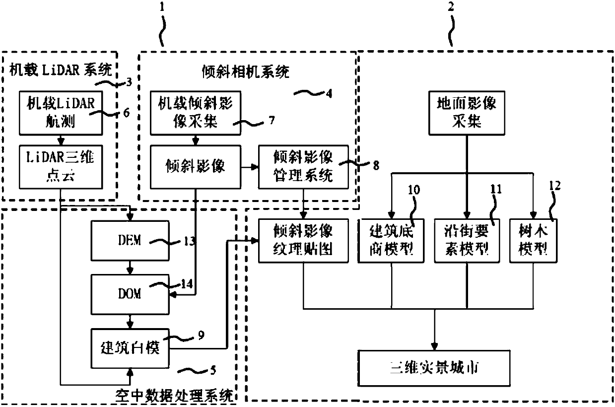
[0020] This embodiment includes: figure 1 As shown, the city true three-dimensional automatic modeling system based on airborne LiDAR and tilted camera includes aerial modeling system 1 and ground imaging system 2, and described aerial modeling system 1 includes airborne LiDAR system 3, tilted camera system 4, Aerial data processing system 5, described airborne LiDAR system 3 includes airborne aerial survey module 6 that can generate LiDAR three-dimensional point cloud, described oblique camera system 4 includes airborne oblique image acquisition system 7 that can generate oblique image, and can generate The oblique image management system 8 of the oblique image texture mapping, the aerial data system includes a building white model module 9, and the ground image system 2 includes a building base model module 10, a street element model module 11, and a tree model module 12;
[0021] The oblique image generated by the oblique image acquisition system 7 is output as an oblique i...
PUM
 Abstract
Description
Claims
Application Information