A fast map planning method for UAV power line inspection system

A technology for power line patrolling and unmanned aerial vehicles, which is applied to navigation and calculation tools, etc., can solve the problems of low efficiency and accuracy of route map production, improve production efficiency and accuracy, reduce manual workload, improve input efficiency and The effect of accuracy

Active Publication Date: 2020-05-08
STATE GRID SHANDONG ELECTRIC POWER +1
View PDF6 Cites 0 Cited by
  • Summary
  • Abstract
  • Description
  • Claims
  • Application Information

AI Technical Summary

Problems solved by technology

However, the efficiency and accuracy of route map production from current drone patrols are relatively low

Method used


Image

  • A fast map planning method for UAV power line inspection system
  • A fast map planning method for UAV power line inspection system
  • A fast map planning method for UAV power line inspection system

Examples


Embodiment Construction

[0032] The present invention will be further described below in conjunction with the accompanying drawings and embodiments.

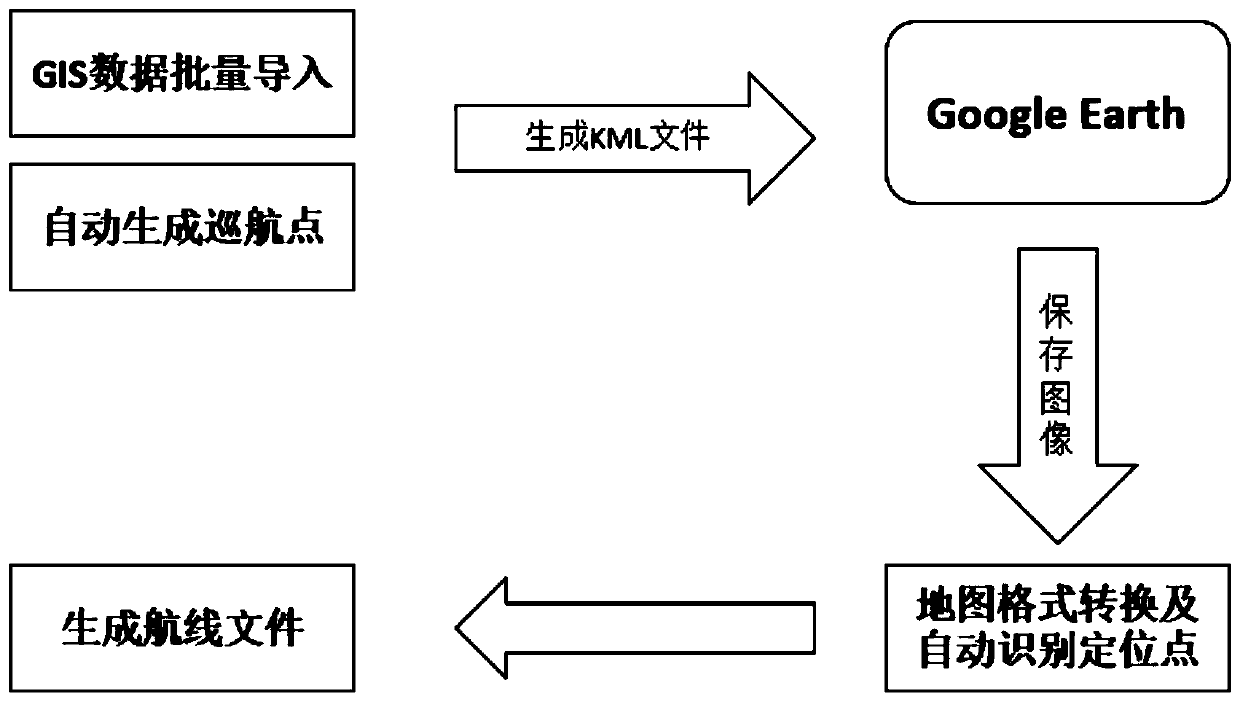
[0033] The method for fast planning of the map of the unmanned aerial vehicle power line inspection system of the present invention comprises the following steps:

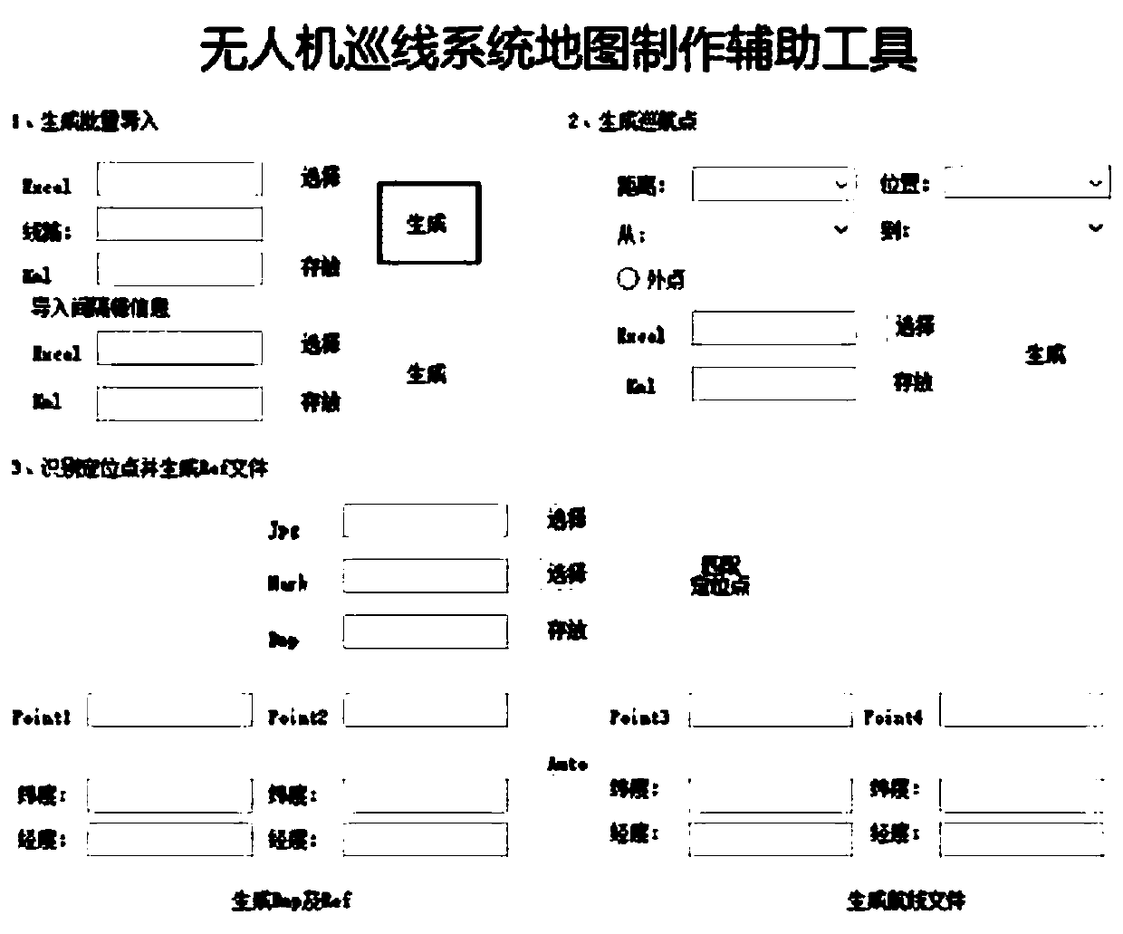
[0034] (1) Batch import of GIS data: enter the coordinate information of the tower and the distance information of the spacer bar into the table for formatting, and realize the batch import of data through software;

[0035] (2) Automatic generation of cruising points: By setting the requirements of cruising points, relying on the spherical arc length formula and azimuth angle formula, the position data of cruising points can be calculated;

[0036] (3) Automatically identify the positioning point: use the template matching algorithm to match the four-corner locator of the saved picture, and obtain the corresponding position data;

[0037] (4) Route file generation: rely on the cruise point...


PUM


Abstract

The invention discloses a rapid map planning method for an unmanned aerial vehicle (UAV) electric power line patrol system. The method comprises: recording support coordinate information and spacer distance information in a table, performing formatting, and performing batch data import; setting the requirement condition of a cruise point, and according to the calculating method of spherical arc length and azimuth, performing calculation to obtain position data of the cruise point; using a template coupling algorithm, coupling a quadrilateral locator of a saved picture to obtain corresponding position data; and according to a cruise point file and support information, generating a task file used in an earth station and performing navigation. The manufacture efficiency and accuracy of a route map for a UAV line patrol system are efficiently improved.

Description

technical field [0001] The invention relates to a method for quickly planning a map of an unmanned aerial vehicle power line inspection system. Background technique [0002] In recent years, the UAV power line inspection method has gradually replaced the manual line inspection operation method, using the UAV as a carrier, carrying visible light cameras, visible light cameras, infrared thermal imaging cameras and communication equipment to fly close to the transmission line, hovering to check the transmission line towers Equipment, detailed inspection of tower structures, insulators, etc. by taking pictures or videos. However, the route map production efficiency and accuracy rate of the current UAV route inspection are relatively low. [0003] The existing technology is mainly affected by the following three problems: the first is to input the GIS information of the tower provided by the power supply company into the Google Earth software without errors; The third is to det...

Claims


Application Information

Patent Timeline
Patent Type & Authority Patents(China)
IPC IPC(8): G01C21/20
CPCG01C21/20
Inventor 赵信华王霞贾会永李保生刘立梁龙飞杜磊梁园斌倪广魁王晓军
Owner STATE GRID SHANDONG ELECTRIC POWER
Why Eureka
Try Eureka