Weather map system with customizable pattern
A map and style technology, applied in the field of meteorology, can solve the problem that the number of symbols cannot be satisfied, and achieve the effect of reducing labor costs and improving work efficiency
- Summary
- Abstract
- Description
- Claims
- Application Information
AI Technical Summary
Problems solved by technology
Method used
Image
Examples
Embodiment Construction
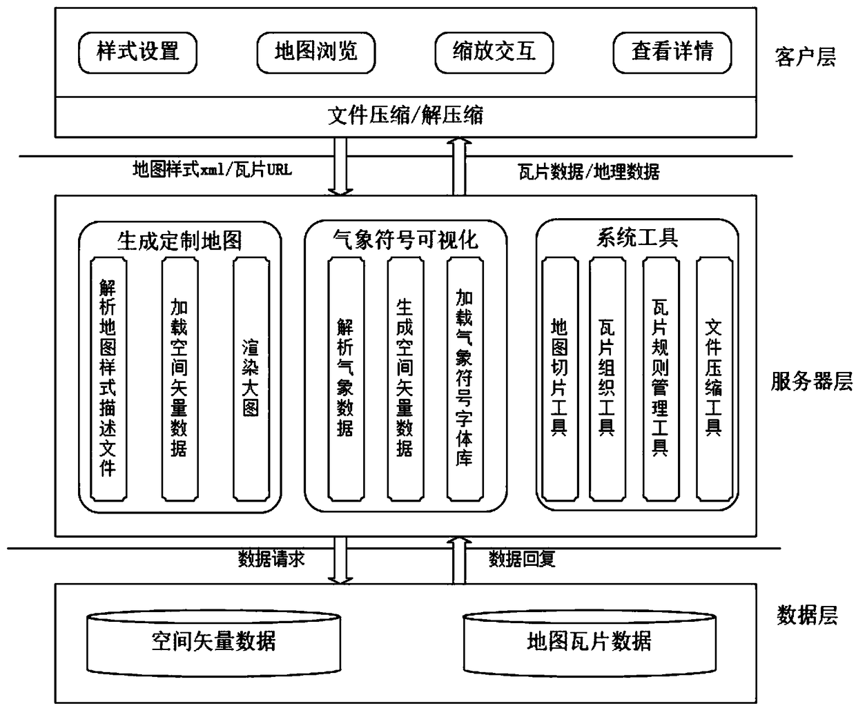
[0013] Such as figure 1 As shown, the weather map client mainly includes functions such as map style setting, map browsing, zooming interaction, and viewing details. The weather map server mainly includes map generation, weather symbol visualization, and system tool modules. The data layer includes spatial vector data and map tile data.
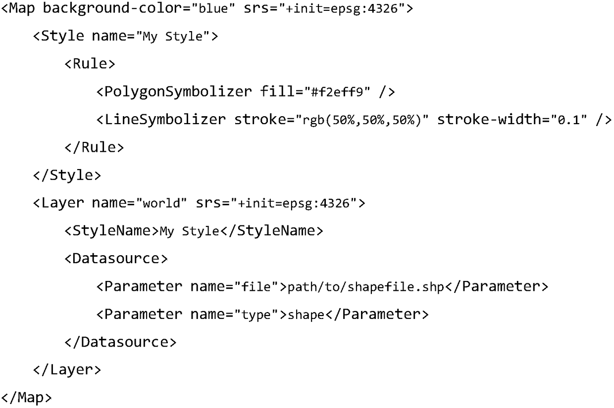
[0014] 1. Style setting All the features of the map are described in an xml file. The layer structure of the map is the tree structure of xml. Each layer contains a geographic data source and multiple styles. The style contains multiple rules, one Rules can contain a variety of symbols, and different symbols contain different attribute settings. Take LineSymbolizer as an example, including stroke (color), stroke-width (width), transparency (stroke-opacity), line intersection mode (stroke -linejoin), line head mode (stroke-linecap), line segment drawing iteration interval (stroke-dasharray), etc. A basic map style description xml is as foll...
PUM
 Abstract
Description
Claims
Application Information
 - R&D
- Intellectual Property
- Life Sciences
- Materials
- Tech Scout
- Unparalleled Data Quality
- Higher Quality Content
- 60% Fewer Hallucinations
Browse by: Latest US Patents, China's latest patents, Technical Efficacy Thesaurus, Application Domain, Technology Topic, Popular Technical Reports.
© 2025 PatSnap. All rights reserved.Legal|Privacy policy|Modern Slavery Act Transparency Statement|Sitemap|About US| Contact US: help@patsnap.com


