
Early identification method of potential landslide based on remote sensing technology

An early identification and potential technology, which is applied in the directions of electromagnetic wave re-radiation, radio wave reflection/re-radiation, and utilization of re-radiation, can solve the problems of difficulty in meeting the needs of early identification of large-scale potential landslides, a large number of manpower and material resources, and achieve improvement. The effect of project operation safety and disaster prevention and mitigation level, strong project practicability, and reduced human and material resources input

Inactive Publication Date: 2018-08-28
CHINA RAILWAY DESIGN GRP CO LTD
View PDF5 Cites 26 Cited by
  • Summary
  • Abstract
  • Description
  • Claims
  • Application Information

AI Technical Summary

Problems solved by technology

[0003] Traditional early identification methods of landslides, such as buried sensors and on-site monitoring methods, require a lot of manpower and material resources, and are mostly limited to the scope of point measurement, which is difficult to meet the early identification needs of large-scale potential landslides

Method used


Image

  • Early identification method of potential landslide based on remote sensing technology
  • Early identification method of potential landslide based on remote sensing technology
  • Early identification method of potential landslide based on remote sensing technology

Examples


Embodiment Construction

[0035] The potential landslide early identification method based on remote sensing technology of the present invention will be further described below in conjunction with the accompanying drawings.

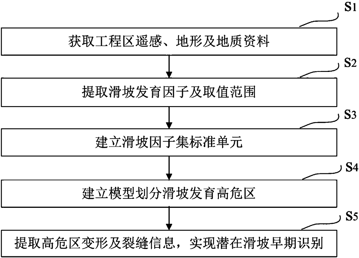
[0036] figure 1 It is a flow chart of the method for early identification of potential landslides based on remote sensing technology in the present invention. Such as figure 1 Shown, the potential landslide early identification method based on remote sensing technology of the present invention comprises the following steps:

[0037] S1. Obtain remote sensing, topographic and geological data of the project area

[0038]The remote sensing data of the project area include high-resolution remote sensing images and multi-phase differential interferometric radar remote sensing images. The high-resolution remote sensing images can be SPOT5 and ALOS satellite images with a resolution of 2.5m, Ziyuan No. 3 satellite images with a resolution of 2.1m, satellite images with higher resoluti...


PUM


Abstract

The invention discloses an early identification method of potential landslide based on the remote sensing technology, and the method comprises the following steps: S1, obtaining remote sensing data, landform data and geological data of a projection region; S2, extracting a landslide development factor and a value range; S3, building a landslide factor set standard unit; S4, building a model, and dividing a landslide development high-risk region; S5, carrying out the differential interferometer radar remote sensing monitoring of the landslide development high-risk region, extracting the deformation and crack information of the high-risk region, and achieving the early recognition of the potential landslide. The method can achieve the early recognition of the potential landslide in a large range, achieves the focusing of a key region, breaks the point measurement range of a conventional method, achieves the area monitoring recognition, can greatly reduce the manpower and material resource investment, remarkably reduces the early recognition cost of the potential landslide, and improves the project operation safety and disaster prevention and disaster mitigation level.

Description

technical field [0001] The invention relates to the field of engineering geological survey, in particular to a method for early identification of potential landslides based on remote sensing technology. Background technique [0002] Landslide disaster is an important content of engineering geological survey. Conventional ground surveys or remote sensing interpretation methods are used to identify landslides that have already occurred, and it is difficult to achieve early identification of potential landslides. Potential landslides are very harmful to the project and bring great risks to the safety of project construction and operation. Therefore, the early identification of potential landslides is of great significance for engineering construction and operation safety. [0003] Traditional early identification methods of landslides, such as buried sensors and on-site monitoring methods, require a lot of manpower and material resources, and are mostly limited to the scope o...

Claims


Application Information

Patent Timeline
Patent Type & Authority Applications(China)
IPC IPC(8): G01S13/86G01S13/89G01S17/89
CPCG01S13/86G01S13/865G01S13/89G01S17/89
Inventor 刘桂卫杨国涛徐永明李国和齐春雨
Owner CHINA RAILWAY DESIGN GRP CO LTD
Learn More