
Evaluation method and evaluation device of seismic exploration data acquisition and observation system in complex structure area

A data acquisition and observation system technology, applied in the field of geophysical exploration, can solve problems such as difficulty in accurately evaluating seismic exploration data acquisition and observation systems, poor sensitivity, and little consideration of the relationship between data acquisition quality

Active Publication Date: 2018-10-19
BC P INC CHINA NAT PETROLEUM CORP +1
View PDF7 Cites 3 Cited by
  • Summary
  • Abstract
  • Description
  • Claims
  • Application Information

AI Technical Summary

Problems solved by technology

However, when the migration velocity model is accurate, the sensitivity of pre-stack depth migration imaging to seismic exploration data acquisition and observation system parameters such as maximum offset, track spacing, and shot density is poor, and it is also difficult to accurately evaluate the seismic exploration data acquisition and observation system. pros and cons
With the continuous improvement of computer technology, the full waveform inversion method has attracted more and more attention, and the technology has gradually matured. However, everyone focuses on the full waveform inversion method itself, and rarely considers the quality of data acquisition and full The relationship between waveform inversion

Method used


Image

  • Evaluation method and evaluation device of seismic exploration data acquisition and observation system in complex structure area
  • Evaluation method and evaluation device of seismic exploration data acquisition and observation system in complex structure area
  • Evaluation method and evaluation device of seismic exploration data acquisition and observation system in complex structure area

Examples


Embodiment

[0098] In the following, two-dimensional design is taken as an example for illustration.

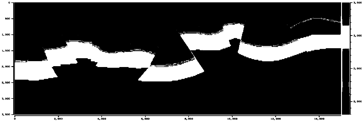
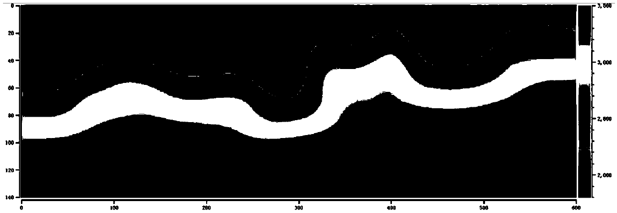
[0099] 1) Establish a geological model with a length of 15,000 meters and a depth of 3,500 meters based on the previous data of a certain domestic work area (i.e., a geological exploration area), and use dx=25 meters and dz=25 meters to separate the distance between the grids into a geological model to obtain the number of vertical and horizontal grids Respectively, the grid geological model V of Nx=600 and Nz=140 true (x,z), such as figure 2 shown.

[0100] 2) Establish 6 sets of different seismic exploration data acquisition and observation systems. The shot point ranges from 2,500 meters to 12,500 meters, and the shot point spacing is 125 meters, with a total of 81 shots; the receiver point spacing is 25 meters. Under the condition that the above observation parameters remain unchanged, five sets of seismic exploration data acquisition and observation systems with maximum offsets ...


PUM


Abstract

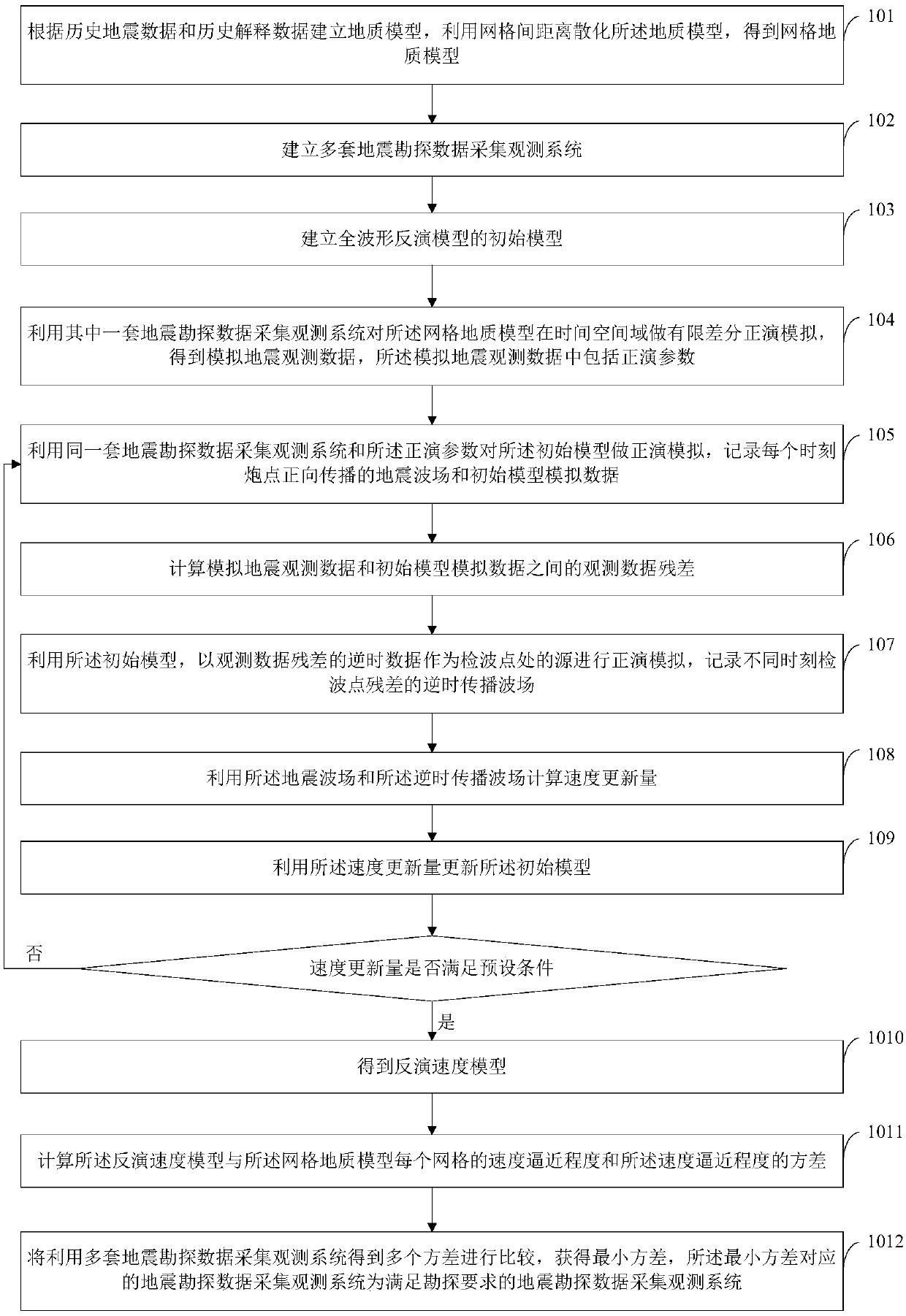
The invention provides an evaluation method and an evaluation device for a seismic exploration data acquisition and observation system in a complex structure area. The method comprises the following steps: establishing a geological model, multiple sets of observation systems and a full waveform inversion initial model; obtaining observation data according to the observation systems and the geological model, obtaining a seismic wave field and simulation data according to the observation systems, forward modeling parameters and the initial model and calculating observation data residual errors between the observation data and analog data; obtaining an inverse-time propagation wave field according to the initial model and inverse-time observation data residual errors; obtaining the velocity update amount and updating the initial model by using the seismic wave field and the inverse-time propagation wave field; obtaining a final inversion velocity model when the velocity update amount meets the requirements; calculating multiple variances of the velocity approximation degree of the final inversion velocity model and the geological model, corresponding to the multiple sets of observation systems, wherein the observation system corresponding to the minimum variance is optimal. According to the scheme, full waveform inversion is applied to the evaluation of an observation system in acomplex high steep structural area, and the advantages and disadvantages of different observation systems can be effectively evaluated.

Description

technical field [0001] The invention relates to the technical field of geophysical exploration, in particular to an evaluation method and device for seismic exploration data collection and observation systems in complex structural areas. Background technique [0002] The design and optimization of seismic exploration data acquisition and observation systems in complex structural areas, especially overthrust nappe areas or salt-bearing dome structural areas, has been a key research issue for many experts and scholars in recent years. On the one hand, the complex seismic wave field generated by complex geological structures makes it difficult for existing velocity analysis methods to adapt; on the other hand, high-speed geological bodies or salt mounds hinder the penetration of seismic waves, forming a shadow area for seismic wave illumination. This will inevitably lead to poor imaging of some parts of the complex geological structure when the same seismic exploration data acq...

Claims


Application Information

Patent Timeline
Patent Type & Authority Applications(China)
IPC IPC(8): G01V13/00
CPCG01V13/00
Inventor 何宝庆吕盼盼何永清宁宏晓马兰卢秀丽
Owner BC P INC CHINA NAT PETROLEUM CORP
Learn More