Plant protection unmanned aerial vehicle route planning method based on arbitrary polygon barrier-free area

A technology for plant protection drones and track planning, applied in the field of plant protection drone track planning, which can solve problems such as low operation efficiency, large drone consumption, and pesticide waste.

Inactive Publication Date: 2018-10-30
NANJING UNIV OF AERONAUTICS & ASTRONAUTICS
View PDF8 Cites 14 Cited by
  • Summary
  • Abstract
  • Description
  • Claims
  • Application Information

AI Technical Summary

Problems solved by technology

In this way, there will be human errors, which will make the theoretical operation area larger than the actual operation area, and when the UAV flies at the boundary of the area, half of the pesticides will be sprayed outside the operation area, resulting in the waste of pesticides, and eventually lead to the failure of the UAV. High consumption and low operating efficiency

Method used


Image

  • Plant protection unmanned aerial vehicle route planning method based on arbitrary polygon barrier-free area
  • Plant protection unmanned aerial vehicle route planning method based on arbitrary polygon barrier-free area
  • Plant protection unmanned aerial vehicle route planning method based on arbitrary polygon barrier-free area

Examples


Embodiment Construction

[0026] The present invention will be described in detail below in combination with specific embodiments.

[0027] The present invention is based on the plant protection UAV track planning method of any polygon barrier-free area, according to the following steps:

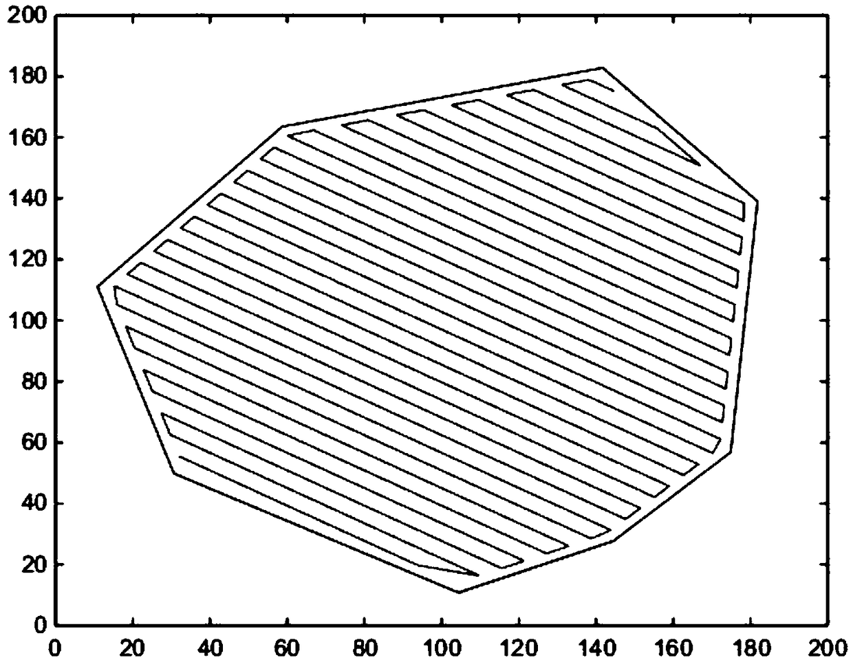
[0028] Step 1: Build the coordinate system of the work environment; the user draws the work area on the map, obtains the coordinates of each vertex in the work area, obtains the minimum longitude and minimum latitude of the vertex, and constructs a two-dimensional coordinate system with the latitude and longitude less than the minimum longitude and latitude of the vertex as the origin ;

[0029] Step 2: Determine whether the working area is a concave polygon. Specifically, it can be judged by whether there is a concave point, and the judgment method is as follows:

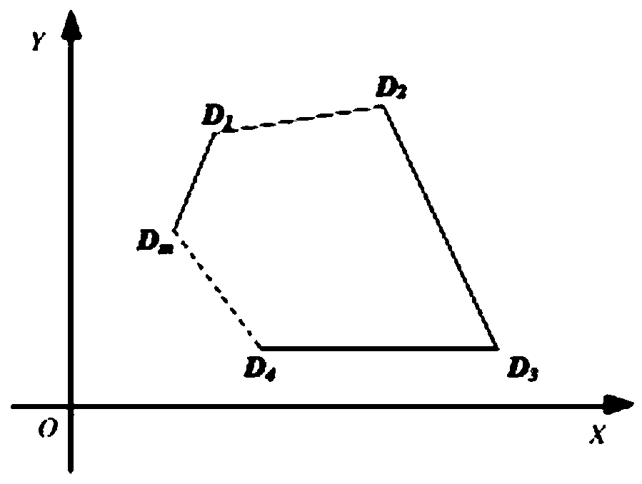
[0030] Such as figure 1 , assuming that the vertices of the region are numbered D in a clockwise order 1 D. 2 D. 3 D. 4 …D n , to determine wheth...


PUM


Abstract

The invention aims to provide a plant protection unmanned aerial vehicle route planning method based on an arbitrary polygon barrier-free area. The method comprises the following steps: constructing aworking environment coordinate system; lining out a working area on a map, acquiring each vertex coordinate of the working area, acquiring the minimal longitude and the minimal latitude of the vertex, and constructing a two-dimensional coordinate system taking longitude and latitude less than the minimal longitude and latitude of the vertex as an original point; judging whether the working area is a concave polygon or a convex polygon by judging whether a concave point exists or not; planning the route of the whole plant protection unmanned aerial vehicle, namely planning the route of the convex polygon area and planning the route of the concave polygon area. The method has the following beneficial effects: relative to the traditional mode of judging the working route directly depending on the vision of an operator without planning, the mode of automatically planning the route of the plant protection unmanned aerial vehicle has the advantages of improving the working accuracy and reducing repeated coverage rate and leaked spray rate.

Description

technical field [0001] The invention belongs to the technical field of unmanned aerial vehicles, and relates to a plant protection unmanned aerial vehicle track planning method based on an arbitrary polygon barrier-free area. Background technique [0002] Plant protection drones are drones used for agricultural and forestry plant protection operations, mainly for spraying operations. Track planning: The track planning of the drone is to plan the optimal or satisfactory flight track for the aircraft under the premise of comprehensively considering the arrival time of the drone, the battery power, and the flight area, so as to ensure Successfully complete the mission. Spray width: the width of the spray under the premise that the sprayed water mist is uniform, without drift, and has sufficient penetrating power. Heading: The direction of the plant protection UAV flight operation. At present, most of the plant protection drones are remotely controlled by the operator's visio...

Claims


Application Information

Patent Timeline
Patent Type & Authority Applications(China)
IPC IPC(8): G01C21/20
CPCG01C21/20
Inventor 盛汉霖叶勇杰张杰陈芊李嘉诚周海榆
Owner NANJING UNIV OF AERONAUTICS & ASTRONAUTICS
Why Eureka
Try Eureka