

Flying dust monitoring system based on unmanned aerial vehicle
A monitoring system and unmanned aerial vehicle technology, applied in the direction of measuring devices, sampling, suspension and porous material analysis, etc., can solve the problems of inability to monitor dust on the construction site, low precision, real-time lag in dust monitoring on the construction site, etc.
- Summary
- Abstract
- Description
- Claims
- Application Information
AI Technical Summary
Problems solved by technology
Method used
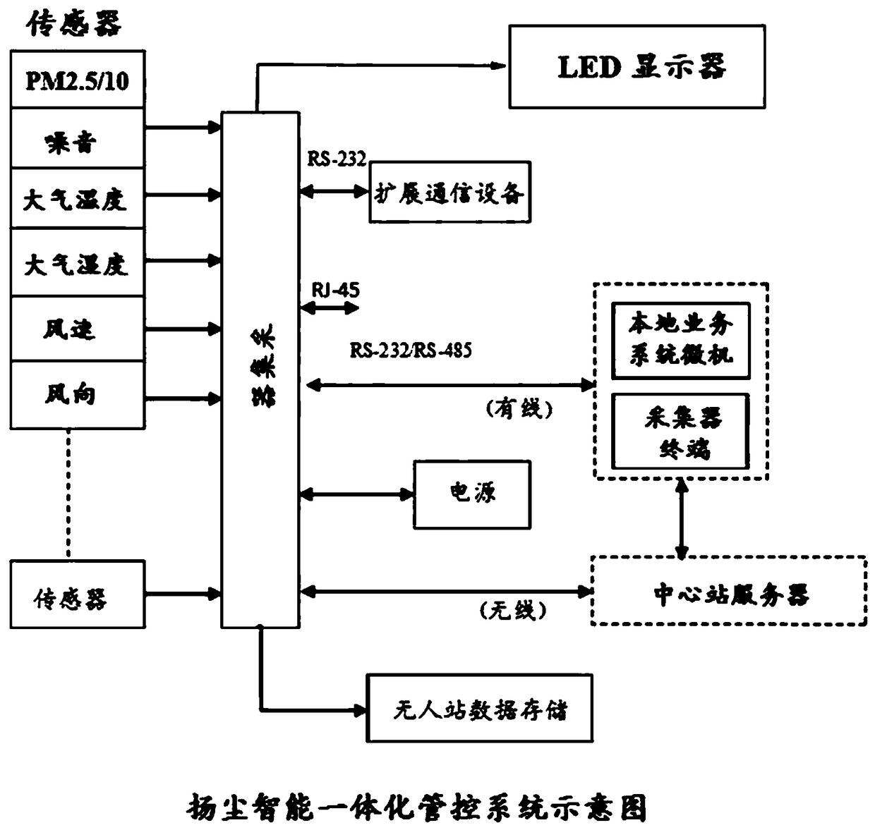
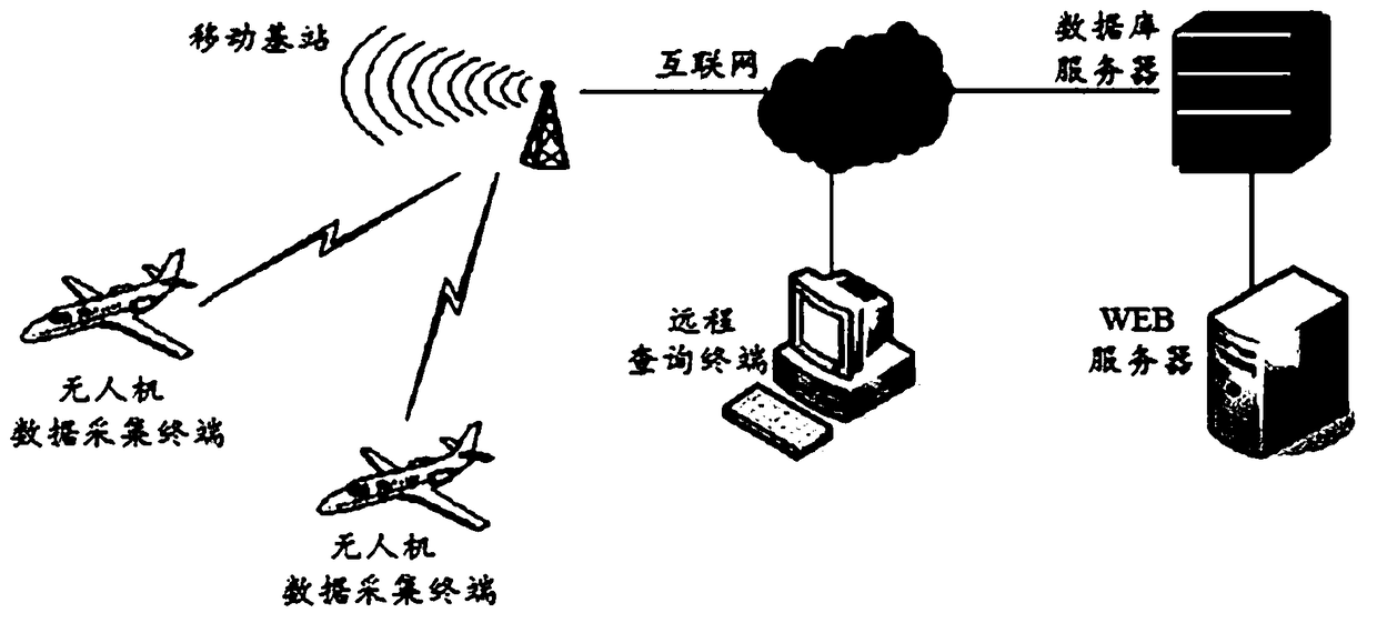
Image

Examples
Embodiment 1
[0081] At 15:55 on June 28, 2017, the location was Miaofeng Mountain Scenic Area. The maximum flight altitude was 260 meters. It took off next to Provincial Highway 101 and reached the highest point after about 7 minutes. Stop mode monitoring (each floor is about 40m high), after flying for about 13 minutes, land to the take-off point, and the gas sampling port is at the same height as the propeller. The operation interface of the test system is as follows: Figure 13 shown.
[0082] Figure 14-Figure 23 It is the relationship diagram between the spatial position and various monitoring parameters. in the Figure 14-Figure 23 Among them, a) is a 3D map of the flight track-data, the X-axis is the longitude, the Y-axis is the latitude, the Z-axis is the altitude, and the gray scale represents the concentration of the measured parameter; b) is the top view of the flight track; c) and d) are Side view of the flight path.
[0083] Depend on Figure 14 It can be seen that withi...
Embodiment 2
[0089] At 14:30 on June 28, 2017, the location was Miaofeng Mountain Scenic Area. The maximum flight altitude was 500 meters. It took off next to Provincial Highway 101 and reached the highest point about 8 minutes later. Stop mode monitoring, after flying for about 15 minutes, land to the take-off point, the height of the gas sampling port is about 40cm higher than the propeller.
[0090] The data of embodiment 2 such as Figure 19 , Figure 20 , Figure 21 , Figure 22 with Figure 23 shown. Analysis and Summary
[0091] From the comparison of the test data of the above two embodiments, it can be seen that the change of the particulate matter data in the first embodiment is more obvious, mainly because the propeller blades have an impact on the air inlet speed of the gas sampling port during the flight, so when the UAV is in an emergency When starting and stopping in an emergency, the data changes greatly; in Example 2, the position of the gas sampling port is increase...
PUM
 Abstract
Description
Claims
Application Information