Method and system for improving specific location resolution of aerial photography

A specific location and aerial photography technology, which is applied in the field of drone shooting panoramas, can solve the problems of time-consuming, low efficiency, poor image clarity, etc., and achieve the effect of improving shooting speed

Pending Publication Date: 2018-11-09
RICOH SOFTWARE RES CENT BEIJING
View PDF6 Cites 4 Cited by
  • Summary
  • Abstract
  • Description
  • Claims
  • Application Information

AI Technical Summary

Problems solved by technology

[0003] Therefore, the above method requires the use of a telephoto lens, high-resolution photography and multiple shots, which is time-consuming and inefficient, and the image clarity is relatively poor

Method used


Image

  • Method and system for improving specific location resolution of aerial photography
  • Method and system for improving specific location resolution of aerial photography
  • Method and system for improving specific location resolution of aerial photography

Examples


Embodiment Construction

[0028] The present invention will be further described below in conjunction with the accompanying drawings and specific embodiments, so that those skilled in the art can better understand the present invention and implement it, but the examples given are not intended to limit the present invention.

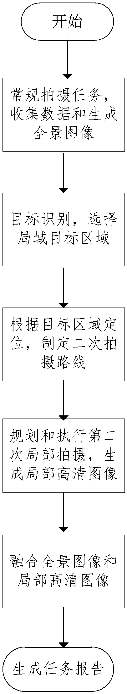
[0029] like figure 1 Shown, be a kind of method for improving the specific position resolution of aerial photography of the present invention, the steps that it comprises are as follows:

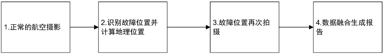
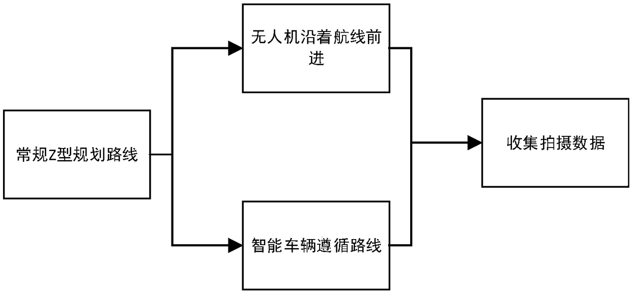
[0030] S1: Follow the camera carrier to move the camera along the route to traverse the whole area for regular shooting, and generate panoramic images according to the shooting data;

[0031] S2: Carry out target recognition according to the image obtained in S1 and the area of ​​the positioning system, select a local target area, analyze the local target area and accurately locate the line;

[0032] S3: According to the positioning of the target area, plan the secondary shooting route of the c...


PUM


Abstract

The invention discloses a method and a system for improving specific position resolution of aerial photography. A carrier mobile camera of the camera is followed, the normal shooting of the whole areais traversed according to the line, and a panoramic image is generated according to the shooting data; target identification is carried out according to the obtained image and the region of the positioning system; a partial target region is selected; the partial target region is analyzed, and the line is positioned accurately; then, according to positioning of the target region, a second photographing line of the camera carrier is planned; a target task is photographed or executed finely; partial photographing data is obtained; and a partial high-resolution image is generated. A partial high-resolution panoramic image is generated in combination with the panoramic image and the partial high-definition image and in fusion with the secondary data result. According to the method and the system for improving specific position resolution of aerial photography in the invention, the results for photographing twice are fused into a panoramic high-resolution photograph, which improves the photographing speed without reducing the image quality of the key target by photographing twice. Therefore, the ultimate goal of the present invention is to generate a partial high-resolution panorama byphotographing twice.

Description

technical field [0001] The present invention designs a method and system for shooting panoramic pictures by unmanned aerial vehicles, and specifically refers to a method for providing specific position resolution of aerial photography. Background technique [0002] At present, under the lens with a large field of view coverage, the precision motion platform carrying the imaging equipment can take high-resolution images of the whole field under the telephoto camera. The device allows automatic tracking and scanning without moving the camera body or lens. The coupled use of two or more devices enables automated range calculations without subsequent polarity rectification, allowing for increased resolution. Control methods for imager positioning can reduce blur caused by camera motion or object motion. [0003] Therefore, the above method requires the use of a telephoto lens, high-resolution photography and multiple shots, which is time-consuming and inefficient, and the imag...

Claims


Application Information

Patent Timeline
Patent Type & Authority Applications(China)
IPC IPC(8): G06T3/40G06T5/50G06T7/00G06T7/80G06K9/00G06K9/62G06Q10/04
CPCG06Q10/047G06T3/4076G06T5/50G06T7/80G06T7/97G06T2207/10048G06T2207/30184G06T2207/20221G06V20/13G06V2201/07G06F18/254
Inventor 付万豪刘殿超李学锋张观良杨光伟李壮
Owner RICOH SOFTWARE RES CENT BEIJING
Why Eureka
Try Eureka