
An ultra-agile satellite area multi-point target task optimization method and system

A technology for target tasks and optimization methods, which is applied in the field of spacecraft autonomous mission planning, and can solve problems such as the inapplicability of multi-point target imaging methods.

Active Publication Date: 2020-10-23
BEIJING INST OF CONTROL ENG
View PDF5 Cites 0 Cited by
  • Summary
  • Abstract
  • Description
  • Claims
  • Application Information

AI Technical Summary

Problems solved by technology

[0003] Therefore, the traditional method for imaging multi-point targets in the area is no longer applicable, and it is necessary to find new solutions for

Method used


Image

  • An ultra-agile satellite area multi-point target task optimization method and system
  • An ultra-agile satellite area multi-point target task optimization method and system
  • An ultra-agile satellite area multi-point target task optimization method and system

Examples


Embodiment Construction

[0082] The present invention will be further described in detail below in conjunction with the accompanying drawings and specific embodiments.

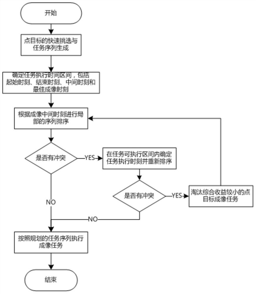
[0083] The invention discloses an ultra-agile satellite area multi-point target task optimization method and system. The invention can ensure fast and efficient screening of target points and form an optimized multi-point target task set in the area. Within the determined task execution interval, the optimal imaging time point is determined by using a weighted average method that integrates factors such as optimal resolution and maximum energy acquisition capability to ensure the best quality of imaging tasks. In order to ensure the efficient resolution of task conflicts, the principle of cost-effectiveness judgment is introduced to perform priority order to ensure the effective execution of high-priority tasks. To solve overlapping tasks in the area, an iterative sorting method that takes into account the minimum attitude maneuver an...


PUM


Abstract

The invention provides a super-agile satellite region multipoint target task optimization method and system. Fast and efficient screening of target points can be ensured and the optimized region multi-point target task set is formed. In order to ensure the best quality of the imaging task, the weighted average method which integrates the best resolution and the maximum energy acquisition capacityis applied to determine the best imaging time point in the determined task execution interval. In order to ensure efficient resolution of the task conflict problem, the cost performance judgment principle is introduced to perform priority ordering so as to ensure effective implementation of the high-priority task. In order to solve the problem of overlapping tasks in the region, the iterative sorting method considering the minimum attitude maneuvering angle between two target points and first visible task priority observation is used so as to effectively ensure efficient execution of the task.The invention is particularly suitable for satellite-borne planning of the intra-region multi-point target imaging task orienting the super-agile satellite and can efficiently complete key problems such as task screening and conflict resolution.

Description

technical field [0001] The invention belongs to the field of spacecraft autonomous task planning, and relates to a task planning method and system for point target imaging tasks in an area. Background technique [0002] Ultra-agile satellites are a type of satellite platform with ultra-fast maneuverability, ultra-high-precision directivity and super-in-place stability. Due to the ultra-agile satellite's super maneuverability and ultra-fast in-place stability characteristics, the imaging capability of the satellite is greatly improved, and it can complete the intensive imaging task of multiple point targets in the area. This leads to the problem of planning and conflict resolution for multi-point target imaging tasks in the region. The existing mission planning and conflict resolution processes are all completed on the ground. Due to the high complexity of the algorithm and the limited resources on the star, it cannot be applied on the star. The specific requirements are: p...

Claims


Application Information

Patent Timeline
Patent Type & Authority Patents(China)
IPC IPC(8): G06Q10/04G06Q10/06
CPCG06Q10/04G06Q10/06313
Inventor 田科丰汤亮刘羽白关新郝仁剑王有懿张科备
Owner BEIJING INST OF CONTROL ENG
Learn More