Semi-automatic point cloud method for making three-dimensional high-definition road map lane line
A lane line, semi-automatic technology, applied in the semi-automatic point cloud field of making 3D high-definition road map lane lines, to achieve the effect of reducing data complexity and calculation costs, overcoming uncertainty, and reducing time consumption
- Summary
- Abstract
- Description
- Claims
- Application Information
AI Technical Summary
Problems solved by technology
Method used
Image

Examples
Embodiment
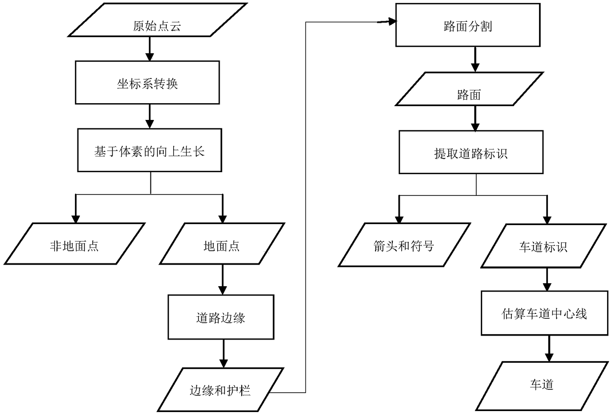
[0058] Before describing this embodiment in detail, it should be pointed out that the semi-automatic point cloud method for making lane lines on a 3D high-definition road map provided by this embodiment is a semi-automatic method, using the roads in the 3D point cloud to create a road map .
[0059] see figure 1 , the invention provides a semi-automatic point cloud method for making lane lines of a three-dimensional high-definition road map, comprising the following steps:
[0060] S1. Preprocessing, transforming the coordinate system and removing non-ground points on the point cloud data to obtain ground points.
[0061] This step is specifically implemented through the following steps:
[0062] S11. Coordinate system transformation. The MLS system utilizes a right-handed orthogonal coordinate system with an arbitrary user-defined orientation and origin. Such a random coordinate system makes it more difficult to plot the relative positions of points. To reduce the comple...
PUM
 Abstract
Description
Claims
Application Information