Dem-assisted intensity-dependent three-dimensional vector inversion method for glacier surface motion
A three-dimensional vector, glacier technology, applied in the reflection/re-radiation of radio waves, measurement devices, 3D modeling, etc., to reduce offset errors, improve image registration accuracy, and improve accuracy.
- Summary
- Abstract
- Description
- Claims
- Application Information
AI Technical Summary
Problems solved by technology
Method used
Image
Examples
specific Embodiment
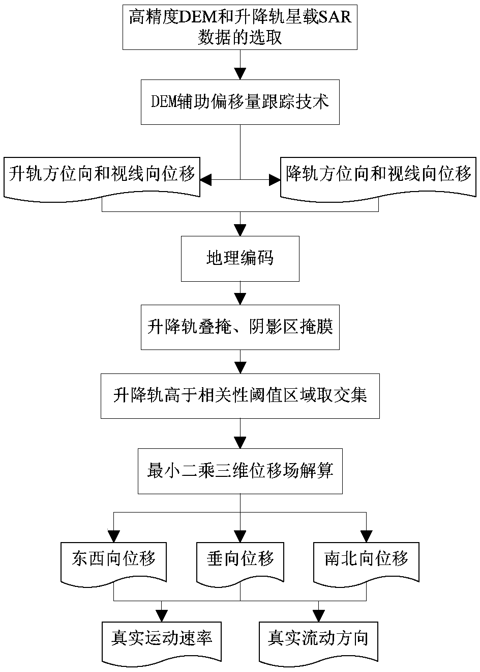
[0114] Taking the estimation of the three-dimensional vector of the surface motion of the Yiga Glacier in Jiali County, Nagqu, Tibet as an example, the specific operation steps of the present invention in practical application are illustrated. Such as figure 1 As shown, the embodiment of the present invention can be implemented according to the following specific steps:
[0115] Step 1: Select high-precision DEM and satellite-borne SAR data of ascending and descending orbits.
[0116] The COSMO-SkyMed radar satellite is a constellation composed of four X-band high-resolution radar satellites, which can quickly obtain the ascending and descending orbit SAR image pairs with similar time distribution in the same area, and select the ascending and descending orbit COSMO-SkyMed data covering the Yiga Glacier, for The HImage imaging mode acquires images with a resolution of 3 m, the polarization mode is HH, and the time difference of the ascending and descending orbit data is only ...
PUM
 Abstract
Description
Claims
Application Information
 - R&D
- Intellectual Property
- Life Sciences
- Materials
- Tech Scout
- Unparalleled Data Quality
- Higher Quality Content
- 60% Fewer Hallucinations
Browse by: Latest US Patents, China's latest patents, Technical Efficacy Thesaurus, Application Domain, Technology Topic, Popular Technical Reports.
© 2025 PatSnap. All rights reserved.Legal|Privacy policy|Modern Slavery Act Transparency Statement|Sitemap|About US| Contact US: help@patsnap.com


