Area target coverage method for imaging satellite based on primary coverage band maximization

A technology for covering strips and regional targets, applied in the field of satellite target coverage, can solve problems such as boundary errors and inability to judge boundary grid coverage filling areas, etc., to achieve the effects of saving satellite resources, improving performance evaluation, and improving accuracy

Pending Publication Date: 2018-12-04
北京市遥感信息研究所 +1
View PDF5 Cites 10 Cited by
  • Summary
  • Abstract
  • Description
  • Claims
  • Application Information

AI Technical Summary

Problems solved by technology

The essence of area coverage is to fill the area of ​​the grid points. However, this method cannot judge whether the boundary grid strictly falls into the coverage filling area, resulting in boundary errors

Method used


Image

  • Area target coverage method for imaging satellite based on primary coverage band maximization
  • Area target coverage method for imaging satellite based on primary coverage band maximization
  • Area target coverage method for imaging satellite based on primary coverage band maximization

Examples


Embodiment Construction

[0052] In order to describe the technical content of the present invention in detail, the technical solutions of the present invention will be further described below in conjunction with the drawings and embodiments.

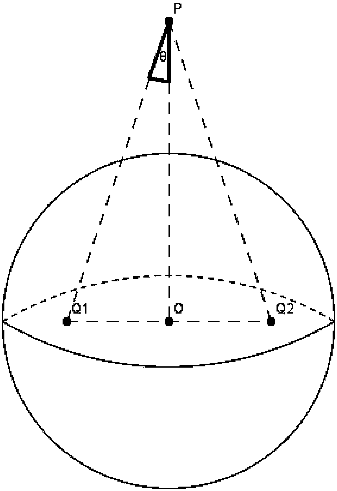
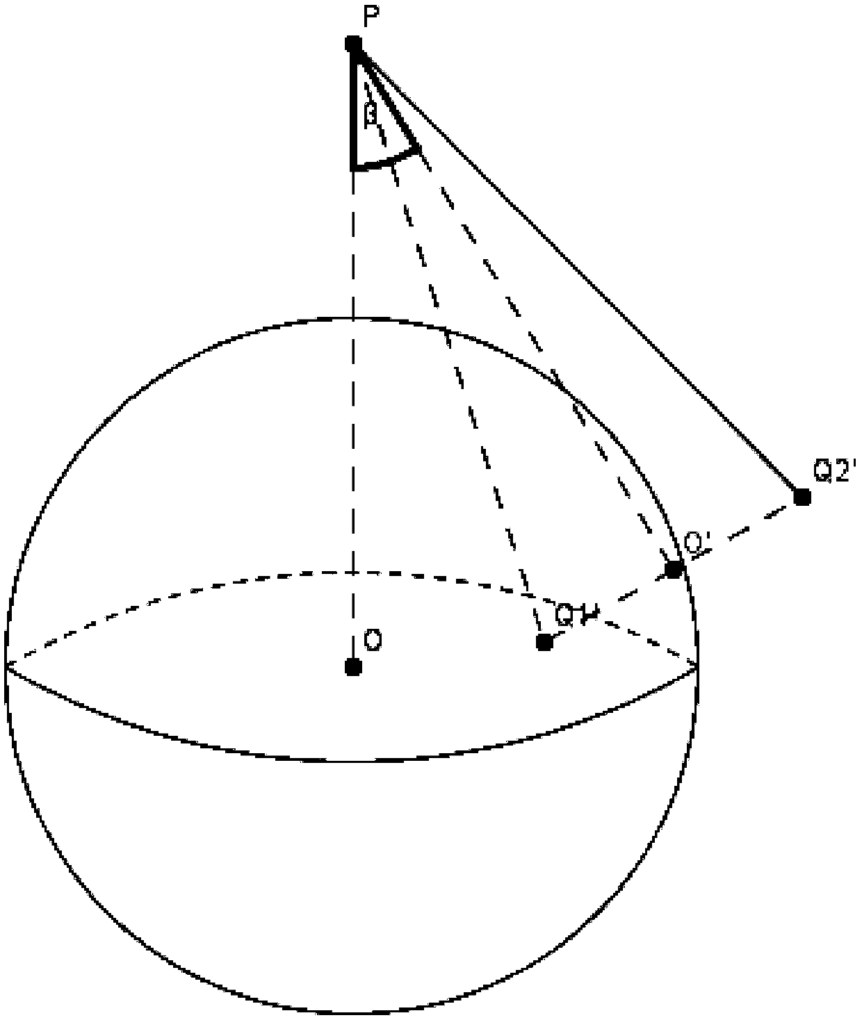
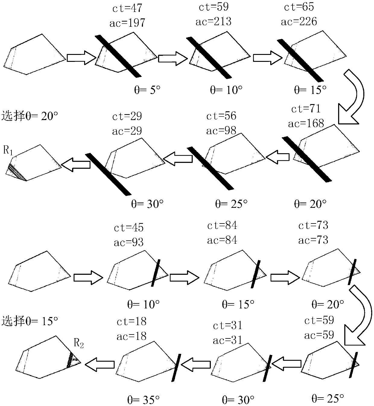
[0053] In order to solve the regional coverage problem based on the strategy of maximizing the utilization of the primary coverage strip, aim at the maximum visible coverage, perform a complete full coverage of the region, and find out the region that is only covered once. For a coverage area, conduct instantaneous coverage searches from different side angles, and select the side angle with the largest number of coverage points to determine the actual coverage plan. The embodiment of the present invention specifically proposes the following two coverage strategies.

[0054] Coverage strategy 1: The satellite changes the side view angle with the preset angle δλ as the step size each time, and scans and covers the coverage area grid once with the instantaneous fie...


PUM


Abstract

An area target coverage method for an imaging satellite based on primary coverage band maximization is provided. A satellite changes a side view angle with a preset angle as a step length every time,meshes of a primary coverage area are scanned and covered by an instantaneous field angle, and attributes of mesh points covered by push-sweep every time are adjusted. After the side view angle and cover area of push-sweep every time are recorded, the attribute value of the mesh of the coverage area is reset. Finally, a push-sweep angle covering the maximum mesh area is selected to add into a sideview scheme. If a plurality of primary coverage areas exist and the maximum push-sweep area after instantaneous coverage is the same, the side view coverage band with the largest actual coverage areais selected in the target area to determine the side view angle, otherwise the instantaneous coverage with the maximum push-sweep area is selected to determine the side view angle. The Area target coverage method for imaging satellite provided by the invention can effectively deal with large-scale situations, and greatly improves performance evaluation of time effectiveness, coverage rate, resolution and the like of area coverage of multiple kinds of imaging satellites under complex constraint conditions.

Description

technical field [0001] The invention relates to the field of satellite target coverage, studies the problem of complete coverage of multi-satellite multi-constrained area targets, and provides an imaging satellite area target coverage method based on the maximization of primary coverage strips. Background technique [0002] Imaging satellites are widely used in military reconnaissance, environmental monitoring and other fields. Compared with a single imaging satellite, the multi-satellite constellation has the advantages of large coverage, short revisit time, low time resolution and low investment risk. Target coverage is one of the important performances of imaging satellites. The accuracy of target coverage area seriously affects the performance of imaging satellites and the accuracy of data calculation, especially in the case of multiple satellites and constraints. The accuracy of target coverage is more important. [0003] The main function of multi-satellite planning a...

Claims


Application Information

Patent Timeline
Patent Type & Authority Applications(China)
IPC IPC(8): G06F17/50G06T17/20
CPCG06T17/20G06F30/20
Inventor 刘锋蔡波李肖冬孙通
Owner 北京市遥感信息研究所
Why Eureka
Try Eureka