An efficient display method and device for dynamic legends in a WebGIS environment
A display method and a display device technology, which are applied in the field of geographic information, can solve problems such as slow calculation speed, user interface legend refresh delay, poor user experience, etc., and achieve the effect of reducing read and write access and improving overall performance
- Summary
- Abstract
- Description
- Claims
- Application Information
AI Technical Summary
Problems solved by technology
Method used
Image
Examples
Embodiment 1
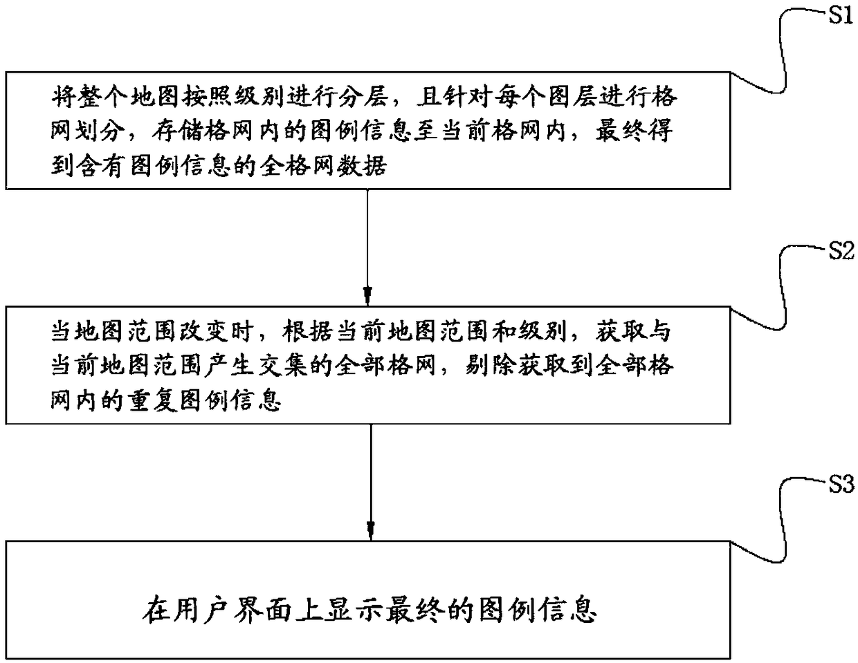
[0036] Such as figure 1 As shown, the efficient display method of the dynamic legend under the WebGIS environment provided by the embodiment of the present invention comprises the following steps:
[0037] Step S1. Layer the entire map according to levels, and divide each layer into a grid, store the legend information in the grid to the current grid, and finally obtain the full grid data including the legend information.
[0038] At present, maps are hierarchical structures, and different levels correspond to different scales. The purpose of this step is to divide each layer into a grid and store legend information in the grid. Specifically, the specific implementation process of this step is as follows:
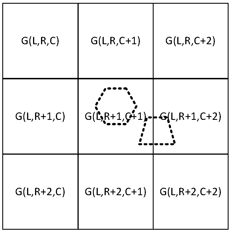
[0039] S11, the whole map is divided into pyramids of several levels according to the pattern of quadtree, each level of pyramid is a layer, and each level of pyramid is divided into several grids arranged horizontally and vertically, and each grid is passed through level, ...
Embodiment 2
[0066] Such as Figure 4 As shown, the present invention provides a kind of efficient display device of dynamic legend under WebGIS environment, for completing the efficient display method of dynamic legend under WebGIS environment provided by the present invention, the efficient display device of described dynamic legend under WebGIS environment comprises
[0067] Preprocessing unit: used to store the legend information into the grid data;
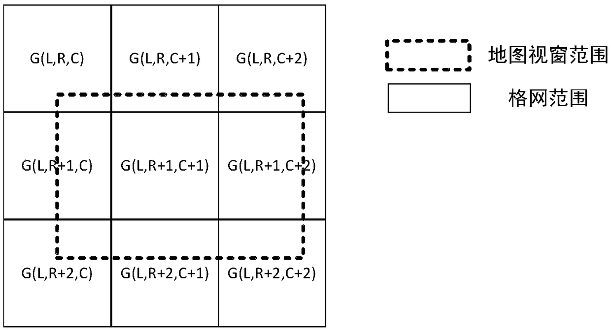
[0068] Legend real-time call unit: when the map range changes, it is used to obtain all grids that intersect with the current map range, and remove duplicate legend information in all grids;
[0069] Interface display unit: used to display the final legend information.
[0070] As a specific structure of the preprocessing unit, it includes:
[0071] The grid division module is used to divide the entire map into several levels of pyramids according to the quadtree mode. Each level of pyramid is a layer, and each level of pyramid is divid...
PUM
 Abstract
Description
Claims
Application Information
 - R&D
- Intellectual Property
- Life Sciences
- Materials
- Tech Scout
- Unparalleled Data Quality
- Higher Quality Content
- 60% Fewer Hallucinations
Browse by: Latest US Patents, China's latest patents, Technical Efficacy Thesaurus, Application Domain, Technology Topic, Popular Technical Reports.
© 2025 PatSnap. All rights reserved.Legal|Privacy policy|Modern Slavery Act Transparency Statement|Sitemap|About US| Contact US: help@patsnap.com


