Digital terrain generation method for branchless river

A digital terrain and river channel technology, applied in image data processing, instrumentation, calculation, etc., can solve the problems of difficulty, long cycle, and high cost of river network models

Active Publication Date: 2018-12-11
SICHUAN UNIV
View PDF12 Cites 11 Cited by
  • Summary
  • Abstract
  • Description
  • Claims
  • Application Information

AI Technical Summary

Problems solved by technology

[0003] Aiming at the problems of high cost, long period and difficulty in constructing the river network model, the present invention proposes a method based on A digital terrain generation method for unbranched rive...

Method used


Image

  • Digital terrain generation method for branchless river
  • Digital terrain generation method for branchless river
  • Digital terrain generation method for branchless river

Examples


Embodiment 1

[0068] In this embodiment, the method for generating digital terrain without branched rivers is described in detail, and the steps are as follows:

[0069] (1) Obtain basic data

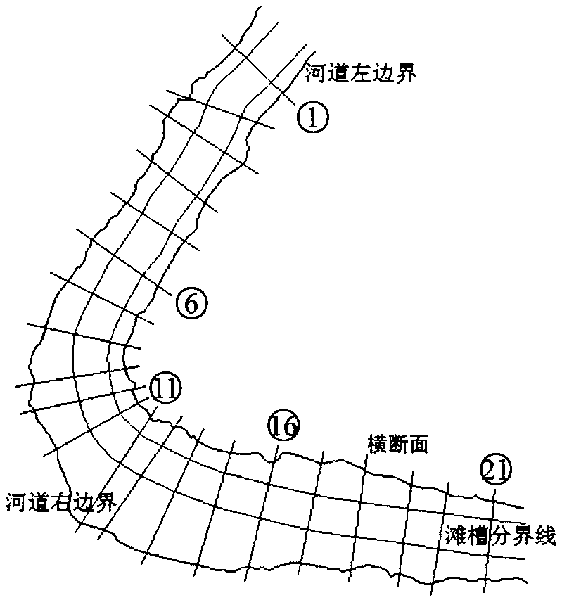
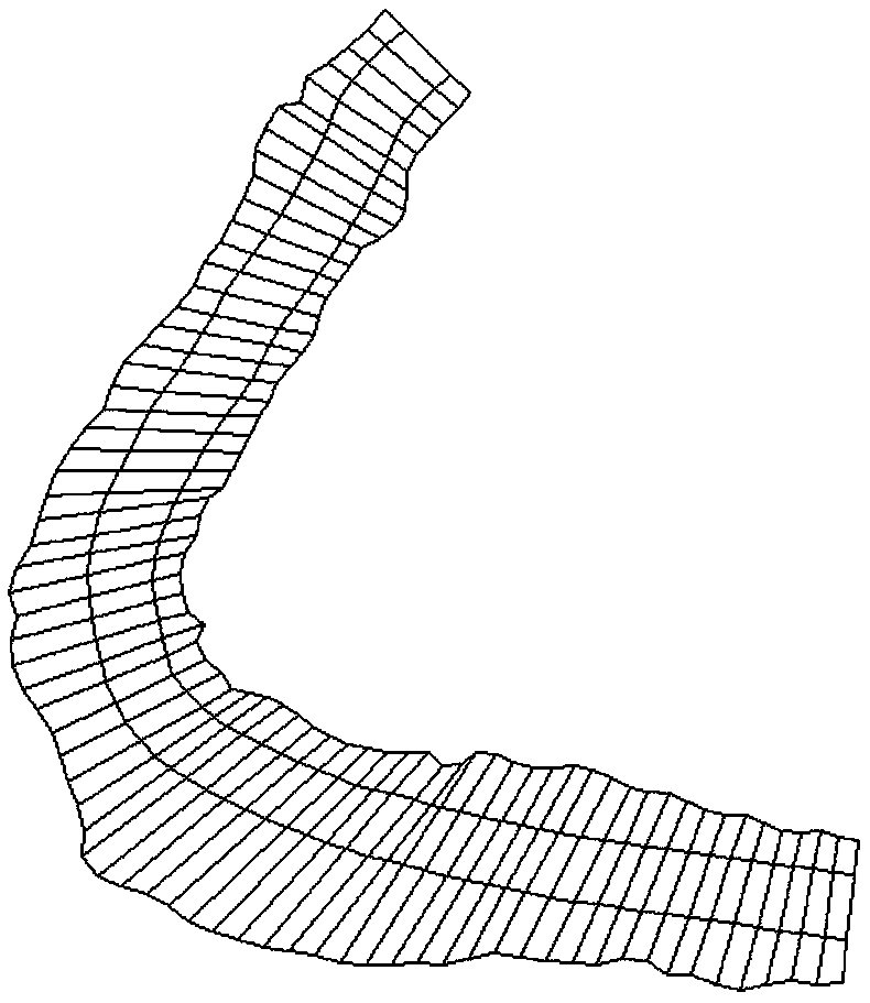
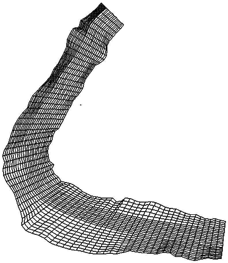
[0070] Select the unbranched target river section that needs to be generated by digital terrain, and the characteristic longitudinal control line and cross-section distribution of the target river section are as follows: figure 1 shown.

[0071] Obtain the terrain data of the characteristic longitudinal control lines of the target river section through satellite images. Specifically, import a high-definition satellite image into CAD software to draw the river channel boundary line and the trough-shoal boundary line to obtain 4 characteristic longitudinal control lines, and The plane coordinate data of several control points on these four longitudinal control lines will be located between the left boundary line of the river channel (the leftmost characteristic longitudinal control line) and the right...


PUM


Abstract

The invention belongs to the technical field of river numerical simulation, and provides a digital terrain generation method for a branchless river. The method comprises the following four steps: (1)acquiring basic data, (2) carrying out mesh generation of target river sections, (3) carrying out cross-section generalization and (4) generating a digital terrain. Based on the characteristic longitudinal control line and less measured cross-sectional topographic data, the method can solve the problems of high cost, long period and great difficulty in constructing river network model caused by the prior art that a large amount of terrain data covering a simulation area and evenly distributed are needed to ensure the truth and reasonableness of the grid interpolation result, and effectively reduces the generation difficulty of river digital terrain and the construction cost of river network model.

Description

technical field [0001] The invention belongs to the technical field of river numerical simulation, and relates to a method for generating digital terrain of a branchless river. Background technique [0002] In river numerical simulation, it is very important whether the terrain value of grid nodes can reflect the real terrain, which directly determines the reliability of simulation results. Many hydrodynamic calculation software, such as Mike, SMS, etc., require a large amount of evenly distributed terrain data covering the digital-analog calculation area in order to ensure that the gridded interpolation results are true and reasonable in river digital terrain interpolation. Due to the long cycle of topographic survey, the difficulty of surveying and the large investment, for general rivers, in most cases, the method of laying out uniform measuring points for the entire river is not used for topographic surveying. Spacing of cross-sectional terrain data. If we still comple...

Claims


Application Information

Patent Timeline
IPC IPC(8): G06T17/20
CPCG06T17/20
Inventor 潘云文杨克君刘欣刘兴年刘超郭志学
Owner SICHUAN UNIV
Why Eureka
Try Eureka