A three-dimensional modeling method and system combining a lidar and a spherical curtain camera

A laser radar and three-dimensional modeling technology, applied in image data processing, instruments, calculations, etc., can solve problems such as large errors and tracking loss, and achieve energy saving, accurate and reliable scenes

Active Publication Date: 2018-12-28
中德人工智能研究院有限公司 +1
View PDF13 Cites 20 Cited by
  • Summary
  • Abstract
  • Description
  • Claims
  • Application Information

AI Technical Summary

Problems solved by technology

[0004] However, vision-based real-time localization and mapping (VSLAM) technology will experience tracking loss when encountering relatively few feature points such as white walls and glass.
Although the loopback detection will re-optimize the path, there will still be a large error after multiple optimizations

Method used


Image

  • A three-dimensional modeling method and system combining a lidar and a spherical curtain camera
  • A three-dimensional modeling method and system combining a lidar and a spherical curtain camera
  • A three-dimensional modeling method and system combining a lidar and a spherical curtain camera

Examples


Embodiment Construction

[0033] The present invention will be further described below. It should be noted that the following examples are based on the technical solution and provide detailed implementation and specific operation process, but the protection scope of the present invention is not limited to this example.

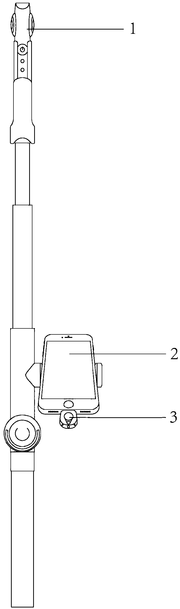
[0034] The present invention is a method for carrying out three-dimensional modeling of a large scene through a laser radar 3 and a dome camera 1, the method comprising the following steps:

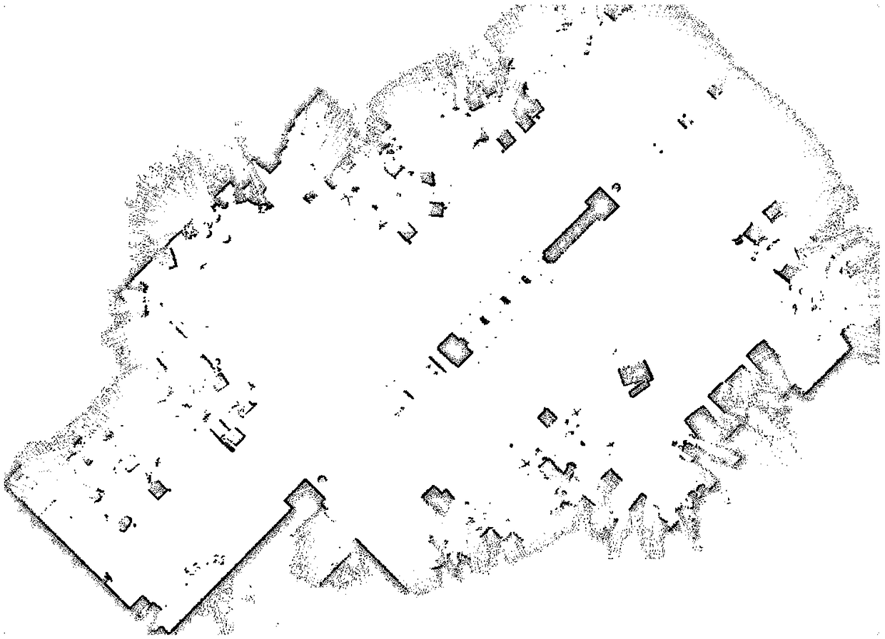
[0035] S1. Use laser radar 3 to scan the current scene in real time to obtain data;

[0036] S2. Trigger the dome camera 1 to take pictures and obtain panoramic photos;

[0037] S3. Upload the radar data and panoramic photos to the mobile terminal 2, and calculate the path and buffer the panoramic photos according to the radar data through the mobile terminal 2;

[0038] S4. Upload the path data and panoramic photo data processed in step S3 to the server for three-dimensional modeling.

[0039] ...


PUM


Abstract

The invention discloses a three-dimensional modeling method and system combined with a laser radar and a spherical curtain camera, which relates to the technical field of three-dimensional imaging modeling. The method comprises the following steps: scanning the current scene with a laser radar to obtain data in real time; triggering a spherical curtain camera to take photographs and obtain panoramic photographs; uploading radar data and panoramic photos to the mobile terminal, calculating a path and buffering the panoramic photos according to the radar data through the mobile terminal; uploading the path data and panoramic photo data processed by the step to the server for three-dimensional modeling. Laser radar real-time scanning and positioning, compared to running into a white wall, when the characteristic points such as glass and the like are few, the vision-based SLAM which is lost in tracking will appear. The real-time scanning and positioning of the laser radar is more stable and accurate than the video stream positioning of the vision-based SLAM, and the created three-dimensional model will not produce model distortion, and the scene of the created three-dimensional model is more accurate and reliable.

Description

technical field [0001] The invention relates to the technical field of three-dimensional imaging modeling, in particular to a three-dimensional modeling method and system combining a laser radar and a dome camera. Background technique [0002] In the process of using a dome camera for 3D modeling, because it involves real-time positioning and mapping (SLAM) technology, the amount of data that needs to be processed for the dome camera (usually binocular or multi-purpose) to shoot video streams all the time Relatively large, this will cause a very large burden on the hardware, generate a large heating phenomenon, and the power will be exhausted in about a few minutes to ten minutes. Secondly, if you directly use the dome camera for spatial positioning, you must use the frame pictures of the video stream captured by the dome camera, and then perform SLAM positioning, but such a large amount of calculation takes up a lot of CPU resources, which will increase a huge amount of pow...

Claims


Application Information

Patent Timeline
Patent Type & Authority Applications(China)
IPC IPC(8): G06T7/521G06T7/55
CPCG06T7/521G06T7/55G06T2207/10016G06T2207/10024
Inventor 崔岩
Owner 中德人工智能研究院有限公司
Why Eureka
Try Eureka