
Inland water network route planning method

A route and water network technology, applied in navigation, surveying and mapping and navigation, navigation calculation tools, etc., to achieve the effects of ensuring navigation safety, fast promotion and popularization, and low cost

Pending Publication Date: 2019-03-01
DALIAN MARITIME UNIVERSITY
View PDF6 Cites 6 Cited by
  • Summary
  • Abstract
  • Description
  • Claims
  • Application Information

AI Technical Summary

Problems solved by technology

The common defect is that they do not start from the characteristics of the inland water system network, such as the complexity of the river network and the diversity of river bridges, and fully consider the safety of ship navigation.

Method used


Image

  • Inland water network route planning method
  • Inland water network route planning method
  • Inland water network route planning method

Examples


Embodiment Construction

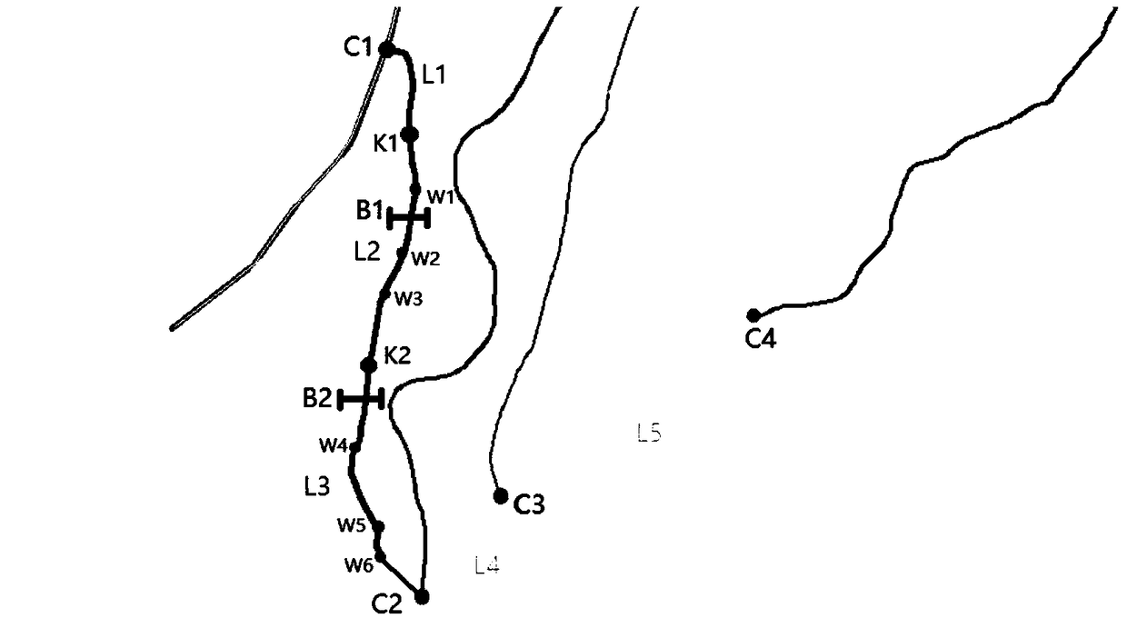
[0027] The specific embodiments of the present invention will be further described below in conjunction with the accompanying drawings.

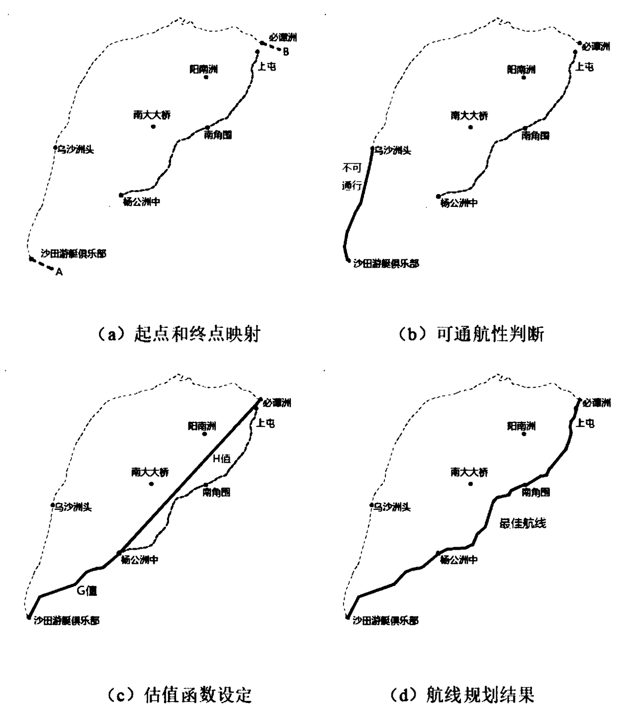
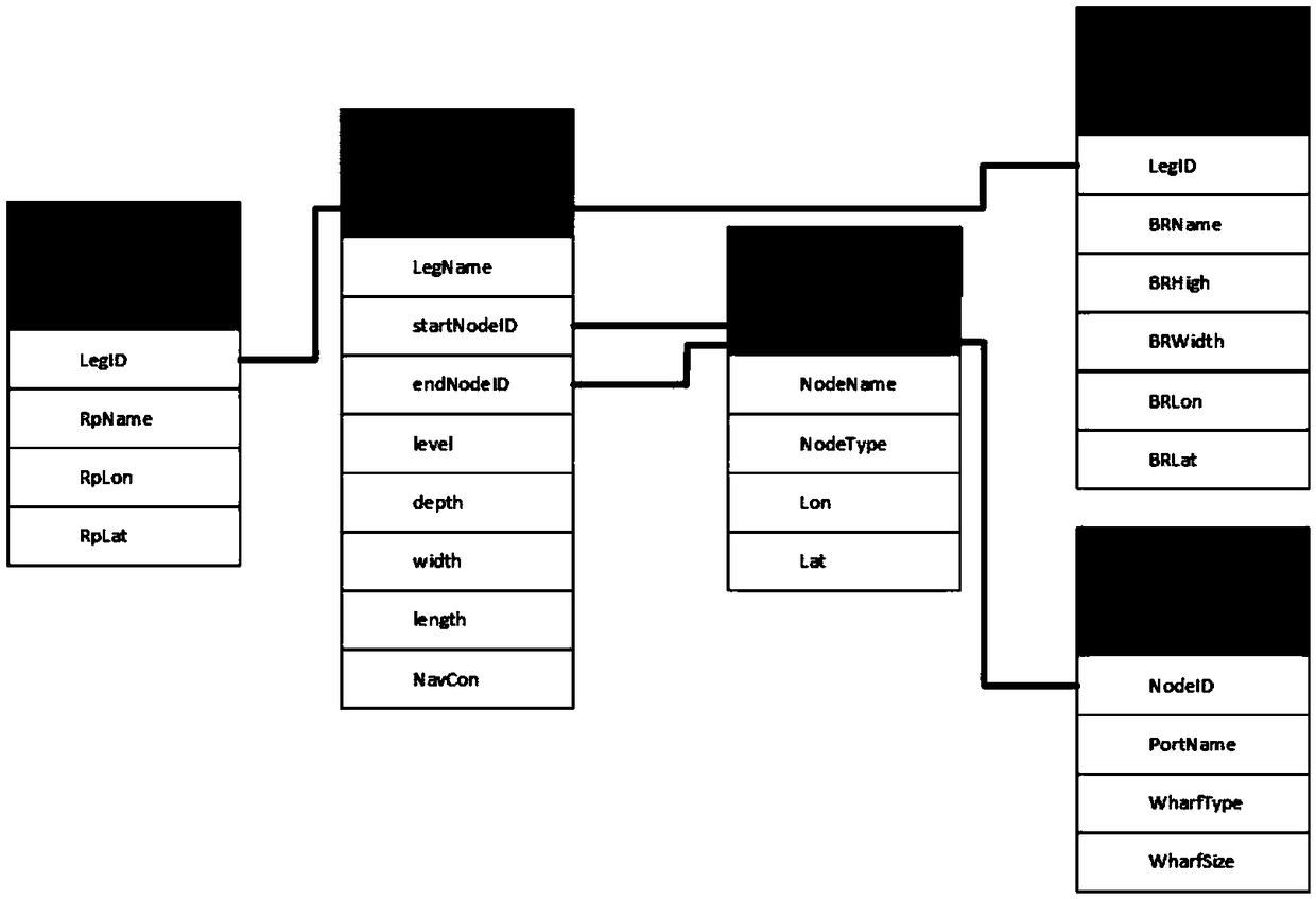
[0028] as attached figure 1 , 2 As shown, a route planning method for an inland water network is realized through a computer system composed of a relational database, a server and a front-end database, including the following steps:

[0029] S1, divide the waterway into several flight segments through the nodes such as route intersections and docks that can be used as the start and end of the route;

[0030] S2, storing flight segment information in the relational database, and forming a directed topological network for the corresponding water network;

[0031] S3, select the start point and end point in the formed directed topology network, the system traverses the data of the voyage segment, and plans an optimal route for the ship to pass safely by comparing the ship's own conditions and channel conditions.

[0032] Further, the flight ...


PUM


Abstract

The invention discloses an inland water network route planning method and a ship route planning handheld terminal APP based on the inland water network route planning method. The inland water networkroute planning method is realized through a computer system which is composed of a relational database, a server and a front-end database, and comprises the following steps that S1, a route is dividedinto a plurality of route segments through nodes which can be used as route starting and ending points such as route intersection points and docks; S2, segment information is stored into the relational database, and a corresponding water network is enabled to form a directed topological network; and S3, a starting point and an ending point are selected in the formed directional topological network, the segment data are systematically traversed, and an optimal route is planned for a ship to safely pass through by comparing the own conditions of the ship with channel conditions. By comparing channel information with ship information, the optimal route is intelligently planned for the ship, and the navigation aid service is provided for the ship through the handheld terminal APP based on anelectronic channel chart so as to better ensure the navigation safety of the ship.

Description

technical field [0001] The invention relates to a method for planning a river transport route, in particular to a method for planning a route for an inland water network. Background technique [0002] There are many rivers and lakes in our country. The great rivers run across the east and west, and the tributaries of the inland rivers connect the north and the south, forming a huge inland water network. The drainage area is 1000km 2 There are more than 1580 rivers above, 100km 2 There are more than 50,000 rivers above, with a total length of 43,000 km. In recent years, remarkable achievements have been made in the construction of inland waterways and port facilities. The volume of inland waterway freight continues to grow. The trend of large-scale and standardized transport ships is obvious. Inland waterway has entered a period of rapid development. However, due to the increasing demand for inland waterway transportation and the increasingly complex navigation environment,...

Claims


Application Information

Patent Timeline
IPC IPC(8): G01C21/20
CPCG01C21/203
Inventor 潘明阳刘乙赛李超李邵喜崔家诚尧旺明李琦王德强郝江凌胡景峰赵丽宁
Owner DALIAN MARITIME UNIVERSITY
Learn More