Drone real-time path planning method based on improved RRT (Rapidly-exploring Random Tree)
A technology for real-time path planning and unmanned aerial vehicles, which is applied to navigation and calculation tools, etc., can solve the problems caused by restrictions, inconvenient operation, and increase the amount of calculation, and achieve the effect of reducing the scope and the amount of calculation.
- Summary
- Abstract
- Description
- Claims
- Application Information
AI Technical Summary
Problems solved by technology
Method used
Image
Examples
Embodiment 1
[0092] 1. Build a partial scrolling window
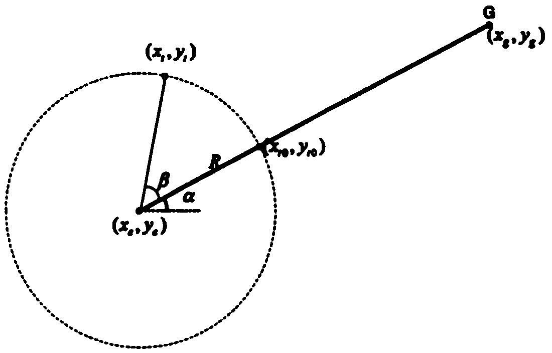
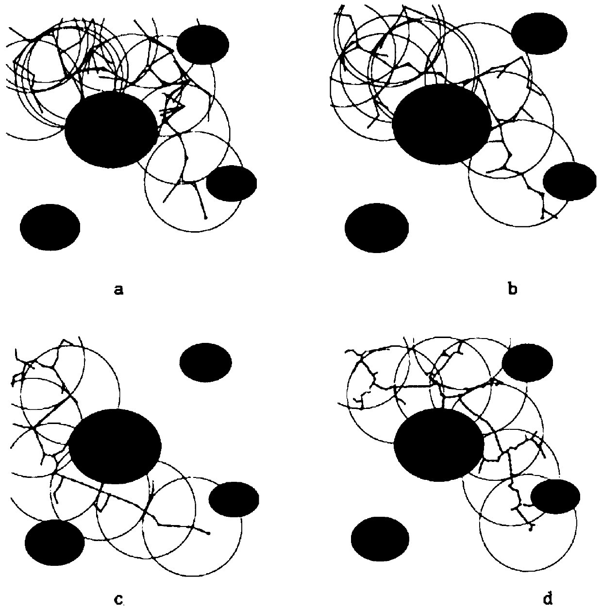
[0093] The local environmental information is obtained through the sensors carried by the UAV, and the planning window is driven in a periodic form. The window area of each planning is defined as Win(q_R(t))={p|p∈C,d(q, q_R(t))≤R}, q_R(t) represents the center of the rolling window, R is the radius of the rolling window, generally the detection radius of the sensor. The aforementioned window is also referred to as the field of view of the drone.
[0094] Since the drone is in the process of real-time route planning and autonomous navigation, it is best to maintain a certain speed and fly continuously without stopping to wait for the next window planning to generate a path before proceeding. Therefore, in order to fly continuously, it is necessary to plan the next window in advance before reaching the local sub-target point, and take the current planned target point as the center of the next planning window. That is, after the ne...
Embodiment 2
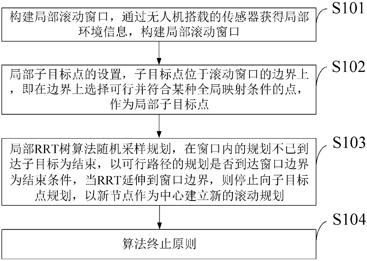
[0114] The general flow of the rolling RRT algorithm provided by the embodiment of the present invention is as follows:
[0115] (1) initialize the variables of the RRT tree in the rolling window;
[0116] (2) judge whether it is located in the rolling window, if it is then go to step 3, not go to step 4;
[0117] (3) As the target point, randomly generate nodes on the boundary
[0118] (4) Obtain local sub-target points on the rolling window boundary, and generate random nodes on the boundary;
[0119] (5) Select the nearest tree node in the current tree species, and generate nodes according to a certain step size;
[0120] (6) Collision detection is performed on the connection line;
[0121] (7) Judging whether it is in the flyable zone and there is no obstacle distribution on the connection line, if not satisfied, return to step 2, and if satisfied, go to step 6;
[0122] (8) will join the tree list, judge to arrive, if not then go to step 9; Yes then end the algorithm;...
PUM
 Abstract
Description
Claims
Application Information
 - R&D
- Intellectual Property
- Life Sciences
- Materials
- Tech Scout
- Unparalleled Data Quality
- Higher Quality Content
- 60% Fewer Hallucinations
Browse by: Latest US Patents, China's latest patents, Technical Efficacy Thesaurus, Application Domain, Technology Topic, Popular Technical Reports.
© 2025 PatSnap. All rights reserved.Legal|Privacy policy|Modern Slavery Act Transparency Statement|Sitemap|About US| Contact US: help@patsnap.com


