An object-based satellite image multi-index built-up area automatic extraction method

A satellite image and built-up area technology, which is applied in the direction of instruments, character and pattern recognition, scene recognition, etc., to achieve the effect of improving the extraction accuracy

Pending Publication Date: 2019-04-09
INST OF REMOTE SENSING & DIGITAL EARTH CHINESE ACADEMY OF SCI
View PDF5 Cites 8 Cited by
  • Summary
  • Abstract
  • Description
  • Claims
  • Application Information

AI Technical Summary

Problems solved by technology

[0010] The purpose of the present invention is to solve the problems existing in the existing built-up area extraction method, and propose a meth...

Method used


Image

  • An object-based satellite image multi-index built-up area automatic extraction method
  • An object-based satellite image multi-index built-up area automatic extraction method
  • An object-based satellite image multi-index built-up area automatic extraction method

Examples


Embodiment Construction

[0028] The present invention will be further elaborated below in conjunction with the accompanying drawings, but it is not used to limit the scope of the present invention.

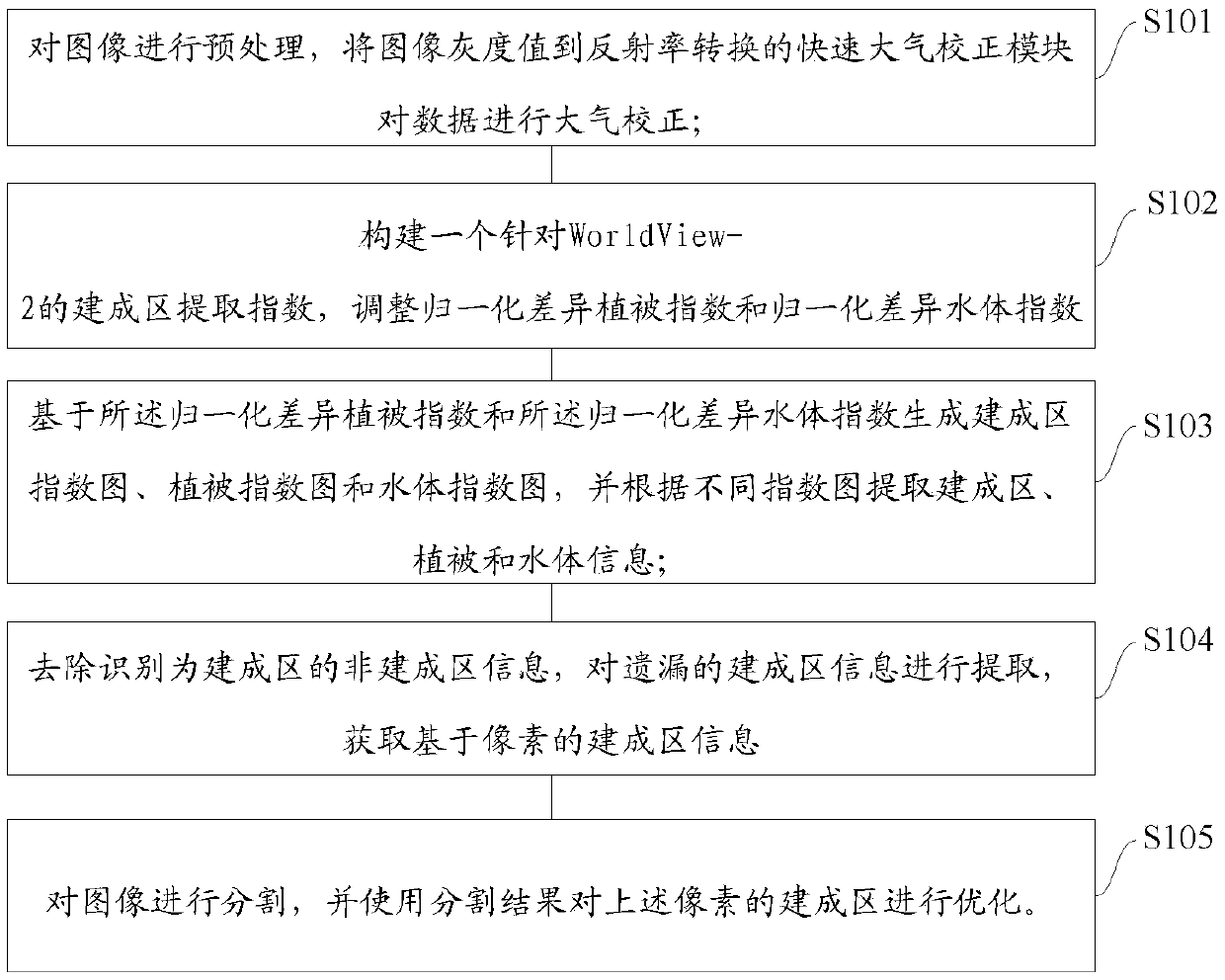
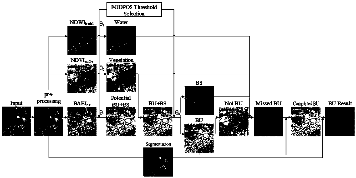
[0029] figure 1 It is a schematic flow chart of an object-based method for automatic extraction of multi-indicator built-up areas from satellite images. Such as figure 1 As shown, the method includes steps S101-S105:

[0030] S101, preprocessing the image, and performing atmospheric correction on the data by a fast atmospheric correction module that converts the image gray value into reflectance.

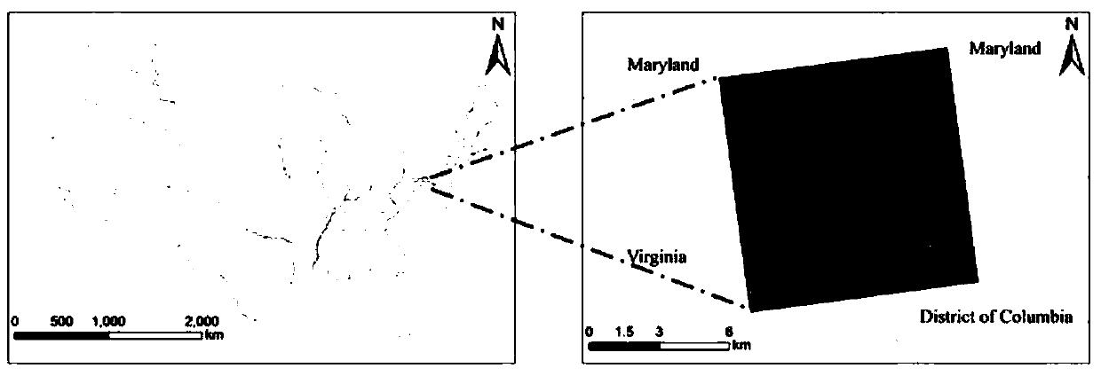
[0031] Specifically, use the fast atmospheric correction module to perform atmospheric correction on the image gray value of WorldView-2. After that, crop the image like image 3 shown to remove regions with invalid values ​​in the original image.

[0032] S102. Construct a built-up area extraction index (BAEIr-c) for WorldView-2, and adjust the normalized difference vegetation index (NDVI) and the normali...


PUM


Abstract

The invention provides an object-based satellite image multi-index built-up area automatic extraction method, and the method comprises the following steps: carrying out the preprocessing of an image,and carrying out the atmospheric correction of data through a rapid atmospheric correction module which converts the gray value of the image to the reflectivity; Constructing a built-up area extraction index for a WorldView-2, and adjusting the normalized difference vegetation index and the normalized difference water body index; Generating a built-up area index map, a vegetation index map and a water body index map based on the normalized difference vegetation index and the normalized difference water body index, and extracting built-up area, vegetation and water body information according todifferent index maps; Removing the non-built-up area information identified as the built-up area, extracting the omitted built-up area information, and obtaining pixel-based built-up area information; and segmenting the image, and optimizing a built-up region of the pixel by using a segmentation result. The contour of the built-up area can be accurately captured, and the extraction precision of the built-up area is improved.

Description

technical field [0001] The invention relates to a technology for automatically extracting multi-indicator built-up areas from satellite images, in particular to an object-based method for automatically extracting multi-indicator built-up areas from satellite images. Background technique [0002] Rapid urban expansion has led to a series of urban problems, such as unreasonable urban sprawl and unreasonable urban land use. Intensive and refined planning has become the trend of urban planning. With the launch of ultra-high resolution remote sensing satellites, it is possible to accurately identify information in urban built-up areas, and has great application potential in fine urban planning. However, the specific patterns of urban built-up areas can vary widely due to different types of roofs, trees, and shading. Therefore, it is more challenging to accurately detect and extract urban built-up areas using high spatial resolution images compared to medium and low resolution i...

Claims


Application Information

Patent Timeline
IPC IPC(8): G06K9/00G06K9/34
CPCG06V20/13G06V10/267
Inventor 孟庆岩孙震辉张颖张琳琳
Owner INST OF REMOTE SENSING & DIGITAL EARTH CHINESE ACADEMY OF SCI
Why Eureka
Try Eureka