UAV operating method and system

A technology for drones and operations, applied in the field of drones, to improve reusability and usability, reduce development difficulty and cost, and simplify control logic

Inactive Publication Date: 2019-06-21
成都蔚来空间科技有限公司
View PDF6 Cites 9 Cited by
  • Summary
  • Abstract
  • Description
  • Claims
  • Application Information

AI Technical Summary

Problems solved by technology

[0003] This disclosure intends to provide a UAV operation system and UAV operation method, which can solve the problems that the existing operation UAV needs to manually manage the obstacle area and need to be equipped with an additional obstacle avoidance system, and can realize the operation area terrain following

Method used


Image

  • UAV operating method and system
  • UAV operating method and system
  • UAV operating method and system

Examples


Embodiment 1

[0048] This embodiment discloses a method for operating an unmanned aerial vehicle, which includes the following contents:

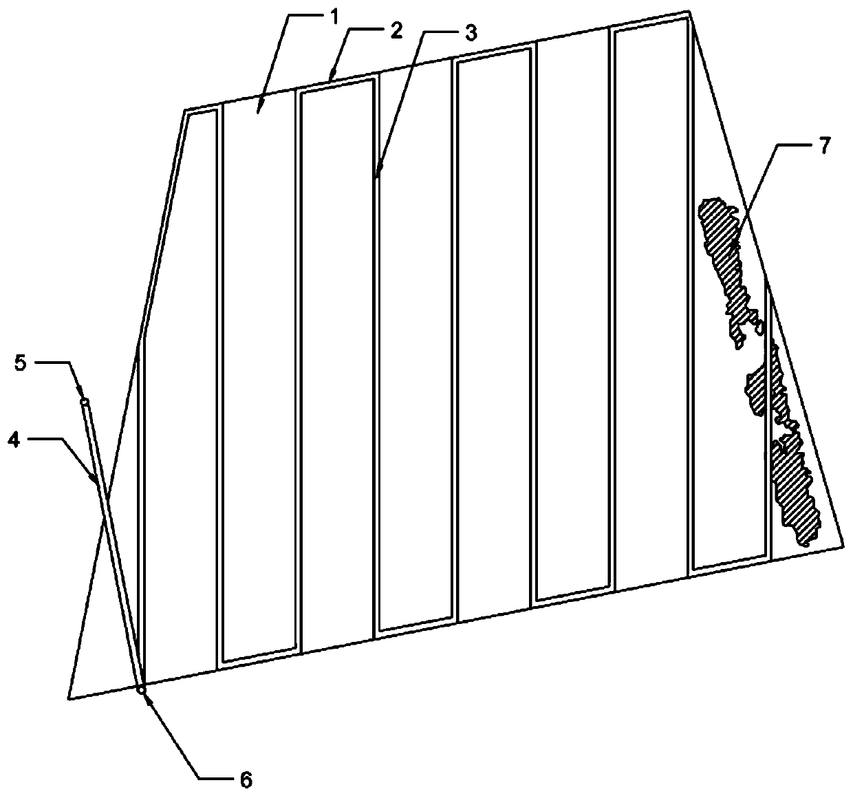
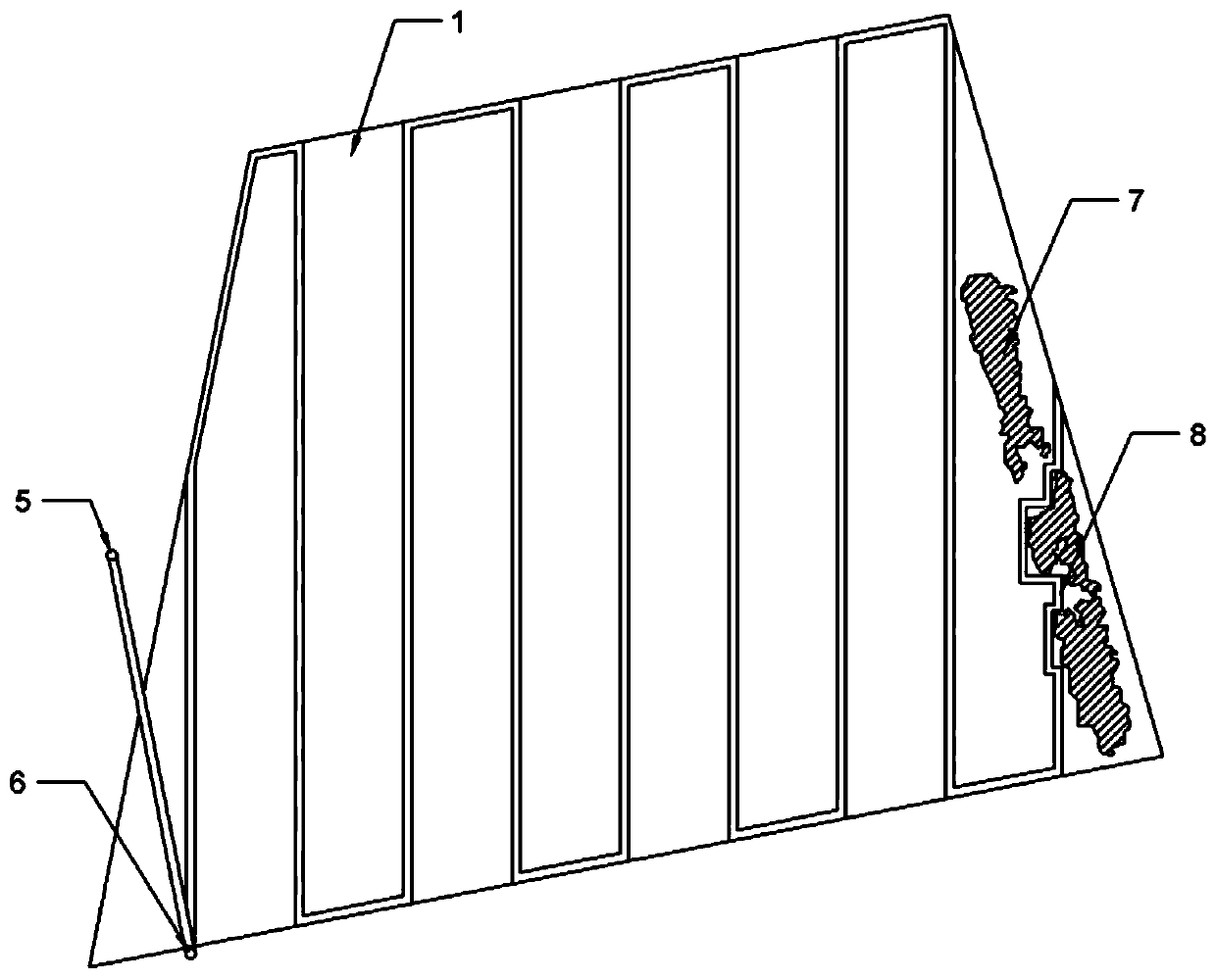
[0049] Acquire and process the spatial three-dimensional data of the operation area 1, and generate the spatial three-dimensional data model of the operation area 1;

[0050] Generate the flight path of the UAV according to the starting position of the UAV, parameter settings and the spatial three-dimensional data model of the operation area 1;

[0051] UAVs fly and operate according to the flight path.

[0052] Perform the following steps when processing the spatial 3D data of the operating area 1:

[0053]According to the delimited operation boundary, obtain the average height of the crops in the operation area 1;

[0054] Subtract the average height of the crops from the height of the area corresponding to the crop range, and add the actual height of the current crops in the area to obtain the current actual spatial three-dimensional data model of t...

Embodiment 2

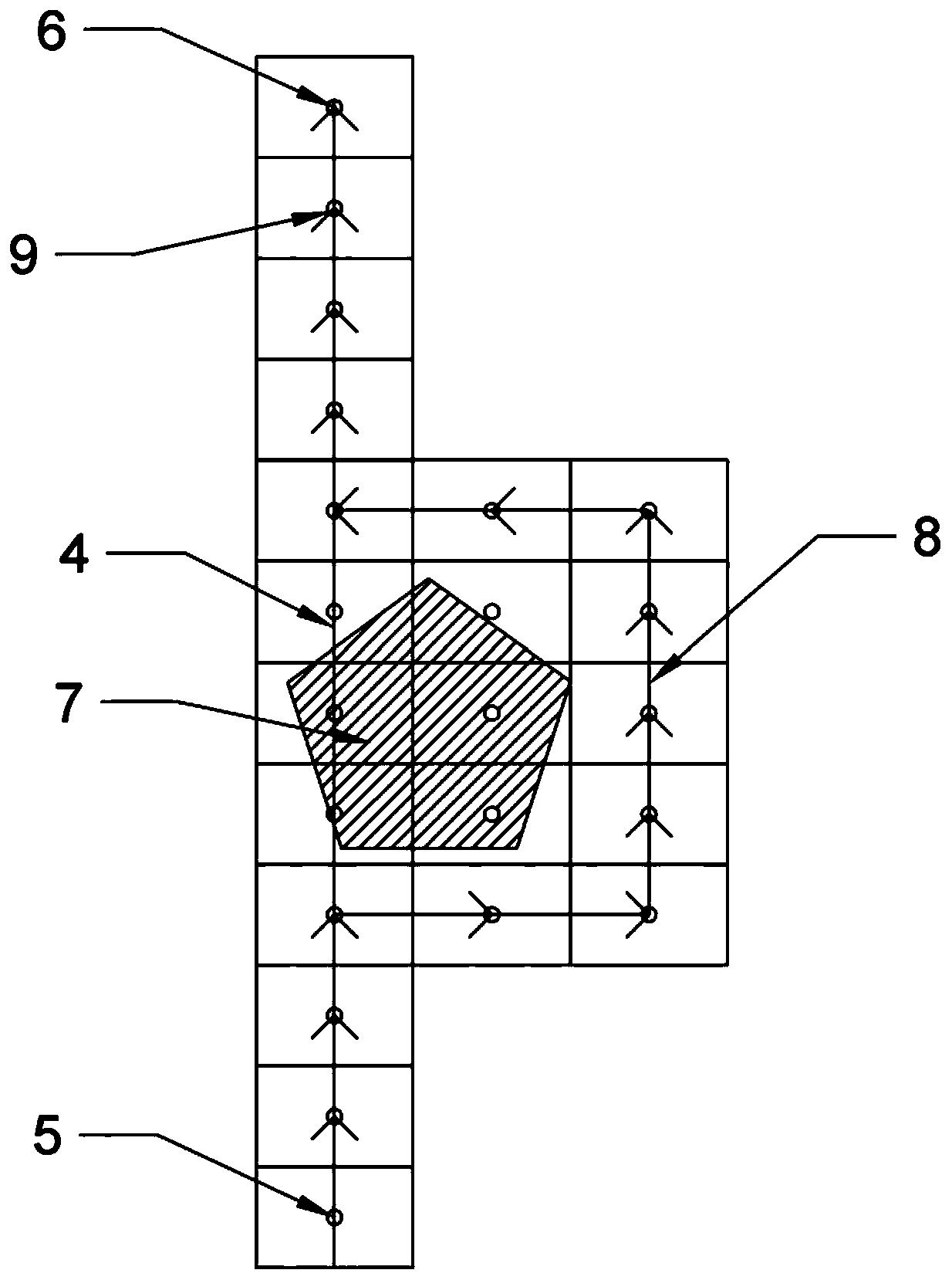
[0095] The difference between this embodiment and the embodiment is: when the operation path is generated, if there is no offset between the current waypoint and the initial two-dimensional route in S100, it will also be judged whether the current course is a direction close to the initial two-dimensional route, If the current heading is a direction close to the initial two-dimensional flight path, then make the current heading the opposite direction of the initial two-dimensional flight path. Specifically, if the current heading is close to the direction of the initial two-dimensional flight path, then perform S500: adjust the current heading to a direction opposite to the direction of the initial two-dimensional flight path, and generate the next waypoint 9 at a preset interval along the current heading; Determine whether the next waypoint 9 is a flyable waypoint 9, if the next waypoint 9 is a flyable waypoint 9, mark the next waypoint 9 as the final waypoint, and make the ne...


PUM


Abstract

The disclosure relates to the technical field of UAVs and in particular to a UAV operating method and system. The UAV operating method includes the following steps of: acquiring and processing the spatial 3D data of a work area, and generating a spatial 3D data model of the work area; generating a flight path of the UAV according to the start position of the UAV, a parameter setting, and the spatial 3D data model of the work area; enabling the UAV to fly and operate according to the flight path. The UAV operating method and system provided by the disclosure can solve the problem that an existing operating UAV needs to manually mark obstacle areas and requires an additional obstacle avoidance system.

Description

technical field [0001] The present disclosure relates to the technical field of unmanned aerial vehicles, in particular to a method and system for operating an unmanned aerial vehicle. Background technique [0002] When the UAV is operating, it needs to plan the flight operation area and flight route, and then fly and operate in the flight operation area according to the flight route. Related technologies use the two-dimensional operating area geographic information map of the target area to determine the target operating area and the operating flight route. This method cannot directly obtain a complete and detailed flight path in the obtained target area, such as when there are obstacles in the flight path. , it is necessary to calibrate the obstacles on the map. Generally, a remote controller with a positioning device is used to calibrate the obstacles or a special marking device is used for marking, or manual marking is performed on the two-dimensional map of the ground s...

Claims


Application Information

Patent Timeline
Patent Type & Authority Applications(China)
IPC IPC(8): G05D1/10
Inventor 刘健飞胥毅峰江亮亮孙俊田王增文纪任鑫郑林林
Owner 成都蔚来空间科技有限公司
Why Eureka
Try Eureka