
A roof viewing angle correction method for optical remote sensing images

A technology of optical remote sensing images and correction methods, which is applied in image enhancement, image analysis, image data processing, etc., can solve the problems of insufficient classification and extraction of buildings, no more in-depth analysis, and tilted shooting angle.

Active Publication Date: 2021-04-30
INST OF SOFTWARE - CHINESE ACAD OF SCI
View PDF9 Cites 0 Cited by
  • Summary
  • Abstract
  • Description
  • Claims
  • Application Information

AI Technical Summary

Problems solved by technology

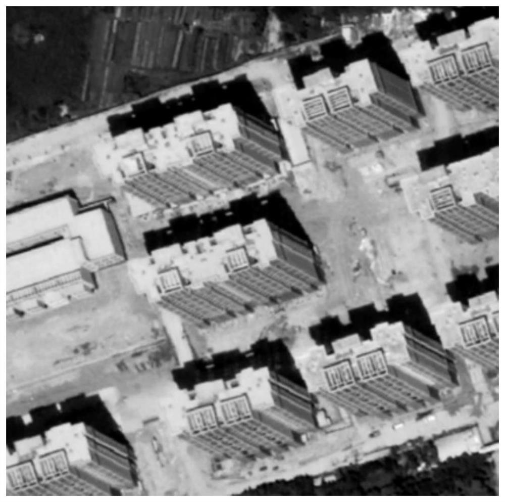
[0004] However, in actual work, due to the influence of various factors, many satellite images are not ideal orthophoto images. Due to the tilted shooting angle, the ground behind a large number of high-rise buildings is blocked. At this time, the imaging surface is not Plane, image pixel coordinates cannot reflect the actual geographic location of the object
In view of the above situation, the existing methods are difficult to deal with the problem of satellite shooting angles, and only focus on the classification and recognition algorithms of satellite images, without taking into account the geographic information implied by the images; at the same time, the existing methods usually use the roof of the building Considering the wall as a whole, the classification and extraction of buildings is not fine enough, and only focuses on the problem of building extraction itself, without further analysis

Method used


Image

  • A roof viewing angle correction method for optical remote sensing images
  • A roof viewing angle correction method for optical remote sensing images
  • A roof viewing angle correction method for optical remote sensing images

Examples


Embodiment Construction

[0037] The specific implementation manner of the present invention will be described in detail below in combination with the embodiments and the accompanying drawings.

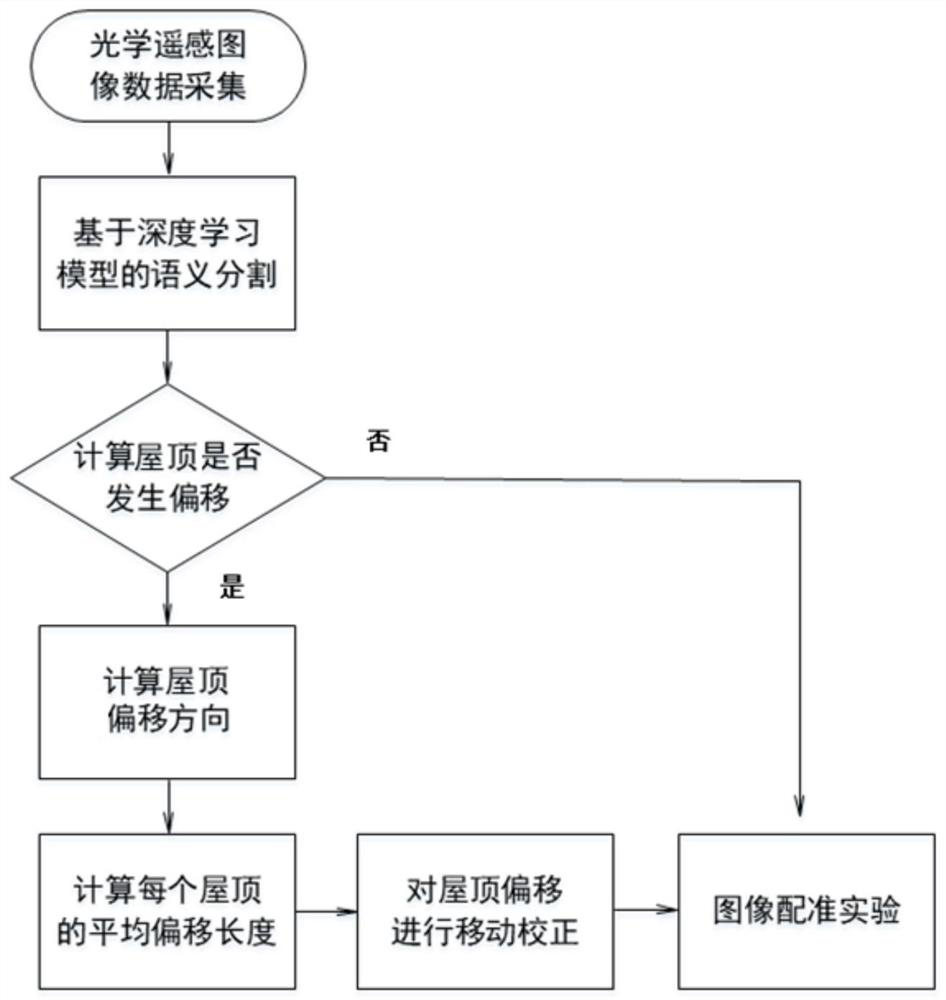
[0038] Such as figure 1 As shown, the present invention provides a method for correcting roof viewing angles based on high-resolution optical remote sensing images, the method comprising the following steps:

[0039] First, use deep learning and semantic segmentation technology to extract the ground feature information of high-resolution remote sensing images, and realize the classification of ground features such as building roofs and walls;

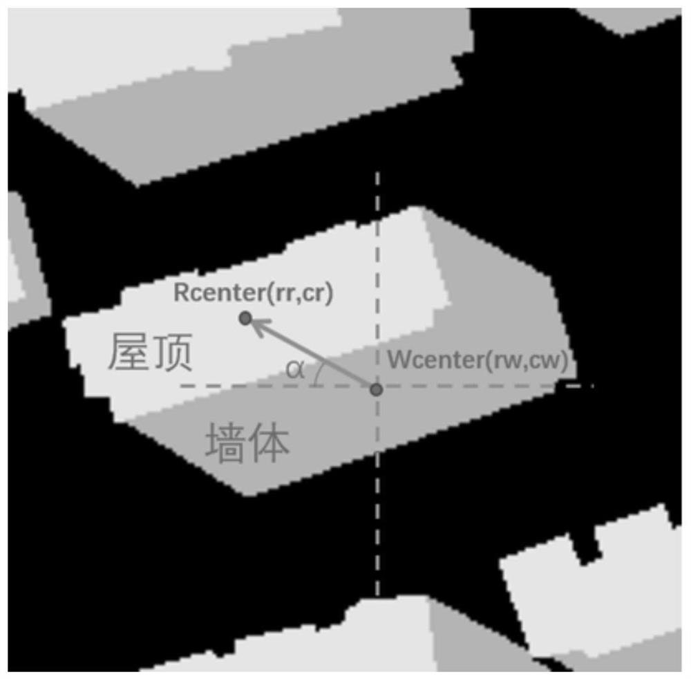
[0040] Then, based on the spatial position relationship between the roof and the wall of the building, the offset direction and offset length of the roof viewing angle are calculated;

[0041] Finally, image processing technology is used to move the roofs with viewing angle shift to the positions without shift according to the magnitude of the shift.

[0042] The inve...


PUM


Abstract

The invention discloses a roof viewing angle correction method of an optical remote sensing image, which is used to realize the determination of the actual position of the roof of a high-rise building under non-orthophoto conditions. The original optical remote sensing image data is divided into training set, validation set and test set randomly; Step 2: Train and optimize the deep learning model to obtain the target pixel-level classification results; Step 3: Use the relative relationship between the building wall and the roof Position relationship, extract the main direction of the roof perspective offset; Step 4: Calculate the perspective offset length of each roof; Step 5: Move the roof position to the standard position in the case of orthophotos according to the roof perspective offset length. The invention solves the problem that the existing building extraction method only pays attention to the image itself and ignores the geographic information, the extraction of the building is more refined, and the calculation automation is easy to be realized.

Description

technical field [0001] The invention belongs to the technical field of optical remote sensing image processing and analysis, and in particular relates to a roof actual position determination technology in dense urban high-rise building areas. Background technique [0002] With the development and progress of high-resolution remote sensing satellite technology, the resolution and shooting frequency of satellite images are getting higher and higher, providing more and more reliable data support for land cover extraction and ground object transformation monitoring. In the classification of urban remote sensing ground objects, the accurate classification of urban buildings is meaningful for urban land use classification and change monitoring. Due to the complex categories of urban buildings, different appearances, different heights, and different materials, remote sensing images present diverse shapes and texture features, and building extraction often becomes a difficult and ke...

Claims


Application Information

Patent Timeline
Patent Type & Authority Patents(China)
IPC IPC(8): G06T5/00G06T7/33G06T7/73
Inventor 李海昌林子彦王思雨张金芳胡晓惠
Owner INST OF SOFTWARE - CHINESE ACAD OF SCI
Learn More