InSAR ground point extraction method and device in complex city environment, server and storage medium
An urban environment and extraction method technology, applied in the field of geographic information, can solve the problem of low accuracy of InSAR ground point extraction, and achieve the effect of accurate extraction
- Summary
- Abstract
- Description
- Claims
- Application Information
AI Technical Summary
Problems solved by technology
Method used
Image
Examples
Embodiment 1
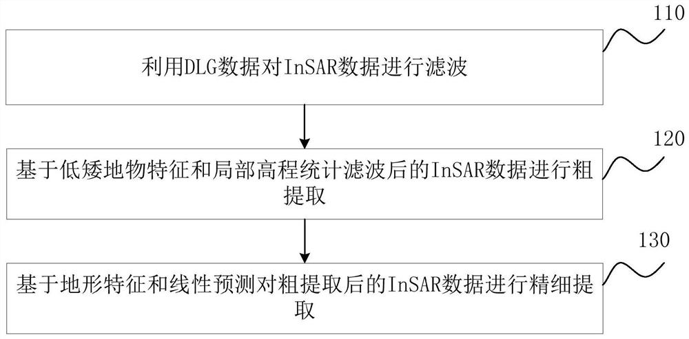
[0071] figure 1 It is a schematic flow diagram of the method for extracting InSAR ground points in a complex urban environment provided by Embodiment 1 of the present invention. This embodiment is applicable to the situation of extracting InSAR ground points in a complex geographical environment, especially in an urban environment. InSAR ground point extraction device is implemented, and can be integrated in the geographic information server, specifically includes the following steps:
[0072] S110, use the DLG data to filter the InSAR data.
[0073] DLG is a digital line map, which is a vector data set stored hierarchically on basic geographic elements on existing topographic maps. DLG includes both spatial information and attribute information.
[0074] Digital Line Map (DLG) is a vectorized data file formed by vectorizing one or more map elements in each map after scanning and geometric correction.
[0075] DLG uses points, lines, and planes to describe the geometric fea...
Embodiment 2
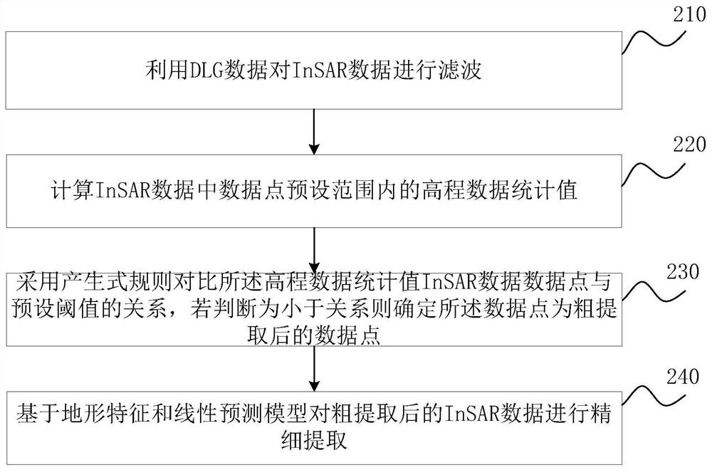
[0105] figure 2 It is a schematic flowchart of the method for extracting InSAR ground points in a complex urban environment provided by Embodiment 2 of the present invention. This embodiment is optimized on the basis of the above-mentioned embodiments. In this embodiment, the rough extraction of InSAR data is realized based on the statistical analysis of low ground features and local elevations. The specific optimization is: calculate the data point prediction in InSAR data Set the statistical value of the elevation data within the range; use the production rule to compare the relationship between the statistical value of the elevation data and the preset threshold, and if it is judged to be less than the relationship, then determine that the data point is a data point after rough extraction.
[0106] Correspondingly, the method for extracting InSAR ground points in a complex urban environment provided in this embodiment specifically includes:
[0107] S210. Use the DLG data...
Embodiment 3
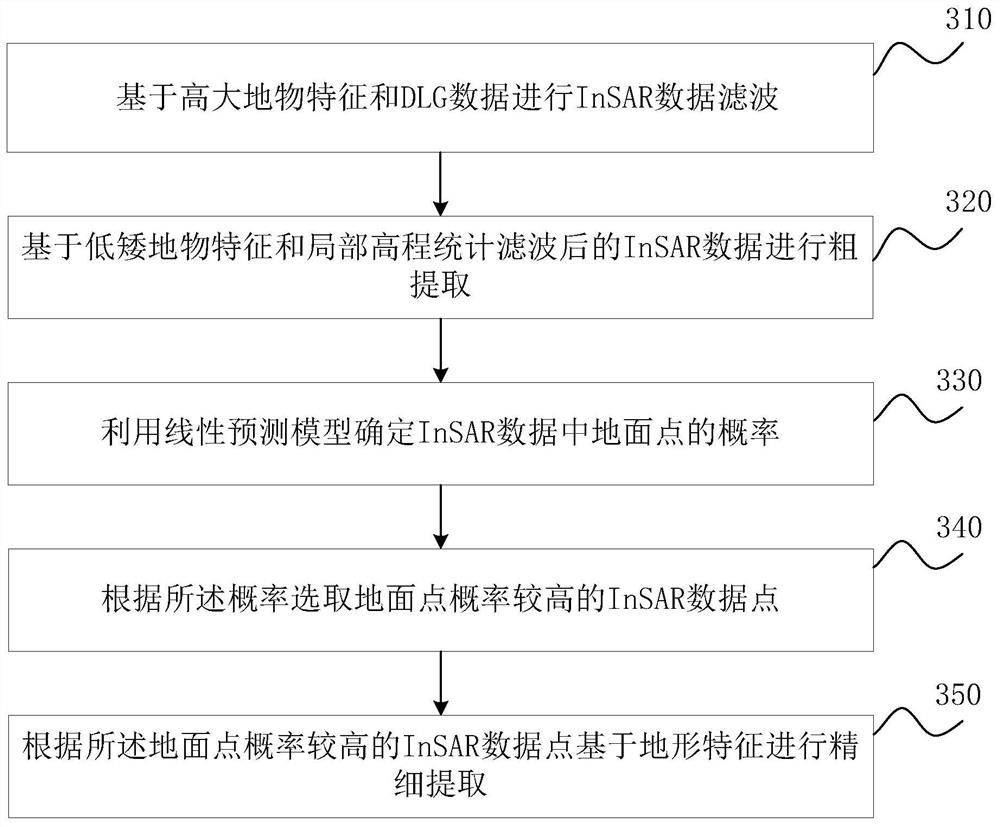
[0116] image 3 It is a schematic flowchart of the method for extracting InSAR ground points in a complex urban environment provided by Embodiment 3 of the present invention. This embodiment is optimized on the basis of the above-mentioned embodiments. In this embodiment, the rough extraction of InSAR data based on terrain features and linear prediction is finely extracted. The specific optimization is: use the linear prediction model to determine the InSAR data The probability of the ground point; select the InSAR data point with a higher probability of the ground point according to the probability; perform fine extraction based on the terrain feature according to the InSAR data point with a higher probability of the ground point.
[0117] Correspondingly, the method for extracting InSAR ground points in a complex urban environment provided in this embodiment specifically includes:
[0118] S310, performing InSAR data filtering based on the features of tall and large objects...
PUM
 Abstract
Description
Claims
Application Information
 - R&D
- Intellectual Property
- Life Sciences
- Materials
- Tech Scout
- Unparalleled Data Quality
- Higher Quality Content
- 60% Fewer Hallucinations
Browse by: Latest US Patents, China's latest patents, Technical Efficacy Thesaurus, Application Domain, Technology Topic, Popular Technical Reports.
© 2025 PatSnap. All rights reserved.Legal|Privacy policy|Modern Slavery Act Transparency Statement|Sitemap|About US| Contact US: help@patsnap.com


