Order processing method and device, equipment and storage medium
A technology for order processing and orders, applied in data processing applications, special data processing applications, geographic information databases, etc., can solve problems such as unfixed division of business districts, many repetitive tasks, and inaccurate order monitoring data, etc., to achieve accurate The effect of streamlining management and reducing duplication of work
- Summary
- Abstract
- Description
- Claims
- Application Information
AI Technical Summary
Problems solved by technology
Method used
Image
Examples
Embodiment 1
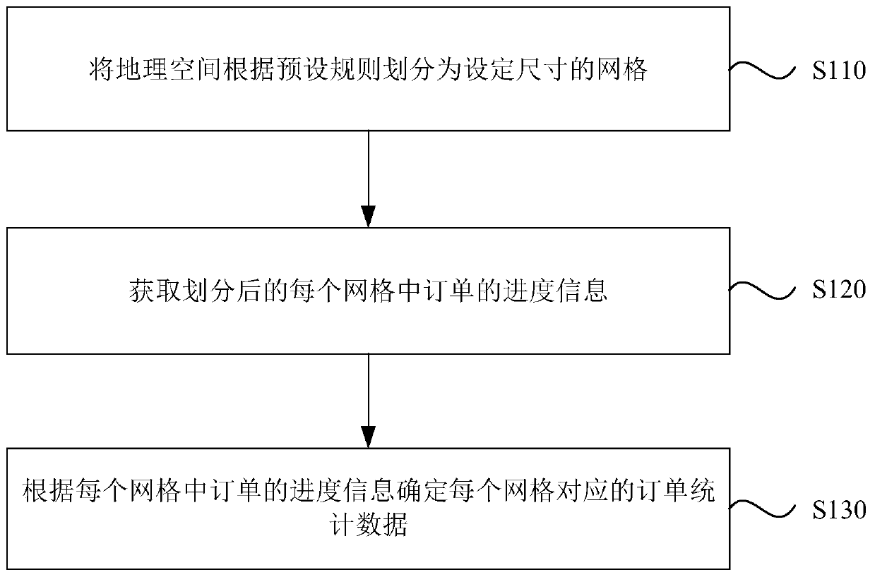
[0027] figure 1 It is a flow chart of the order processing method provided by Embodiment 1 of the present invention. This embodiment is applicable to monitoring orders. The method can be executed by an order processing device, and the device can be implemented by software and / or hardware.
[0028] Such as figure 1 As shown, the order processing method provided by the embodiment of the present invention mainly includes the following steps:
[0029] S110. Divide the geographic space into grids with a set size according to preset rules.
[0030] In this embodiment, geographic space can be understood as any geographic area on the earth's surface. A grid can be understood as a geographical area of set size. It should be noted that the grid in this embodiment refers to the grid in the geographical area, which is then displayed on the electronic map according to a certain ratio.
[0031] It should be noted that the shape of the grid may be a square, a rectangle, a regular hexag...
Embodiment 2
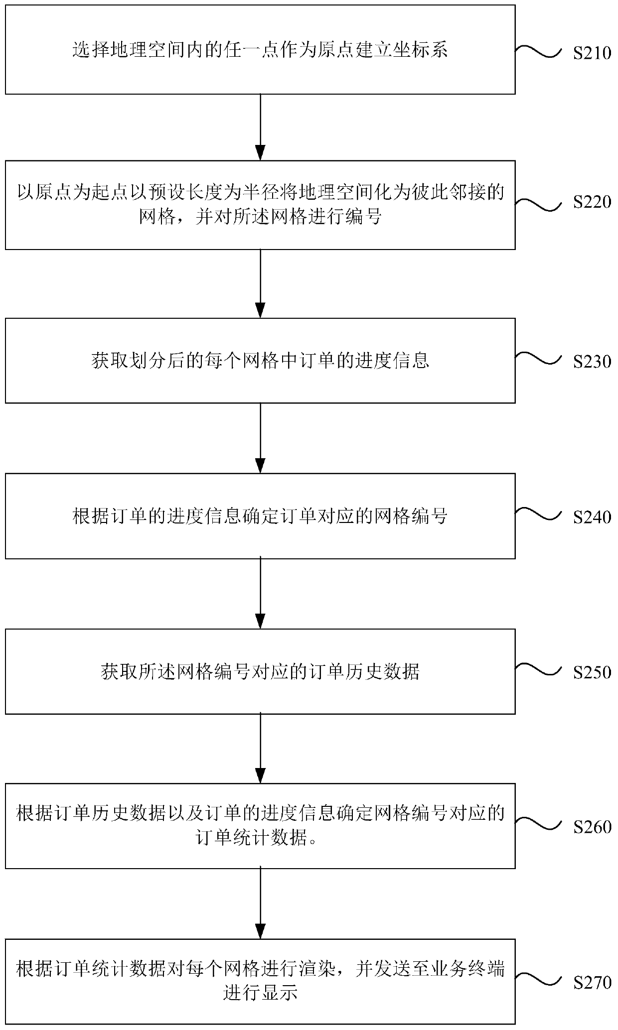
[0041] figure 2 It is a flow chart of an order processing method provided by Embodiment 2 of the present invention. On the basis of the above embodiments, this embodiment further optimizes the order processing method, such as figure 2 As shown, the optimized order processing method mainly includes the following steps:
[0042] S210. Select any point in the geographic space as the origin to establish a coordinate system.
[0043] Further, the point on the earth whose longitude and latitude are both 0 is used as the origin of the coordinates, and the longitude and latitude of the earth are used as the horizontal axis and the vertical axis respectively to establish a plane Cartesian coordinate system, or a designated point on the geographical area is used as the origin of the coordinates , take the longitude and latitude where the specified point is located as the horizontal axis and vertical axis respectively to establish a plane Cartesian coordinate system.
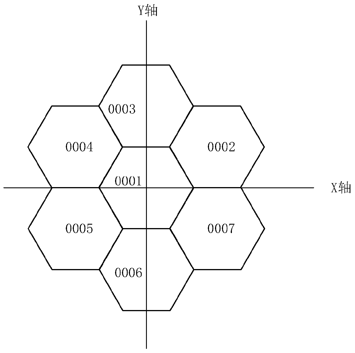
[0044] For exa...
Embodiment 3
[0070] Figure 5 A schematic structural diagram of an order processing device provided in Embodiment 3 of the present invention. This embodiment is applicable to monitoring orders, and the device may be implemented by software and / or hardware.
[0071] Such as Figure 5 As shown, the order processing device provided by the embodiment of the present invention mainly includes the following parts:
[0072] A grid division module 510, configured to divide the geographic space into grids of a set size according to preset rules;
[0073] A progress information obtaining module 520, configured to obtain progress information of orders in each divided grid;
[0074] The determination module 530 is configured to determine the order statistics data corresponding to each grid according to the progress information of the orders in each grid.
[0075] The order processing device provided by the embodiment of the present invention divides the geographic space into grids of a set size acco...
PUM
 Abstract
Description
Claims
Application Information
 - R&D
- Intellectual Property
- Life Sciences
- Materials
- Tech Scout
- Unparalleled Data Quality
- Higher Quality Content
- 60% Fewer Hallucinations
Browse by: Latest US Patents, China's latest patents, Technical Efficacy Thesaurus, Application Domain, Technology Topic, Popular Technical Reports.
© 2025 PatSnap. All rights reserved.Legal|Privacy policy|Modern Slavery Act Transparency Statement|Sitemap|About US| Contact US: help@patsnap.com


