Landslide disaster emergency monitoring and troubleshooting method based on interferometric synthetic aperture radar (In SAR)

A technology for disasters and geological disasters, applied in measurement devices, radio wave measurement systems, radio wave reflection/re-radiation, etc. , It is beneficial to combat vegetation disturbance and increase the overall effect

Inactive Publication Date: 2019-07-19
YUNNAN UNIVERSITY OF FINANCE AND ECONOMICS
View PDF2 Cites 13 Cited by
  • Summary
  • Abstract
  • Description
  • Claims
  • Application Information

AI Technical Summary

Problems solved by technology

[0004] The purpose of the present invention is: in order to solve the technical problems of low efficiency and poor accuracy of landslide disaster emergency monitoring, provide a landslide disaster emergency monitoring and investigation method based on InSAR

Method used


Image

  • Landslide disaster emergency monitoring and troubleshooting method based on interferometric synthetic aperture radar (In SAR)
  • Landslide disaster emergency monitoring and troubleshooting method based on interferometric synthetic aperture radar (In SAR)
  • Landslide disaster emergency monitoring and troubleshooting method based on interferometric synthetic aperture radar (In SAR)

Examples


Embodiment Construction

[0028] In order to make the object, technical solution and advantages of the present invention clearer, the present invention will be further described in detail below in conjunction with the accompanying drawings and embodiments. It should be understood that the specific embodiments described here are only used to explain the present invention, not to limit the present invention.

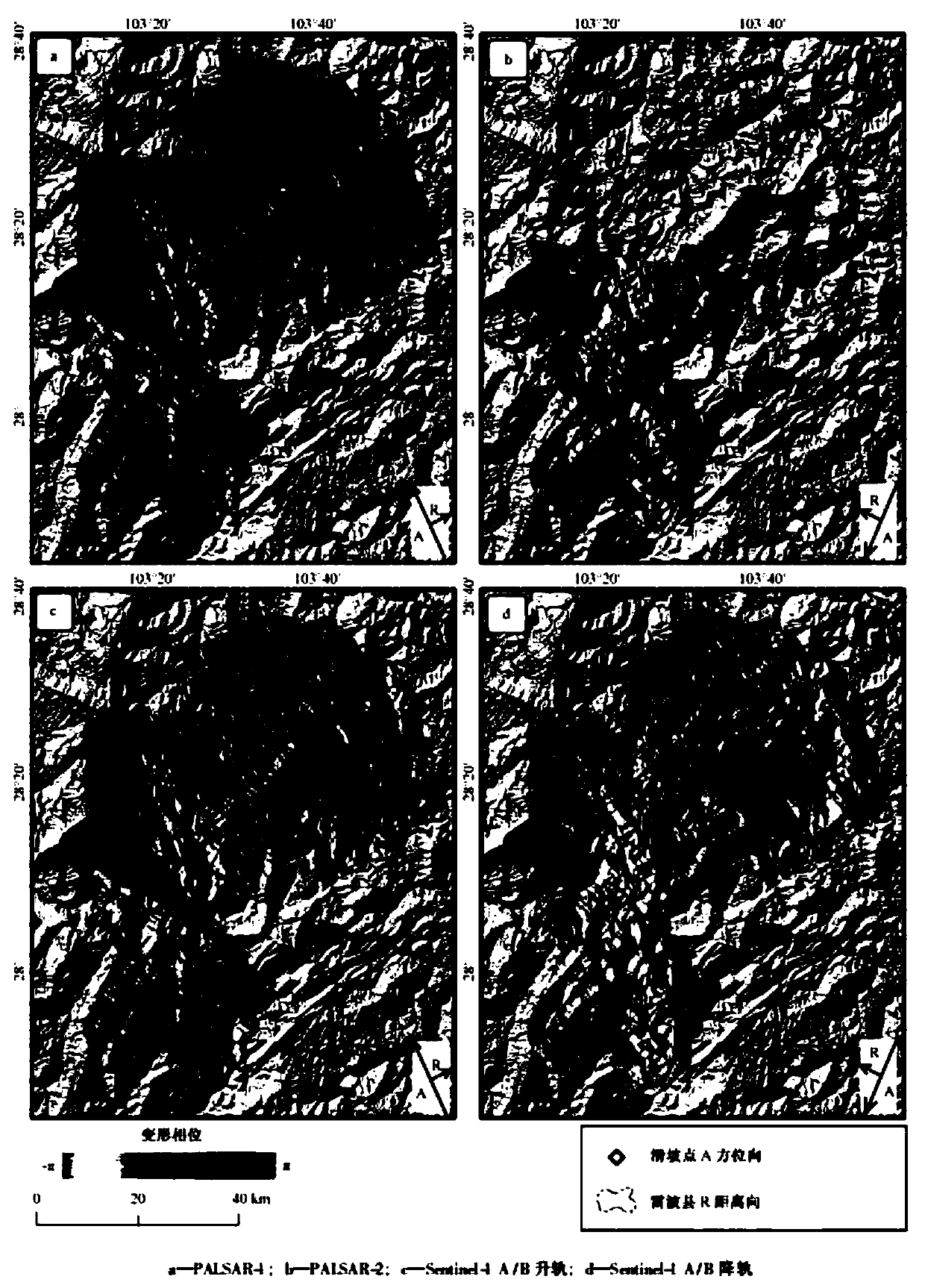
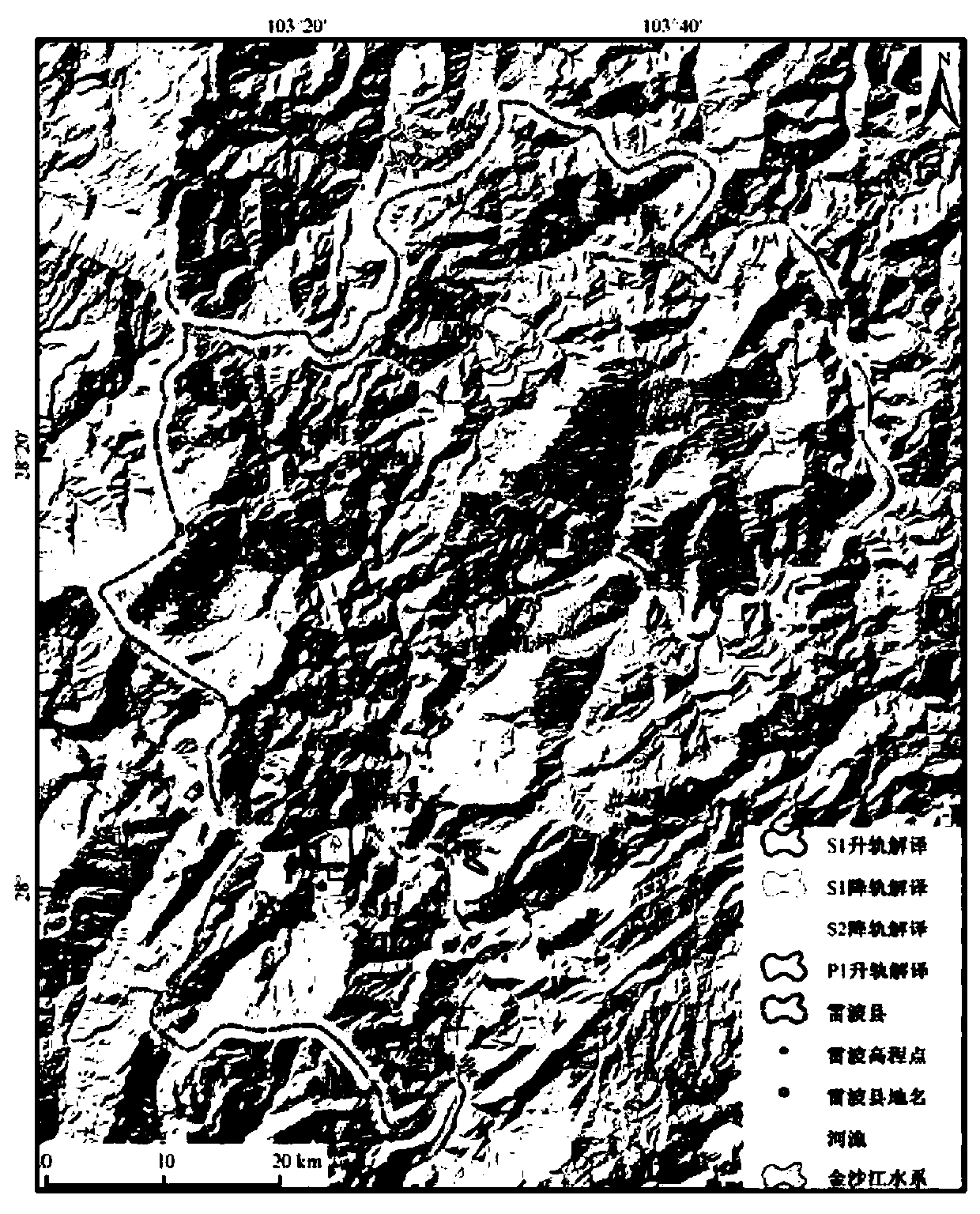
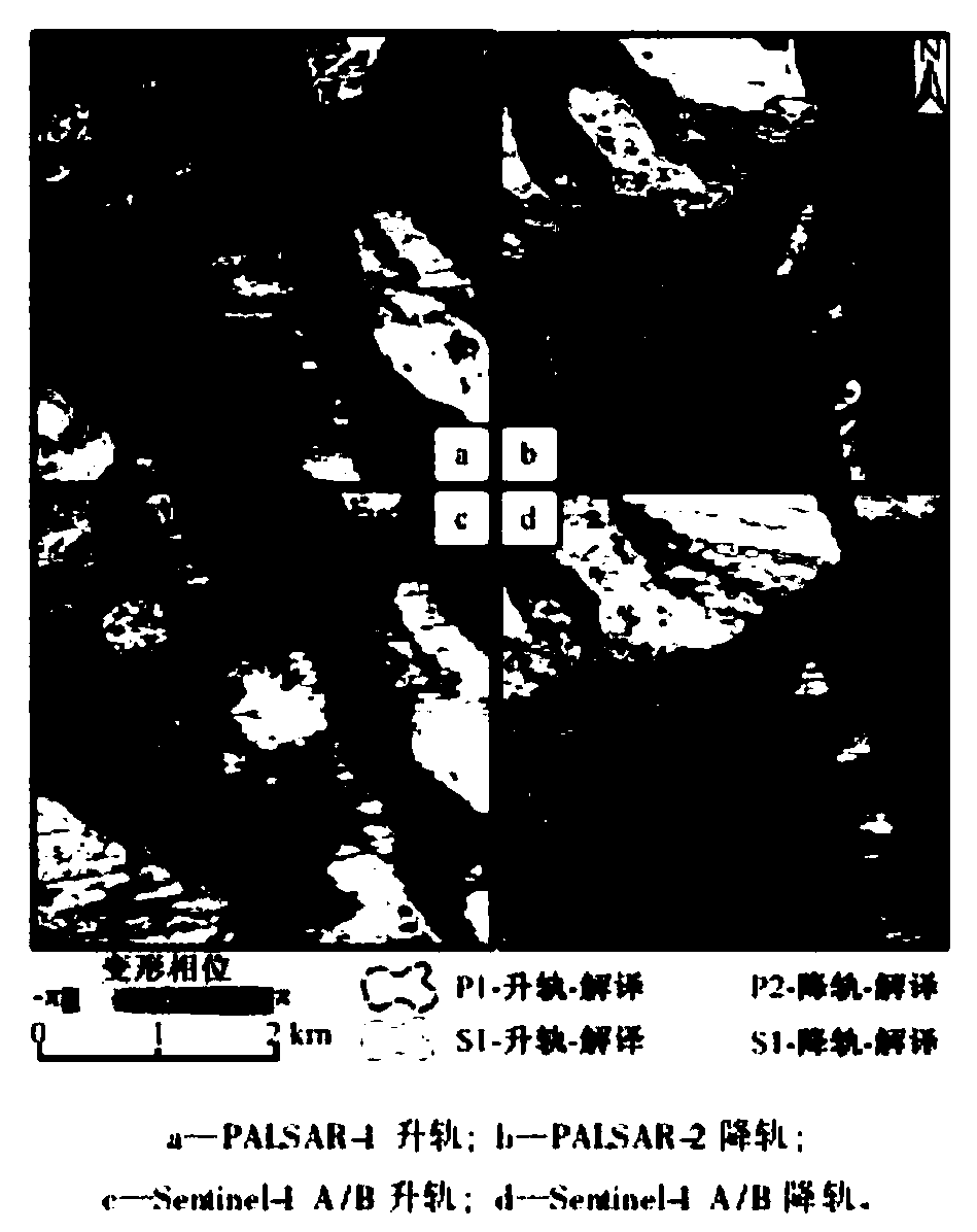
[0029] see Figure 1~3 ;Collect 17 scenes of archived PALSAR SAR data covering the study area from January 2007 to March 2011, and splicing and cutting according to the scope of the study area; use SRTMDEM with a resolution of 30m in the United States to eliminate the terrain phase. According to the calculation method of the small baseline, 8 interference combinations are selected, and the average spatial baseline is 299.069m. In addition, the 2-scene down-orbit PALSAR data of October 22, 2016 and January 28, 2017, the 2-scene down-orbit data of Sentinels A / B on December 3, 2016 and December 27, 2...


PUM


Abstract

The invention discloses a landslide disaster emergency monitoring and troubleshooting method based on an interferometric synthetic aperture radar (In SAR). The landslide disaster emergency monitoringand troubleshooting method based on the In SAR comprises the following steps that S1, data selection is carried out, specially, target area active geological disaster data is obtained based on the InSAR, and an original data set is obtained trough a plurality of times of measurement; S2, interference processing is carried out, specially, the interference processing is carried out on the data through a PALSAR ( Phased Array type L-band Synthetic Aperture Radar); S3, comprehensive interpreting is carried out, specially, the deformation is mainly observed by the In SAR, and optical remote sensing, landform and geological condition characteristics are assisted in interpreting active geological disasters in a target area; and S4, a landslide disaster map is drawn. According to the landslide disaster emergency monitoring and troubleshooting method based on the In SAR, the target area active geological disaster data is obtain based on the In SAR, the original data set is obtained through themultiple times of measurement, the surface deformation is then measured through an interference phase change, the landslide disaster emergency monitoring and troubleshooting method based on the In SAR has the advantages of allday, allweather, wide observation range, high sensitivity, high performance-price ratio, traceability of observation time and the like, and great significance to the rapid troubleshooting of the large-scale geological disasters is achieved.

Description

technical field [0001] The invention belongs to the technical field of landslide disaster treatment, in particular to an InSAR-based emergency monitoring and investigation method for landslide disasters. Background technique [0002] On June 24, 2017, a high-level landslide occurred in Xinmo Village, Diexi Town, Mao County, Sichuan Province, causing heavy casualties and property losses. After the landslide occurred, some researchers used interferometric synthetic aperture radar technology to retrospectively observe and found that there had been deformation for a long time before the landslide. This is consistent with the phenomenon of constant-speed deformation and accelerated deformation found by relevant researchers and other Cils before the occurrence of geological disasters. However, due to the high altitude, steep terrain, and complex surface coverage conditions in Southwest my country, optical remote sensing interpretation is difficult to fully identify, and many high...

Claims


Application Information

Patent Timeline
Patent Type & Authority Applications(China)
IPC IPC(8): G01S13/90
CPCG01S13/9023
Inventor 张洪何锋
Owner YUNNAN UNIVERSITY OF FINANCE AND ECONOMICS
Why Eureka
Try Eureka