

Remote sensing image classification method based on multi-scale depth features
A technology of remote sensing images and depth features, applied in the fields of instruments, character and pattern recognition, computer parts, etc., can solve the problems of high-resolution remote sensing images being highly complex, redundant, and unable to accurately describe complex objects and objects.
- Summary
- Abstract
- Description
- Claims
- Application Information
AI Technical Summary
Problems solved by technology
Method used
Image

Examples
Embodiment Construction
[0045] The technical scheme is described in detail in combination with graphics.
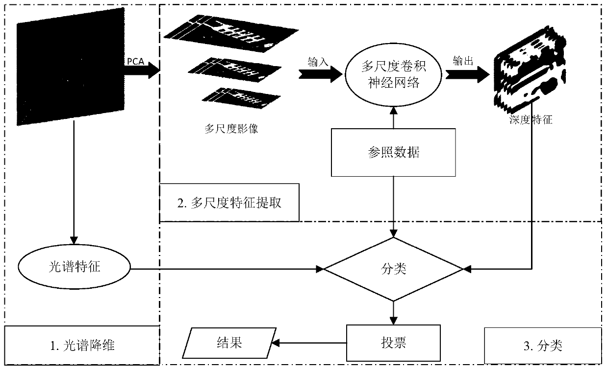
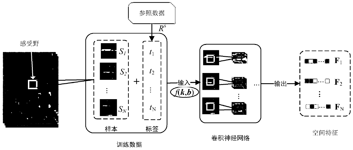
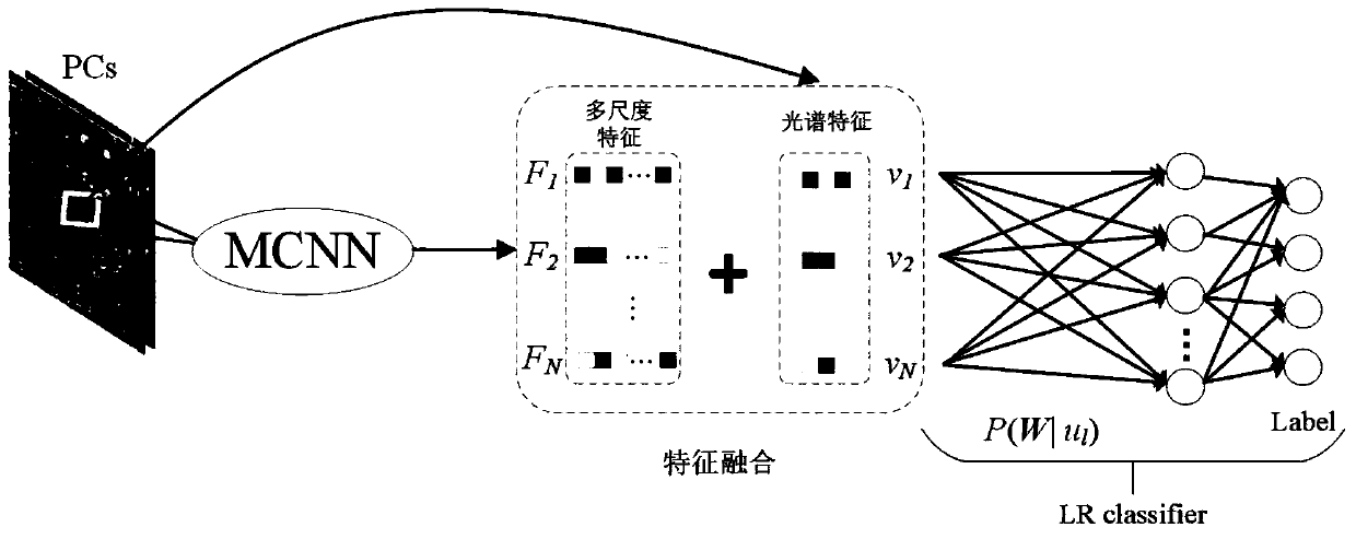
[0046] In the image classification method based on multi-scale depth features of the present invention, firstly, the algorithm can automatically establish a multi-scale image pyramid. Secondly, with the help of traditional convolutional neural network algorithms, this algorithm can automatically extract high-level image features using self-learning algorithms. Finally, the multi-scale depth image features and spectral features are fused to improve the classification accuracy of remote sensing images. The following is an example of multi-scale depth feature extraction and remote sensing classification algorithm. The process is as follows: figure 1 As shown, the specific implementation steps are as follows:
[0047] 1. Spectral dimensionality reduction
[0048] Using the principal component analysis (PCA) algorithm, the original remote sensing image data is reduced to three spectral bands while...
PUM
 Abstract
Description
Claims
Application Information