A method to obtain point cloud road height in unity
A point cloud and height technology, applied in image analysis, instruments, calculations, etc., can solve problems such as low degree of automation and point cloud height will not be completely flat, so as to reduce workload, reduce human error, and reduce memory usage Effect
- Summary
- Abstract
- Description
- Claims
- Application Information
AI Technical Summary
Problems solved by technology
Method used
Image
Examples
Embodiment
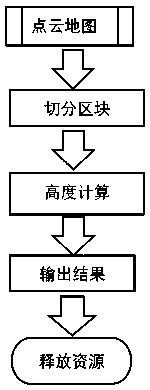
[0045] As a general-purpose graphics engine, Unity integrates a third-party physics engine, which can meet the needs of physics and image simulation in the field of autonomous driving. Thanks to these advantages, we can implement a new method of efficiently obtaining lidar point clouds in the newer version of Unity. The overall implementation process is as follows figure 1 shown, including the following steps:
[0046] Step 1. Obtain the point cloud map of the entire scene.
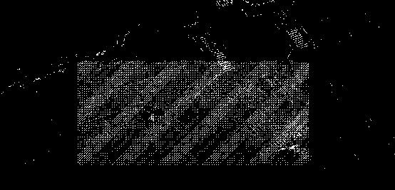
[0047] Step 2: Segment the point cloud map to obtain multiple blocks, that is, figure 2 As shown, the point cloud of the whole scene is divided into small point clouds according to the blocks.
[0048] Generally, at least the following two methods can be used to obtain the segmented blocks: (1) The block segmentation is completed in the point cloud map export stage, and a small point cloud map file (usually a pcd file) is exported.
[0049] (2) Use the Unity engine to segment the point clo...
PUM
 Abstract
Description
Claims
Application Information
 - R&D
- Intellectual Property
- Life Sciences
- Materials
- Tech Scout
- Unparalleled Data Quality
- Higher Quality Content
- 60% Fewer Hallucinations
Browse by: Latest US Patents, China's latest patents, Technical Efficacy Thesaurus, Application Domain, Technology Topic, Popular Technical Reports.
© 2025 PatSnap. All rights reserved.Legal|Privacy policy|Modern Slavery Act Transparency Statement|Sitemap|About US| Contact US: help@patsnap.com


