A method and device for extracting mountain landscape buildings based on high-resolution remote sensing images

A remote sensing image and extraction method technology, applied in image analysis, image enhancement, scene recognition, etc., can solve the problems of lack of extraction analysis, cumbersome process, high algorithm cost, etc., to reduce the probability of spectral confusion, reduce the influence of shadows, and expand spectral differences Effect

Active Publication Date: 2021-06-01
SOUTHEAST UNIV
View PDF7 Cites 0 Cited by
  • Summary
  • Abstract
  • Description
  • Claims
  • Application Information

AI Technical Summary

Problems solved by technology

This method has certain advantages for landscape buildings with obvious rectangular shapes in a small area, but it relies on the rectangular shape features of buildings, and the process is cumbersome and the algorithm cost is high. not applicable
In addition, in the prior art, there are many studies on the microscopic level of the single building in the scenic area, and there is a lack of extraction and analysis of the relationship between the architectural landscape elements in the scenic area and the relationship between them at the macro level.
[0004] Under the current construction level and conditions, the lack of rapid, accurate and practical guiding significance for the extraction of surface landscape elements of landscape garden planning has become one of the key factors restricting the development of scientific design of regional landscape garden planning to a higher level.

Method used


Image

  • A method and device for extracting mountain landscape buildings based on high-resolution remote sensing images
  • A method and device for extracting mountain landscape buildings based on high-resolution remote sensing images
  • A method and device for extracting mountain landscape buildings based on high-resolution remote sensing images

Examples


Embodiment Construction

[0033] The technical solution of the present invention will be further described below in conjunction with the accompanying drawings. It should be understood that the embodiments provided below are only intended to disclose the present invention in detail and completely, and fully convey the technical concept of the present invention to those skilled in the art. The present invention can also be implemented in many different forms, and does not Limited to the embodiments described herein. The terms used in the exemplary embodiments shown in the drawings do not limit the present invention.

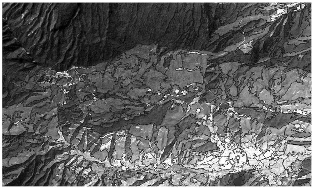
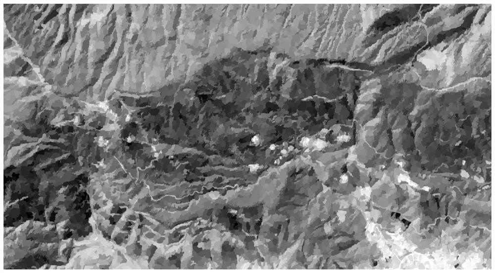
[0034] Most of the buildings in scenic spots are located in mountainous areas and woodlands. Due to the large difference in spectral characteristic values ​​between the sunny side and the shady side of the mountain due to the difference in shadow, and the landscape buildings are small in size and easy to be shaded, the existing technical means are high in cost, low in efficiency, and poor i...


PUM


Abstract

The invention discloses a method and equipment for extracting mountain landscape buildings based on high-resolution remote sensing images. The method includes: segmenting the remote sensing image, using NDVI to extract the non-vegetation area in the remote sensing image; segmenting the non-vegetation area, extracting the building area through NDBI; segmenting the building area again, and calculating the normalized shadow of each patch Building index NSBI; calculate the NSBI discrimination of each patch in the non-vegetated area and set the discrimination threshold, based on which the landscape architecture area is extracted. The present invention reduces the influence of the large-area shadow area in the shaded area of ​​the remote sensing image on the extraction result by introducing the near-infrared band of the spectrum of the remote sensing image that has a significant difference between the shadow and the non-shade. By enlarging the NSBI relative difference between the segmented landscape patch and the surrounding patches, expanding the relative spectral difference between the landscape architecture in the bright area, the landscape architecture in the shadow area, and the shadow interval, reducing the probability of spectral confusion, so that the landscape architecture and its adjacent patches can be clearly distinguished. distinguish.

Description

technical field [0001] The invention belongs to the field of digital landscape site exploration, and in particular relates to a method and equipment for extracting mountain landscape buildings based on high-resolution remote sensing images. Background technique [0002] It is of great significance to obtain the building area and spatial distribution of scenic spots conveniently and accurately for the development of tourism resources, landscape evaluation of scenic spots, and management of existing building resources. Compared with traditional field surveys, remote sensing technology has irreplaceable advantages of high frequency, wide coverage, and low cost. It provides an important scientific dimension and quantitative analysis means for the development of contemporary digital landscapes, and at the same time improves the study of landscape characteristics from sensation to Perception, from qualitative to quantitative, has technical significance for improving the quantitati...

Claims


Application Information

Patent Timeline
Patent Type & Authority Patents(China)
IPC IPC(8): G06K9/00G06K9/34G06V10/28
CPCG06V20/13G06V10/267G06V20/176G06V20/194G06V20/188G06V10/28G06T7/174G06T2207/10036G06T2207/30168G06T2207/30188G06V20/10
Inventor 李哲何钰昆成玉宁赵锴彧韩笑陈菲菲宋爽杨宇欣谢祺铮曹息郑世丰
Owner SOUTHEAST UNIV
Why Eureka
Try Eureka