Satellite despun control method based on geomagnetic measurement
A satellite and derotation technology, applied in space navigation equipment, space navigation vehicles, space navigation equipment, etc., can solve problems such as difficult to guarantee the effectiveness of gyroscope fault judgment, unstable output of optical sensors, etc.
- Summary
- Abstract
- Description
- Claims
- Application Information
AI Technical Summary
Problems solved by technology
Method used
Image
Examples
Embodiment Construction
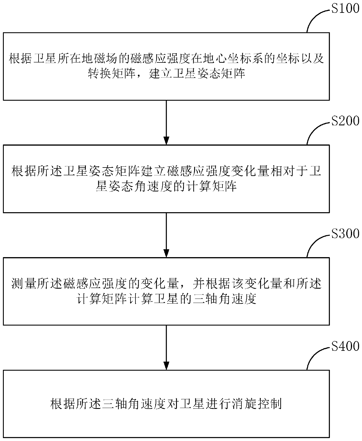
[0045] Refer below figure 1 The specific implementation and working principle of the satellite derotation control method based on geomagnetic measurement in the present invention are described in detail.
[0046] like figure 1 As shown, the satellite derotation control method based on geomagnetic measurement provided by the present invention comprises the following steps:
[0047] S100: Establish a satellite attitude matrix according to the coordinates of the magnetic induction intensity of the magnetic field where the satellite is located in the geocentric coordinate system and the transformation matrix;
[0048] In this step, the magnetic induction intensity of the geomagnetic field at the position of the satellite is assumed to be The unit is Wb / m 2 , and its coordinates in the geocentric coordinate system are [B x ,B y ,B z ] T , which can be calculated from the magnetic induction intensity, magnetic declination and magnetic inclination given by the international g...
PUM
 Abstract
Description
Claims
Application Information
 - R&D
- Intellectual Property
- Life Sciences
- Materials
- Tech Scout
- Unparalleled Data Quality
- Higher Quality Content
- 60% Fewer Hallucinations
Browse by: Latest US Patents, China's latest patents, Technical Efficacy Thesaurus, Application Domain, Technology Topic, Popular Technical Reports.
© 2025 PatSnap. All rights reserved.Legal|Privacy policy|Modern Slavery Act Transparency Statement|Sitemap|About US| Contact US: help@patsnap.com


