
Sub-basin confluence simulation method considering influence of terrace silt dam

A simulation method and sub-basin technology, applied in the field of sub-basin confluence simulation of distributed hydrological model

Active Publication Date: 2020-01-21
CHINA INST OF WATER RESOURCES & HYDROPOWER RES
View PDF4 Cites 3 Cited by
  • Summary
  • Abstract
  • Description
  • Claims
  • Application Information

AI Technical Summary

Problems solved by technology

[0003] The purpose of the present invention is to provide a sub-basin confluence simulation method considering the influence of terraced check dams, so as to solve the aforementioned problems existing in the prior art

Method used


Image

  • Sub-basin confluence simulation method considering influence of terrace silt dam
  • Sub-basin confluence simulation method considering influence of terrace silt dam
  • Sub-basin confluence simulation method considering influence of terrace silt dam

Examples


Embodiment

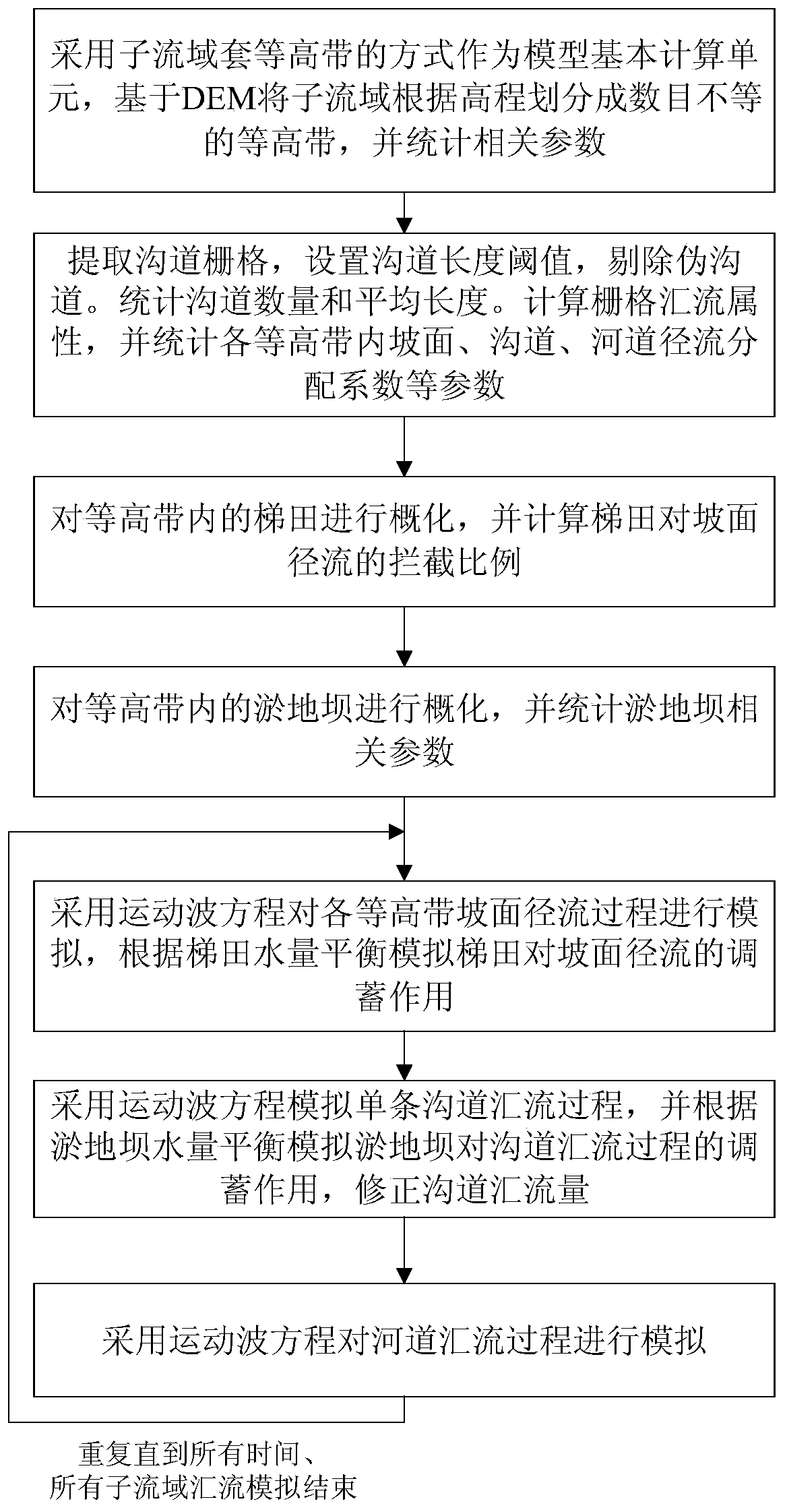
[0085] The embodiment of the present invention provides a sub-basin confluence simulation method considering the influence of terraced check dams, such as figure 1 shown, including the following steps:

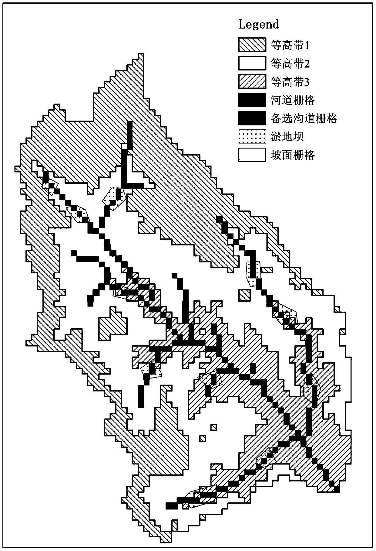
[0086] In S1, the sub-basin contour zone is used as the basic calculation unit of the model. In this example, one sub-basin is taken as an example to illustrate the entire confluence process. Among them, it is assumed that the sub-watershed is divided into 3 contour zones, which are sorted and divided according to the grid elevation. Contour zone 1 has the highest elevation, and contour zone 3 has the lowest elevation, such as figure 2 shown. In the extraction of application examples, the threshold value of river channel extraction is 5km 2.

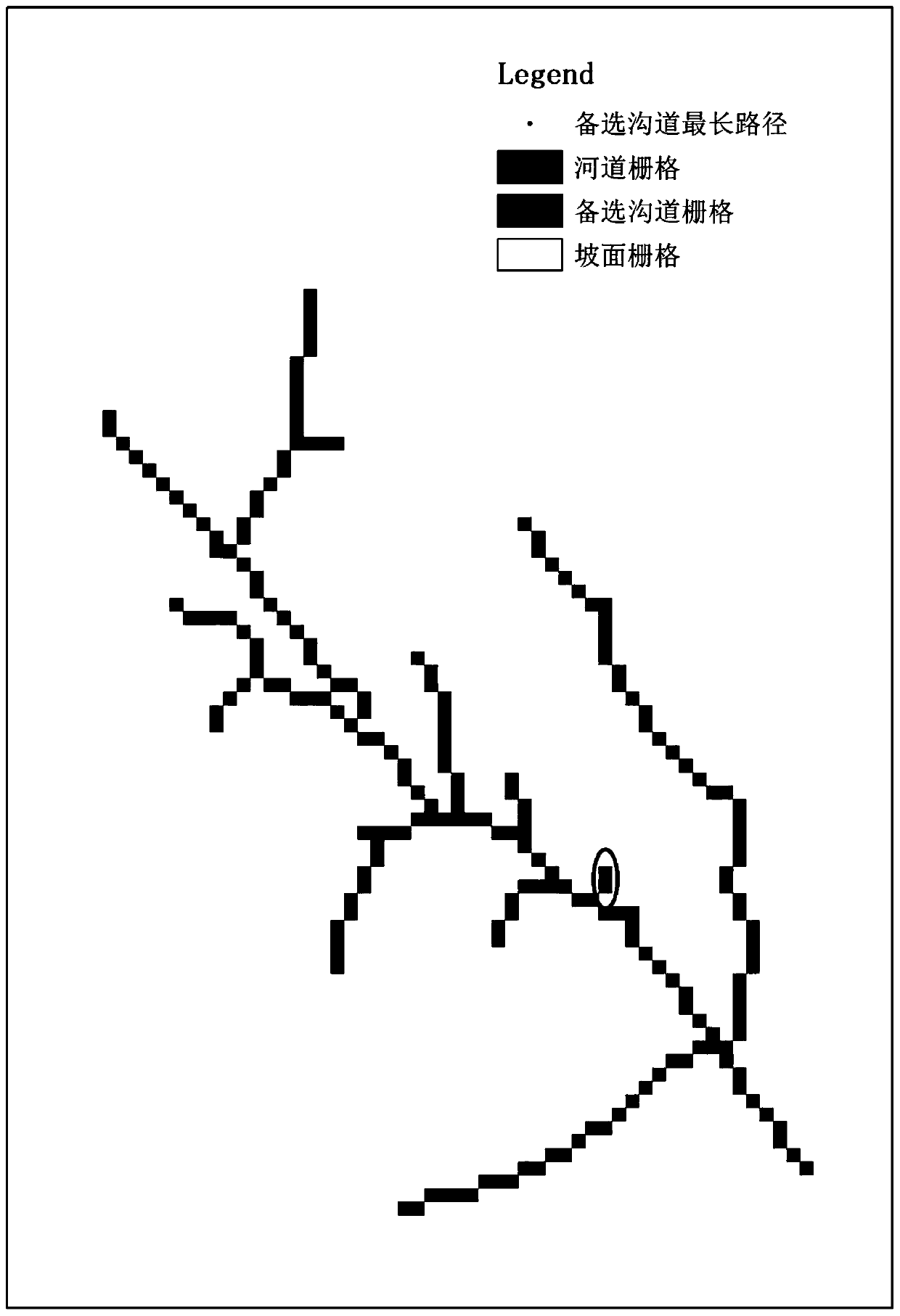
[0087] S2, set 0.5km 2 Threshold extraction of candidate channels. Find the candidate channel grids directly into the channel grid as the outlet grid, and perform a traceback traversal search on them to find the longest candidate ...


PUM


Abstract

The invention discloses a sub-basin confluence simulation method considering the influence of a terrace silt dam, and relates to the technical field of hydrological model simulation. The method comprises the following steps: taking a mode of sleeving equal-height zones in sub-basins as a basic calculation unit of a model, dividing the sub-basins into unequal-number equal-height zones according toelevation based on DEM, counting related parameters, extracting channel grids, setting a channel length threshold, and removing pseudo-channels; generalizing the terraces and the silt dams in the equal-height zone, calculating the interception ratio of the terraces to slope runoff, and counting related parameters of the silt dams; and simulating the confluence process of the slope surface, the single channel and the riverway of each equal-height zone based on a motion wave equation. According to the method, the influence of silt dam construction and terrace construction in the calculation uniton the confluence process can be simulated.

Description

technical field [0001] The invention relates to the technical field of sub-basin confluence simulation of distributed hydrological models, in particular to a sub-basin confluence simulation method considering the influence of terraced warping dams. Background technique [0002] Distributed hydrological model is an effective means to study the process and mechanism of water cycle, and also an effective tool to solve many practical hydrological problems. As the complexity of the research question increases, so does the model function. In the mountainous area of ​​the Loess Plateau, terraced fields are widely distributed, with vertical and horizontal ditches. In order to effectively utilize rainwater to increase grain production, a large number of check dams have been built on the ditches in this area to store the floods and sediments in the mountainous areas and create fields. The construction of terraced check dams has a huge impact on the process of river basin confluence. ...

Claims


Application Information

Patent Timeline
IPC IPC(8): G06F30/18G06F30/20G06F16/29G06T17/05
CPCG06F16/29G06T17/05
Inventor 刘佳嘉周祖昊严子奇龚家国贾仰文王浩徐东坡褚俊英
Owner CHINA INST OF WATER RESOURCES & HYDROPOWER RES
Learn More