Synthetic image construction method based on Landsat long-time sequence

A long-term sequence and synthetic image technology, applied in the field of remote sensing mapping, to achieve the effect of improving time resolution and eliminating accidental situations

Active Publication Date: 2020-02-04
NANJING FORESTRY UNIV
View PDF5 Cites 7 Cited by
  • Summary
  • Abstract
  • Description
  • Claims
  • Application Information

AI Technical Summary

Problems solved by technology

[0009] The purpose of the present invention is to solve the above-mentioned problems existing in the existing Landsat remote sensing image synthesis method, and propose a method for generating high-precision cloud-free synthetic images of any given date by only using Landsat long-term series surface albedo data

Method used


Image

  • Synthetic image construction method based on Landsat long-time sequence
  • Synthetic image construction method based on Landsat long-time sequence
  • Synthetic image construction method based on Landsat long-time sequence

Examples


Embodiment Construction

[0043] The technical solution of the present invention will be further described below according to the embodiments.

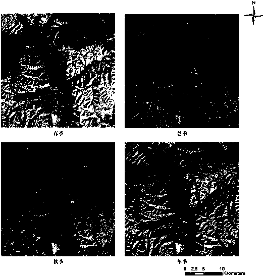
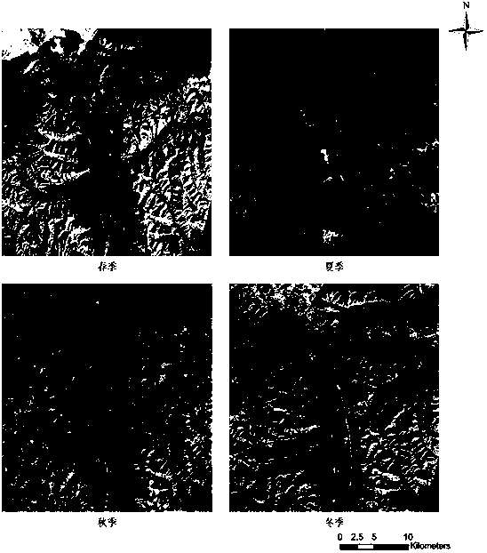
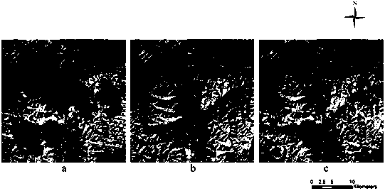
[0044] Such as figure 1 The shown synthetic image construction method based on Landsat long-term series includes the following steps: First, collect all available Landsat series images with cloud cover less than 80%, and then remove the noise observations in Landsat images such as clouds, cloud shadows, and snow Then, each clear observation value is fitted according to certain rules, and the surface reflectance change curve of each pixel in each band is established, and finally the daily synthetic image of Landsat surface reflectance can be generated.

[0045] 1) Data acquisition

[0046] This embodiment adopts the Landsat TM / ETM+ / OLI landsat image data downloaded from the United States Geological Survey (USGS) website from September 9, 1987 to May 30, 2017, with cloud cover less than 80%. The downloaded data track The number is 132 / 34, with a total of 510 ...


PUM


Abstract

The invention provides a synthetic image construction method based on a Landsat long time sequence. The method comprises the following steps: firstly, collecting all available images of which the cloud amount is lower than 80 percent in the Landsat series; then removing noise observation points in the Landsat images such as clouds, cloud shadows and snow, then fitting each clear observation valueaccording to a certain rule, establishing a surface reflectance change curve of each pixel of each waveband, and finally generating a synthetic image of daily Landsat surface reflectance. According to the method, the time resolution of image construction is effectively improved, accidental conditions occurring on the earth surface can be effectively eliminated, the method is not influenced by noise which cannot be recognized by a cloud detection algorithm, the periodic change condition of the earth surface reflectivity caused by seasonal change of the earth surface and change of the solar altitude angle is reflected, and the inter-year change trend of the reflectivity is obtained.

Description

technical field [0001] The invention relates to a synthetic image construction method based on Landsat long-term sequence, and belongs to the technical field of remote sensing mapping. Background technique [0002] Since Landsat (US Land Satellite) was launched in 1972, it has accumulated a large amount of remote sensing image data of the earth's surface. With the advantages of continuous observation cycle, moderate spatial resolution, high quality, scientific data processing and archiving, Landsat has achieved great success in land coverage Change analysis, vegetation growth monitoring, and crop yield estimation play an important and even irreplaceable role. However, the repeated observation period of the Landsat series of satellite images is 16 days, and the earth observation will be affected by weather conditions such as clouds and snow, and the Landsat ETM+ sensor image has bands since May 2003, and the data is missing. Both limit the further use of Landsat data. So ge...

Claims


Application Information

Patent Timeline
IPC IPC(8): G06T17/05G06F16/58G06F16/587
CPCG06T17/05G06F16/5866G06F16/587Y02A90/10
Inventor 李明诗张亚丽
Owner NANJING FORESTRY UNIV
Why Eureka
Try Eureka