Terrain prediction method, apparatus and system using continuous wave radar, and unmanned aerial vehicle

A prediction method and wave radar technology, applied in the field of unmanned aerial vehicles, can solve the problems affecting the accuracy of terrain prediction and the existence of outliers, and achieve the effect of clearing interference and high prediction accuracy.

Pending Publication Date: 2020-03-17
SZ DJI TECH CO LTD
View PDF6 Cites 0 Cited by
  • Summary
  • Abstract
  • Description
  • Claims
  • Application Information

AI Technical Summary

Problems solved by technology

However, in actual situations, due to the interference of the continuous wave radar's internal and external environments, there will be outliers in the distance measured by the continuous wave radar, which will affect the accuracy of terrain prediction

Method used


Image

  • Terrain prediction method, apparatus and system using continuous wave radar, and unmanned aerial vehicle
  • Terrain prediction method, apparatus and system using continuous wave radar, and unmanned aerial vehicle
  • Terrain prediction method, apparatus and system using continuous wave radar, and unmanned aerial vehicle

Examples


Embodiment Construction

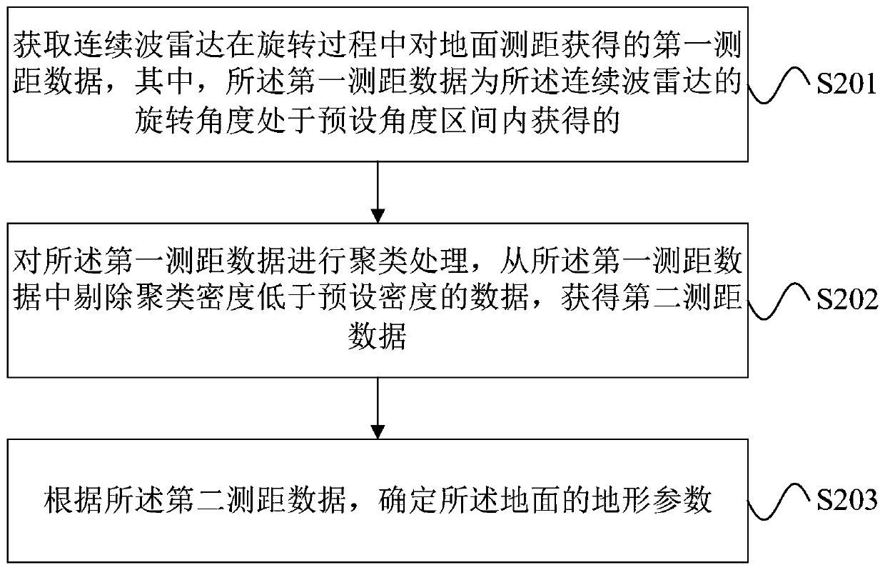
[0034] In order to make the purpose, technical solutions and advantages of the embodiments of this specification more clear, the technical solutions in the embodiments of this specification will be clearly and completely described below in conjunction with the drawings in the embodiments of this specification. Obviously, the described embodiments It is a part of the embodiments of this specification, not all of them. Based on the embodiments in this specification, all other embodiments obtained by persons of ordinary skill in the art without creative efforts fall within the protection scope of this specification.

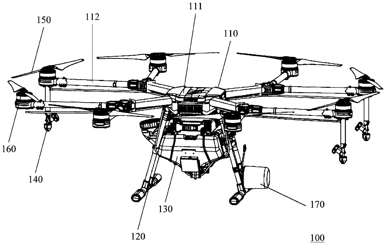
[0035] The embodiments of this specification provide a continuous wave radar terrain prediction method, device, system and unmanned aerial vehicle. The drone may be a drone, such as a rotorcraft, for example, a multi-rotor aircraft propelled by multiple propulsion devices through the air, but it may also be other types of aircraft, and the embodiments of this specif...


PUM


Abstract

Provided are a terrain prediction method, apparatus and system using a continuous wave radar, and an unmanned aerial vehicle. The method comprises: acquiring first distance measurement data obtained by a continuous wave radar rotating to a preset angle interval during rotation to perform distance measurement on the ground (S201); performing clustering processing on the first distance measurement data, and removing data, with a clustering density lower than a preset density, from the first distance measurement data to obtain second distance measurement data (S202); and according to the second distance measurement data, determining terrain parameters of the ground (S203). Data with a clustering density lower than a preset density is first removed as outliers, and terrain prediction is then performed; therefore, interference in a continuous wave radar is eliminated, such that the accuracy of prediction of the ground terrain by the continuous wave radar is higher.

Description

technical field [0001] The embodiment of this description relates to the technical field of unmanned aerial vehicles, and in particular to a continuous wave radar terrain prediction method, device, system and unmanned aerial vehicle. Background technique [0002] At present, UAVs can be used in many scenarios. Taking the agricultural industry as an example, UAVs can cultivate land, sow, spray pesticides, and harvest crops, etc., bringing great benefits to the agricultural field. In these operating scenarios, most drones need to fly close to the ground and avoid accidentally hitting the ground when climbing. On relatively flat ground, based on the Global Positioning System (Global Positioning System, GPS) and Inertial Measurement Unit (Inertial Measurement Unit, IMU) data, UAVs can complete the above tasks more smoothly; It is necessary to adjust the action in advance, perform operations such as climbing, descending, decelerating, braking, etc., to achieve flying near the gr...

Claims


Application Information

Patent Timeline
IPC IPC(8): G01S13/935
CPCG01S13/935G01S13/08G01S7/41
Inventor 祝煌剑高迪王春明
Owner SZ DJI TECH CO LTD
Why Eureka
Try Eureka