Advanced receiver autonomous integrity monitoring simulation evaluation method and device

An integrity monitoring and receiver technology, applied in the field of satellite navigation, to achieve the effect of simple and easy-to-implement simulation evaluation process

Active Publication Date: 2020-04-10
NO 20 RES INST OF CHINA ELECTRONICS TECH GRP +1
View PDF3 Cites 6 Cited by
  • Summary
  • Abstract
  • Description
  • Claims
  • Application Information

AI Technical Summary

Problems solved by technology

[0004] At present, there are no relevant international and domestic standards for ARAIM user processing algorithms and performance evaluation. The implementation

Method used


Image

  • Advanced receiver autonomous integrity monitoring simulation evaluation method and device
  • Advanced receiver autonomous integrity monitoring simulation evaluation method and device
  • Advanced receiver autonomous integrity monitoring simulation evaluation method and device

Examples


Embodiment Construction

[0032] The present invention will be further described below in conjunction with the accompanying drawings and embodiments.

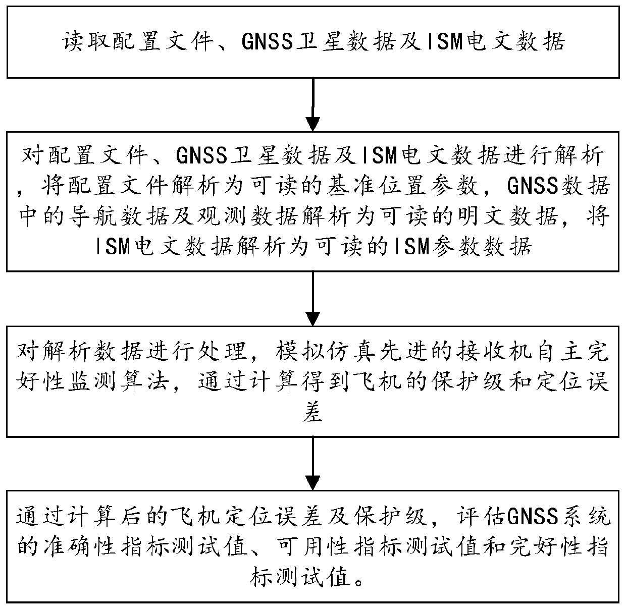
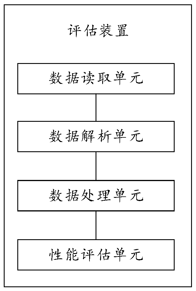
[0033] The embodiment of the present invention discloses an advanced receiver integrity monitoring simulation evaluation method, referring to figure 1 As shown, it mainly includes the following steps:

[0034] Step 1: Read the configuration file, GNSS satellite data and ISM message data;

[0035] The configuration file is a reference position; it is a simulation reference position parameter, including longitude, latitude and height.

[0036] Described GNSS satellite data is from GNSS multimode receiver, and data type comprises ephemeris data, almanac data and pseudorange data; For the continuous data of GNSS multimode receiver output, what the present invention uses is the GNSS multimode recorded in the storage device The continuous data output by the receiver is stored in binary text files in units of days;

[0037] The ISM message data is the integ...


PUM


Abstract

The invention provides an advanced receiver autonomous integrity monitoring simulation evaluation method and device. The method comprises the following steps of: reading a configuration file, GNSS satellite data and ISM message data; through the analyzed GNSS satellite data and ISM message parameters, simulating an advanced receiver autonomous integrity monitoring (ARAIM) algorithm, and performingcalculation to obtain the protection level and positioning error of an aircraft; and evaluating an accuracy index test value, an availability index test value and an integrity index test value of theGNSS system according to the calculation result. The advanced receiver autonomous integrity monitoring simulation evaluation method is completely and systematically established, the ARAIM does not have an existing standard, an ARAIM standard environment is simulated for monitoring, and the whole simulation evaluation process is simple and easy to execute.

Description

technical field [0001] The invention relates to the technical field of satellite navigation, in particular to an advanced receiver simulation evaluation method and device. Background technique [0002] The combination of satellite, airborne and ground positioning and navigation technologies provides flight guidance information for aircraft to enable them to fly safely and normally, which is the basis for the safe and efficient operation of modern civil aviation. In order to ensure the safety of civil aviation operations, the application of global satellite navigation system (GNSS) to civil aviation navigation needs to solve the problem that the performance of satellite navigation systems does not meet the high standard requirements of civil aviation operations. [0003] In the GNSS civil aviation application requirements proposed by ICAO, the US Federal Aviation Administration (FAA) and the US Radio Commission for Aeronautics (RTCA), it is emphasized that the airborne satell...

Claims


Application Information

Patent Timeline
IPC IPC(8): G01S19/23
CPCG01S19/23
Inventor 王雪峰王岸石苏从兵杨明赵毓譞刘洋褚映红康建荣
Owner NO 20 RES INST OF CHINA ELECTRONICS TECH GRP
Why Eureka
Try Eureka