

Unmanned aerial vehicle image-based established route ground object identification and positioning method
A technology for ground object recognition and unmanned aerial vehicles, which is applied in scene recognition, character and pattern recognition, surveying and navigation, etc., can solve the problems of low positioning accuracy, loss of small object features, and lack of local detail information, so as to improve accuracy. degree, reduce the loss rate, and avoid the effect of excessive loss
- Summary
- Abstract
- Description
- Claims
- Application Information
AI Technical Summary
Problems solved by technology
Method used
Image

Examples
Embodiment Construction
[0032] In order to make the object, technical solution and advantages of the present invention clearer, the present invention will be further described in detail below in conjunction with the accompanying drawings and embodiments. It should be understood that the specific embodiments described here are only used to explain the present invention, not to limit the present invention.
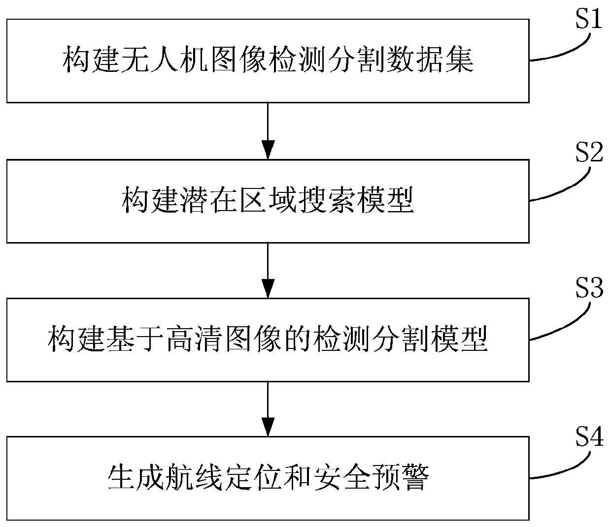
[0033] figure 1 A flow chart showing the method for identifying and locating features on a predetermined route based on images of unmanned aerial vehicles provided by the present invention is described in detail as follows:
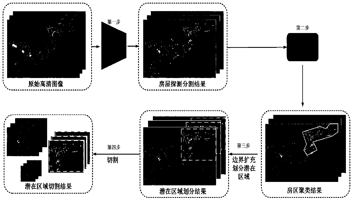
[0034] Step S1: Construct the UAV image detection segmentation dataset. The data used for training in the present invention adopts JOUAV CW-20 unmanned aerial vehicle, and the shooting camera adopts Nikon D810. Generally, the patrol aerial photography is carried out at a position 300 meters above the ground, and the images involve deserts, barren mountains, towns and other s...
PUM
 Abstract
Description
Claims
Application Information