

Automatic updating method and system for three-dimensional geological structure model based on GIS platform
A structural model, three-dimensional geological technology, applied in the field of geological exploration, can solve problems such as affecting efficiency and quality, and can not be updated quickly and efficiently in real-time modeling data automatically.
- Summary
- Abstract
- Description
- Claims
- Application Information
AI Technical Summary
Problems solved by technology
Method used
Image

Examples
Embodiment 1
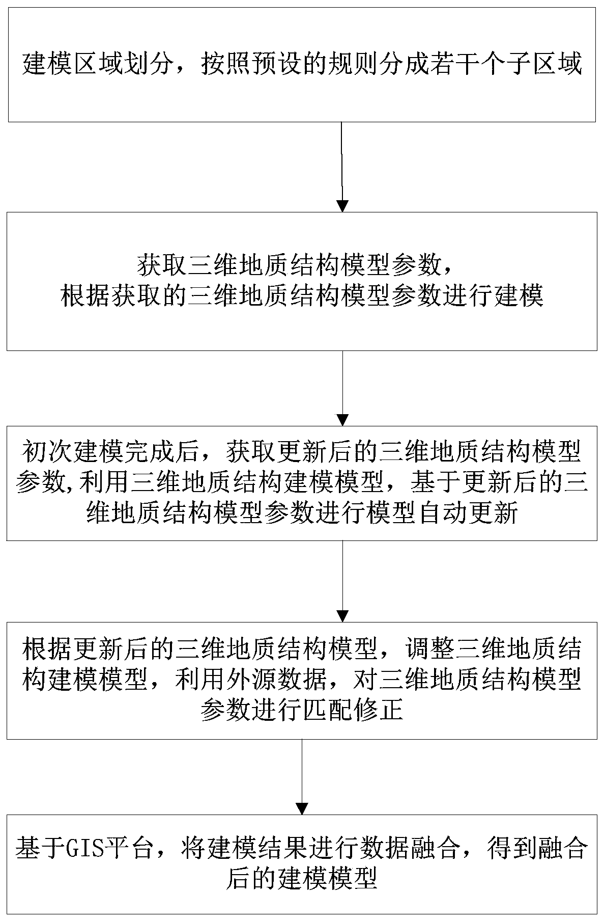
[0036] In one or more embodiments, a method for automatically updating a three-dimensional geological structure model based on a GIS platform is disclosed. Through the automatic updating method for a three-dimensional geological structure model based on a GIS platform, the earth information system can be used to conduct real-time analysis in combination with data information , the detection part adopts the real-time acquisition method to analyze and process the modeling data in real-time and quickly, so that the fast and efficient automatic update of the 3D geological structure model can be realized. Next, the method for automatically updating the three-dimensional geological structure model based on the GIS platform of the present invention will be specifically described.
[0037] figure 1 The process of the automatic update method of the three-dimensional geological structure model based on the GIS platform is recorded, and the specific sequence includes the following steps:...
Embodiment 2
[0052] In one or more embodiments, a system for automatically updating a three-dimensional geological structure model based on a GIS platform is disclosed, including:
[0053] means for dividing the modeling area of the three-dimensional geological structure model into several sub-areas;
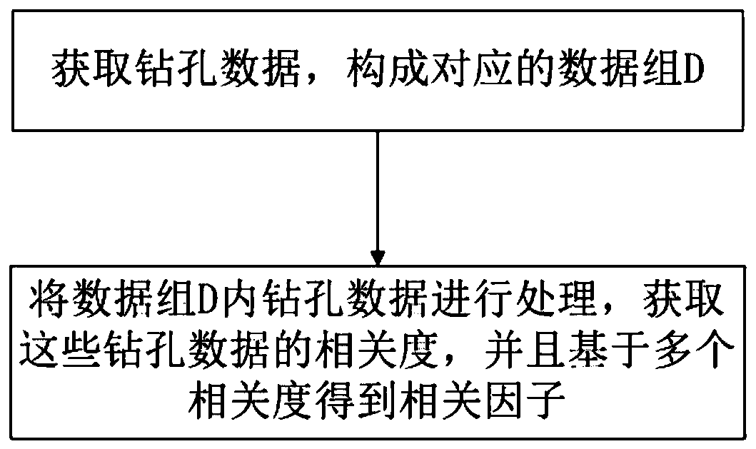
[0054] A device for obtaining a plurality of borehole data in each sub-region, and determining the correlation degree and correlation factor among the multiple borehole data;
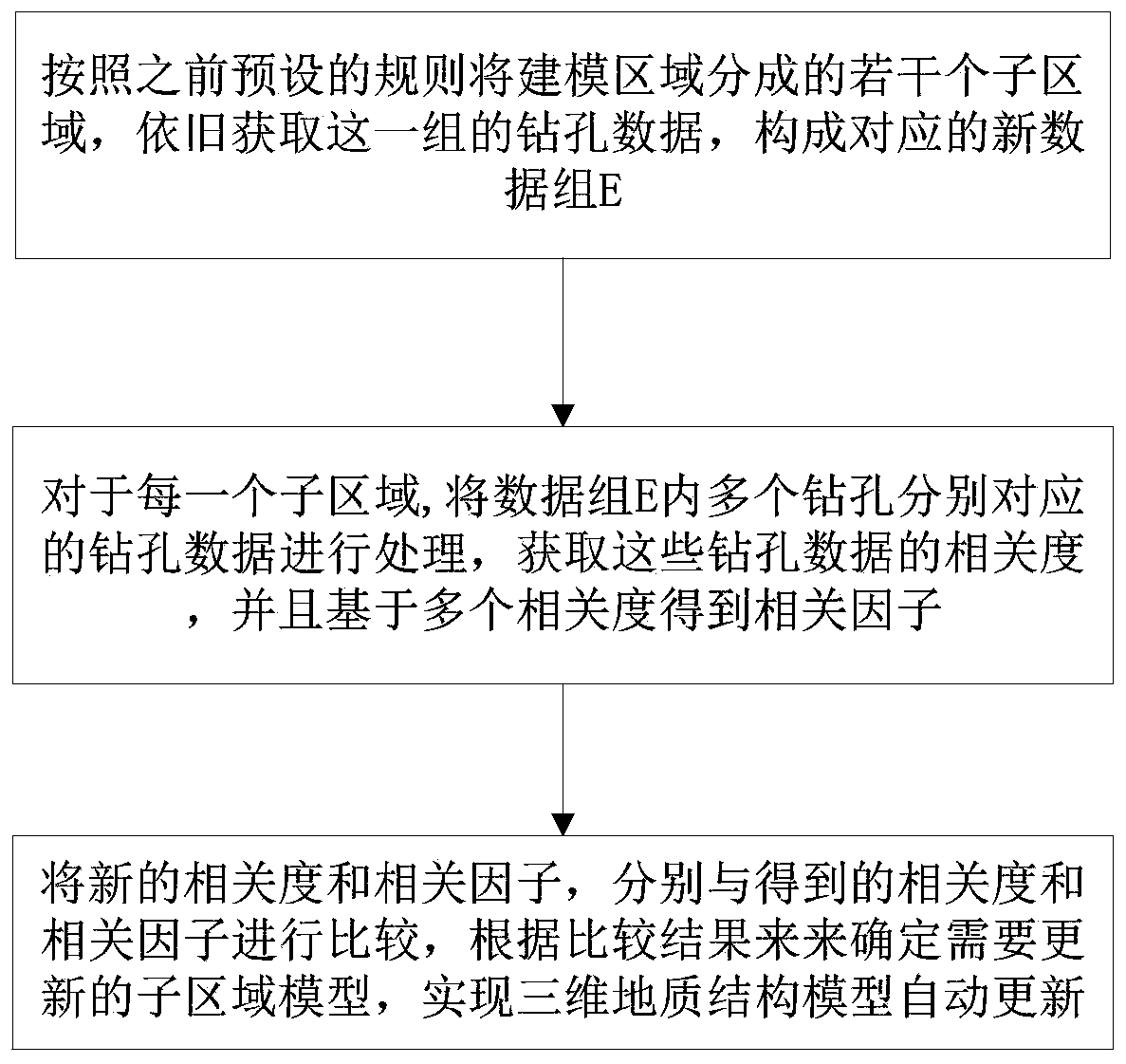
[0055] A device for obtaining updated three-dimensional geological structure model parameters, reacquiring multiple borehole data in each sub-region, and determining new correlations and correlation factors between the multiple borehole data;
[0056] The device is used to compare the new correlation degree and correlation factor in each sub-region with the correlation degree and correlation factor before updating, determine the sub-region that needs to update the parameters, and realize the update of the three-dime...
Embodiment 3
[0058] In one or more embodiments, a terminal device is disclosed, including a server, the server includes a memory, a processor, and a computer program stored on the memory and operable on the processor, and the processor executes the The program realizes the automatic update method of the three-dimensional geological structure model based on the GIS platform in the first embodiment. For the sake of brevity, details are not repeated here.
PUM
 Abstract
Description
Claims
Application Information