
Method for accurately acquiring mining influence boundaries and determining building damage grades

A boundary and level technology, applied in the field of level, can solve problems such as boundary delimitation, historical data inversion, building damage level impact, etc., and achieve the effect of reducing the influence of human subjective factors and objective data basis.

Inactive Publication Date: 2020-08-18
CHINA UNIV OF MINING & TECH
View PDF2 Cites 5 Cited by
  • Summary
  • Abstract
  • Description
  • Claims
  • Application Information

AI Technical Summary

Problems solved by technology

In practice, method one usually uses technical means such as leveling, GPS measurement, and 3D laser scanning to conduct on-site surveys and surveys; there are defects such as heavy workload, high cost, and difficult to accurately delineate boundaries, and this type of surveying method cannot obtain mining areas. Inversion of historical data cannot be carried out, and at the same time, the damage level of on-site survey buildings is seriously affected by human subjective factors
The application of the second method also has certain limitations and regional applicability. Among them, the most classic probability integral method model has the problem of too fast convergence, which leads to inaccurate delineation of mining impact boundaries; in addition, the application of this model in mountainous areas is also Significantly affected by terrain factors

Method used


Image

  • Method for accurately acquiring mining influence boundaries and determining building damage grades
  • Method for accurately acquiring mining influence boundaries and determining building damage grades
  • Method for accurately acquiring mining influence boundaries and determining building damage grades

Examples


Embodiment Construction

[0029] In order to make the object, technical solution and advantages of the present invention clearer, the present invention will be further described in detail below in conjunction with the accompanying drawings and embodiments. It should be understood that the specific embodiments described here are only for explaining the present invention, and are not intended to limit the present invention.

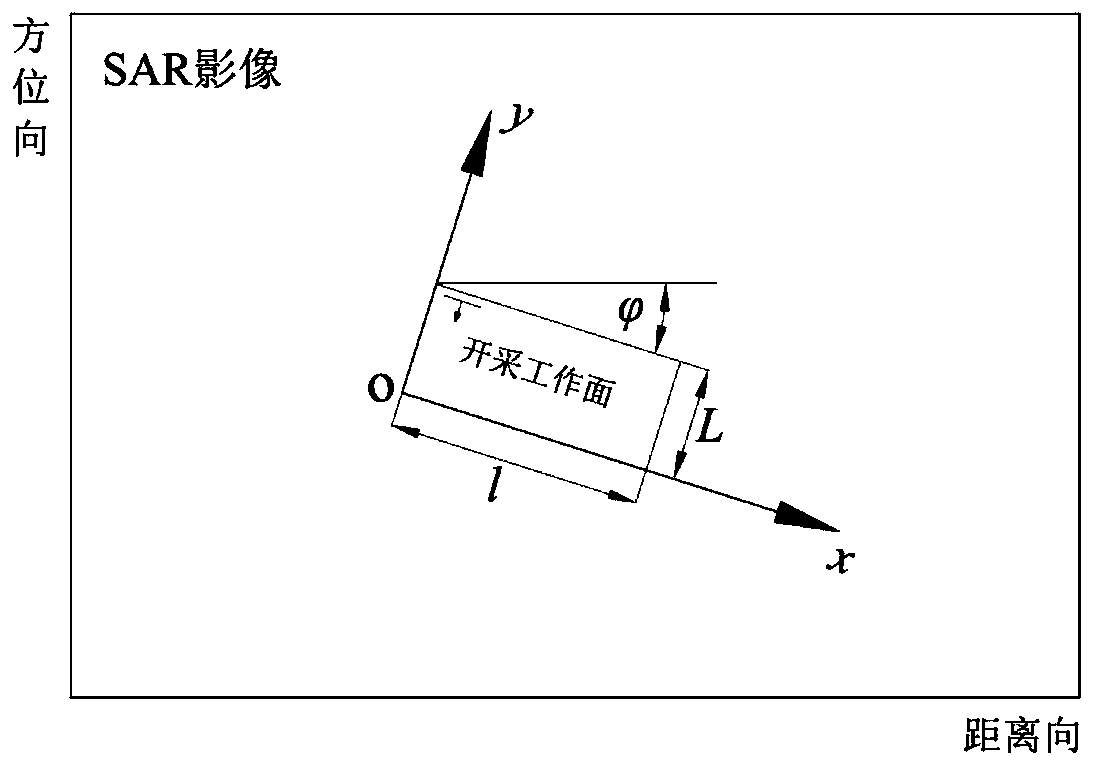
[0030] Such as figure 1 with figure 2 As shown, a method of accurately obtaining the mining influence boundary and determining the damage level of buildings of the present invention, the steps are:

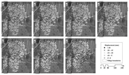
[0031] (1) InSAR time series analysis and interpretation of surface deformation: select N continuous imaging SAR image data covering the target area, and perform time series processing of surface deformation information to obtain the surface deformation information of the radar line of sight in the study area, as shown in image 3 shown.

[0032] (2) The deformation of the radar lin...


PUM


Abstract

The invention discloses a method for accurately obtaining a mining influence boundary and determining a building damage grade. The method belongs to the field of mining damage technology identification, and comprises the following specific steps: (1) interpreting by using N-scene SAR image data continuously imaged in a target area through an InSAR time sequence analysis method to obtain a time sequence of deformation of a mining influence area to the ground surface along a radar sight line; (2) solving earth surface three-dimensional deformation information based on the subsidence prediction model by using the related information of the mined working surface and the geological mining parameters of the target area, so as to accurately obtain earth surface subsidence, inclination (curvature)and horizontal deformation; (3) determining a mining influence boundary and a building damage grade based on each deformation index. The steps are simple, the detection effect is good, an effective,real and reliable data basis can be provided for mining damage technology identification work, mine and enterprise (citizen) disputes can be fairly and fairly solved, and social contradictions are relieved.

Description

technical field [0001] The invention relates to a method for obtaining the mining impact boundary and determining the building damage level, and is especially applicable to a method for accurately obtaining the mining impact boundary and determining the building damage level for surveying and mapping of coal mines involved in underground resource mining. Background technique [0002] Coal, as the main energy source in our country, plays a vital role in the development of the national economy and society, but the ground subsidence caused by the mining of underground resources is also very prominent, which will not only destroy the ecological environment, but also cause various buildings on the ground to be damaged to varying degrees. damage. Under the current theme of sustained and stable development of Chinese society, it has become one of the urgent problems to quickly resolve the contradiction between coal enterprises and building owners, accurately conduct mining damage t...

Claims


Application Information

Patent Timeline
Patent Type & Authority Applications(China)
IPC IPC(8): G01S13/90G01S7/41
CPCG01S7/418G01S13/9094G01S13/9027
Inventor 刁鑫鹏吴侃杨隽李晓莹徐勇
Owner CHINA UNIV OF MINING & TECH
Learn More