
Navigation airport low-altitude navigation chart based on AR display technology and implementation system thereof

A display technology and airport technology, applied in the field of general aviation, can solve the problems of distracting the driver's energy, the display screen is easy to reflect, and the navigation data is manually opened one by one. The effect of remote data network update

Active Publication Date: 2020-09-04
邹仲恒
View PDF7 Cites 6 Cited by
  • Summary
  • Abstract
  • Description
  • Claims
  • Application Information

AI Technical Summary

Problems solved by technology

Although it is a professional chart software, the drawing method of the chart is exactly the same as that of the paper version. The most important flight procedures (including instrument flight procedures and visual flight procedures) are two-dimensional and divided into: Horizontal section diagram and vertical section diagram, part of the chart is not drawn to scale due to reasons such as the chart size, part of the flight procedures and route navigation points, and each chart is stored in a separate file, there is : Retrieval of navigation information needs to be manually clicked one by one, the display screen is easy to reflect light, and the pilot needs to slide the screen by hand, which is inconvenient to operate. Different runway takeoff and landing directions and different navigation methods are divided into different chart displays, which distracts the pilot. In flight control and monitoring, the signal of the built-in positioning and navigation module is easily interrupted

Method used


Image

  • Navigation airport low-altitude navigation chart based on AR display technology and implementation system thereof
  • Navigation airport low-altitude navigation chart based on AR display technology and implementation system thereof
  • Navigation airport low-altitude navigation chart based on AR display technology and implementation system thereof

Examples


Embodiment Construction

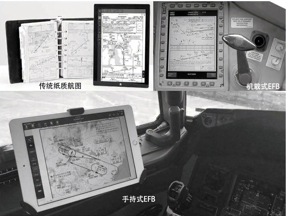
[0033] figure 1 It shows the current status of aircraft charts. The electronic flight bag (EFB) used by pilots is essentially an "electronic version of paper charts". Although it is a professional aeronautical chart software, the drawing method of the aeronautical chart is exactly the same as that of the paper version, such as figure 1 As shown in , the chart is two-dimensional, divided into: horizontal profile and vertical profile, and each chart is stored in a separate file, there is: to retrieve the navigation data, you need to manually click one by one to open the discontinuous, need to It is inconvenient for pilots to slide the screen with their hands. Different take-off and landing directions of runways and different navigation methods are divided into different charts and displayed separately, which distracts the pilot's monitoring energy.

[0034] For this reason, this embodiment presents a low-altitude chart of a general aviation airport based on AR display technolog...


PUM


Abstract

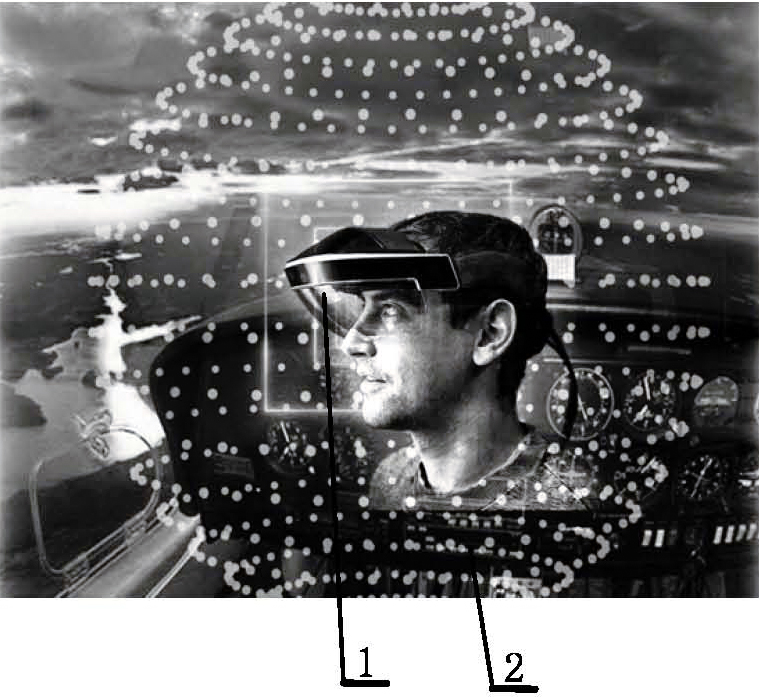
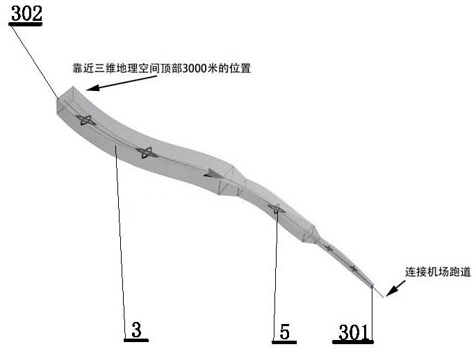
The invention discloses a navigation airport low-altitude navigation chart based on an AR display technology and an implementation system thereof. When the aircraft is close to an airport or takes offfrom the airport, the navigation airport low-altitude navigation map is displayed in a visual screen with AR glasses worn on the head, and the navigation airport low-altitude navigation map display comprises a three-dimensional geographic space and a navigation map element three-dimensional data model associated with geographic data of the three-dimensional geographic space; the aerograph elementthree-dimensional data model comprises: an aerograph element three-dimensional data model, the system comprises a flight program data model, an airport data model, an obstacle data model, a conduction device data model and a special ground object data model. The flight program data model is a continuous navigation channel and track line displayed on a descending navigation channel or an ascendingnavigation channel of an airfield runway from the upper limit of a low-altitude three-dimensional geographic space of an aircraft, and a hollow-square-shaped closed transparent cavity is formed around the navigation channel and the track line. According to the invention, visual approach and departure three-dimensional chart elements and attribute information are provided for pilots as flight guidance.

Description

technical field [0001] The invention belongs to the technical field of general aviation, and relates to a low-altitude aerial chart of a general aviation airport based on AR display technology and a system for its realization. Background technique [0002] At present, there is no complete professional chart for general aviation. The "National General Aviation Airport Information Compilation" only contains the airport plan, and the visual flight chart does not include flight procedures and other important chart elements and navigation information, and there is no electronic flight bag for low-altitude charts. (EFB) and 3D products. [0003] At present, the electronic flight bag (EFB) or "electronic chart" and "flight procedure" used by civil aviation pilots are essentially "electronic paper charts". Although it is a professional chart software, the drawing method of the chart is exactly the same as that of the paper version. The most important flight procedures (including in...

Claims


Application Information

Patent Timeline
Patent Type & Authority Applications(China)
IPC IPC(8): G06T17/05G06T19/00G06F16/29
CPCG06T17/05G06T19/006G06F16/29
Inventor 邹仲恒
Owner 邹仲恒
Learn More