
Measurement method of CORS-based unmanned aerial vehicle laser scanning and oblique photography integrated measurable BIM for rural residential land measurement

A rural homestead and laser scanning technology, which is applied in photogrammetry/video measurement, radio wave measurement system, measuring device, etc., can solve the problem of not being able to meet the requirements of cadastral survey specifications, unable to meet the requirements of rural homestead survey, and unable to generate It can measure 3D BIM and other issues to achieve the effect of enriching the means of spatial data collection

Inactive Publication Date: 2020-11-17
宁波冶金勘察设计研究股份有限公司
View PDF3 Cites 6 Cited by
  • Summary
  • Abstract
  • Description
  • Claims
  • Application Information

AI Technical Summary

Problems solved by technology

That is to say, it meets the requirements of 1:500 topographic map, but it cannot meet the requirements of rural homestead survey
[0007] Practice has proved that simply relying on UAV oblique photogrammetry for operations cannot meet the geometric accuracy required by the cadastral survey specifications for rural homestead parcels
Moreover, the BIM of rural homestead parcels constructed based on point cloud data lacks the support of image texture data, and cannot generate corresponding measurable 3D BIM

Method used


Image

  • Measurement method of CORS-based unmanned aerial vehicle laser scanning and oblique photography integrated measurable BIM for rural residential land measurement
  • Measurement method of CORS-based unmanned aerial vehicle laser scanning and oblique photography integrated measurable BIM for rural residential land measurement
  • Measurement method of CORS-based unmanned aerial vehicle laser scanning and oblique photography integrated measurable BIM for rural residential land measurement

Examples


Embodiment Construction

[0055] The present invention will be further described below in conjunction with the examples. The description of the following examples is provided only to aid the understanding of the present invention. It should be pointed out that for those skilled in the art, some modifications can be made to the present invention without departing from the principles of the present invention, and these improvements and modifications also fall within the protection scope of the claims of the present invention.

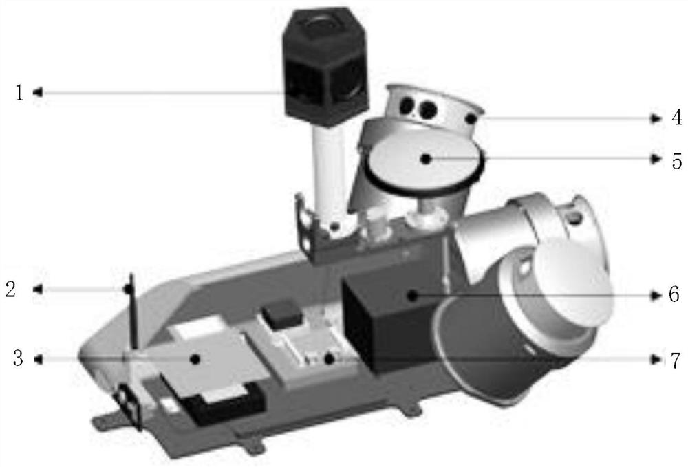
[0056] The normal scanning accuracy of the UAV 3D lidar scanner can reach the centimeter level, and the data acquisition accuracy is high, which can meet the geometric accuracy requirements required by the cadastral survey specifications for rural homestead parcels. Such as figure 1 As shown, the UAV 3D lidar scanner is equipped with an airborne 3D lidar scanning measurement data acquisition system. The airborne 3D lidar scanning measurement data acquisition system includes a 360...


PUM


Abstract

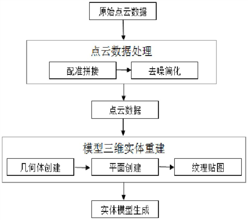
The invention relates to a measurement method of a CORS-based unmanned aerial vehicle laser scanning and oblique photography integrated measurable BIM for rural residential land measurement. The method comprises the following steps: step 1, acquiring three-dimensional lattice data of rural residential land houses; 2, performing registration splicing and denoising simplification on the original point cloud data to obtain high-precision point cloud data. The method has the advantages that: 1) cadastral measurement is conducted indoors based on the measurable three-dimensional BIM, elevation points, surface features, landforms, ditches, sills and the like with proper density are collected and can be mapped on the measurable three-dimensional BIM through indoor work, and a large amount of field data collection work is omitted; 2) based on the measurable three-dimensional BIM, data acquisition of rural residential land space elements can be carried out, and the means of space data acquisition is enriched; 3) the measurable three-dimensional BIM can be used for visual browsing, all scenes within the range of 360 degrees around a shooting site can be completely displayed, an operator canfreely rotate the mouse to browse and stretch the distance, and the method is intuitive.

Description

technical field [0001] The invention belongs to the field of laser scanning and oblique photography, and in particular relates to a CORS-based measurement method for rural homesteads using a measurable BIM integrated with unmanned aerial vehicle laser scanning and oblique photography. Background technique [0002] The specific contents of the investigation of cadastral elements of rural homesteads include: first, the preparatory stage of the investigation of cadastral elements. Preliminary preparations are generally some preparatory work that needs to be carried out before the ownership investigation, mainly including dividing cadastral areas and cadastral sub-areas, collecting and sorting out relevant data such as the source of land ownership, compiling the base map of the investigation work, and pre-programming the parcel codes etc.; Second, investigate the boundary of ownership. Investigating the status of land ownership is mainly to investigate the nature of land owners...

Claims


Application Information

Patent Timeline
Patent Type & Authority Applications(China)
IPC IPC(8): G01C11/02G01S19/47G01S19/44
CPCG01C11/025G01S19/44G01S19/47
Inventor 张子江徐军蔺岩徐坤代云峰周海涛
Owner 宁波冶金勘察设计研究股份有限公司
Learn More