Remote sensing image segmentation algorithm based on convolutional neural network

A technology of convolutional neural network and segmentation algorithm, which is applied in the field of semantic segmentation algorithm, can solve the problems of slow manual analysis and insufficient processing of remote sensing image information, so as to improve the speed, capture rate of effective information, improve segmentation accuracy, and clear The effect of the scene analysis effect

Pending Publication Date: 2020-11-24
SHENYANG INST OF AUTOMATION - CHINESE ACAD OF SCI
View PDF0 Cites 8 Cited by
  • Summary
  • Abstract
  • Description
  • Claims
  • Application Information

AI Technical Summary

Problems solved by technology

Traditional remote sensing image recognition basically relies on manual analysis. For remote sensing images that contain a lot of co

Method used


Image

  • Remote sensing image segmentation algorithm based on convolutional neural network
  • Remote sensing image segmentation algorithm based on convolutional neural network
  • Remote sensing image segmentation algorithm based on convolutional neural network

Examples


Example Embodiment

[0039] The present invention will be further described in detail below in conjunction with the accompanying drawings and embodiments.

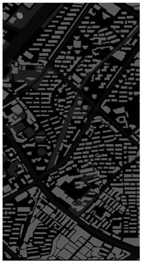
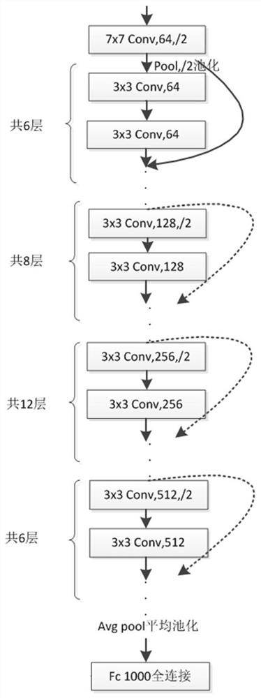
[0040] The invention uses a convolutional neural network to perform semantic segmentation on remote sensing images, that is, performs pixel-level classification and pixel coloring on different types of objects to achieve the purpose of semantic segmentation. What the present invention aims to achieve is the category distinction of each pixel, and the deep residual network structure is combined with the pyramid pooling model to realize the semantic segmentation task of the remote sensing image by the deep neural network.

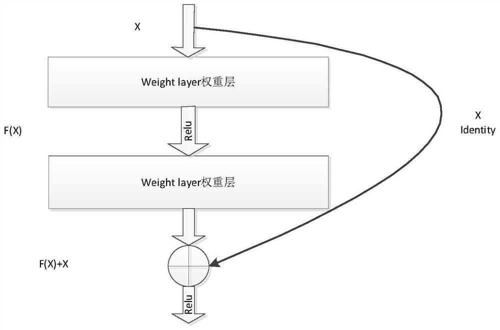
[0041] In the traditional sense, the depth of the network has a great influence on the final classification and recognition of images, so the conventional idea is that the deeper the network design, the better, but many experimental results have proved that when the network stack is very deep, The effect will be worse. Analy...


PUM


Abstract

The invention relates to a remote sensing image segmentation algorithm based on a convolutional neural network, and the algorithm comprises the steps: employing ResNet34 pre-training weight parametersas the depth guarantee of a network layer, so as to solve a problem of gradient disappearance when the network layer is deepened; a pyramid pooling module is adopted to aggregate context informationof different areas in the image so as to improve the capability of obtaining global information; designing a loss function by adopting a method of combining a cross entropy loss function and regularization constraints, wherein the cross entropy is used for judging the closeness degree of actual output and expected output in the multi-classification problem; the regularization term can reduce the complexity of the model so as to prevent overfitting and improve the generalization ability of the model. According to the method, the designed composite convolutional neural network algorithm is applied to semantic segmentation of the remote sensing image, so that the speed of information recognition in the remote sensing image and the capture rate of effective information are greatly improved, and the method is of great significance to information analysis of the remote sensing image.

Description

technical field [0001] The present invention proposes a semantic segmentation algorithm for satellite remote sensing images, utilizes the excellent characteristics of convolutional neural networks in image segmentation, applies it to the field of semantic segmentation of satellite remote sensing images, and realizes pixel-level segmentation of remote sensing images, and the segmentation results can be It is used in satellite map construction, military target detection and other fields. Background technique [0002] Remote sensing images refer to images of the earth that are aerially photographed in space by drones, remote sensing satellites, and other aircraft. Because the earth image obtained by aerial photography is a bird's-eye view, it is beneficial to clearly observe the surface information, which is objective and macroscopic, and has great value for the study of surface characteristics. [0003] There are many remote sensing satellites currently operating in Earth orb...

Claims


Application Information

Patent Timeline
IPC IPC(8): G06K9/00G06K9/34G06N3/04G06N3/08
CPCG06N3/08G06V20/13G06V10/267G06N3/045Y02T10/40
Inventor 王恩德李学鹏齐凯候绪奎彭良玉
Owner SHENYANG INST OF AUTOMATION - CHINESE ACAD OF SCI
Why Eureka
Try Eureka