Method and device for constructing high-precision map
A construction method and map technology, applied in image enhancement, image analysis, image data processing, etc., can solve the problem of low efficiency of high-precision map construction, and achieve the effect of improving construction efficiency and high accuracy
- Summary
- Abstract
- Description
- Claims
- Application Information
AI Technical Summary
Problems solved by technology
Method used
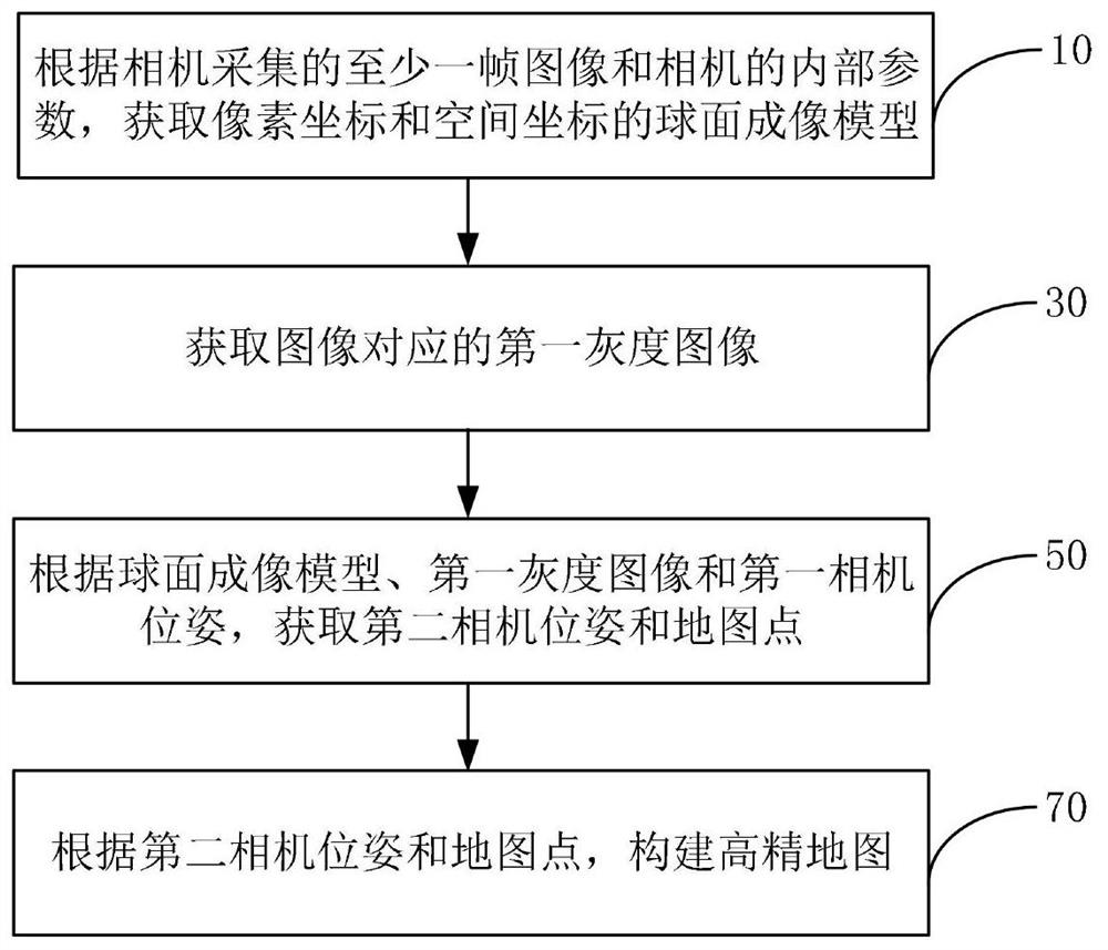
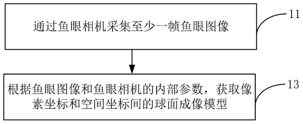
Image

Examples
Embodiment Construction
[0039] Hereinafter, exemplary embodiments according to the present application will be described in detail with reference to the accompanying drawings. Apparently, the described embodiments are only some of the embodiments of the present application, rather than all the embodiments of the present application. It should be understood that the present application is not limited by the exemplary embodiments described here.
[0040] Application overview
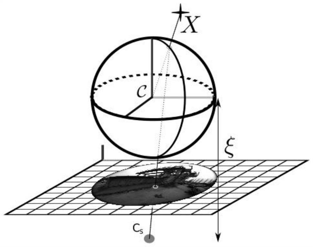
[0041] Simultaneous Localization and Mapping (SLAM) is widely used in the construction of high-precision maps. At present, when using SLAM to construct high-precision maps, the pinhole imaging model is often used to represent the imaging process of the camera. The imaging principle of the pinhole imaging model limits the viewing angle of the camera. In practice, in order to obtain a better de-distortion effect, the viewing angle of the pinhole camera is generally less than 90°. Only by collecting multi-view images in different...
PUM
 Abstract
Description
Claims
Application Information
 - R&D
- Intellectual Property
- Life Sciences
- Materials
- Tech Scout
- Unparalleled Data Quality
- Higher Quality Content
- 60% Fewer Hallucinations
Browse by: Latest US Patents, China's latest patents, Technical Efficacy Thesaurus, Application Domain, Technology Topic, Popular Technical Reports.
© 2025 PatSnap. All rights reserved.Legal|Privacy policy|Modern Slavery Act Transparency Statement|Sitemap|About US| Contact US: help@patsnap.com