
Rapid database building method and system for land survey

A land survey and fast technology, applied in the field of geographic information system, can solve the problems of high data error rate and high labor cost, and achieve the effect of improving data quality, reducing labor cost, and reducing participation in the process

Pending Publication Date: 2020-12-29
武汉欧铭达科技有限公司
View PDF1 Cites 3 Cited by
  • Summary
  • Abstract
  • Description
  • Claims
  • Application Information

AI Technical Summary

Problems solved by technology

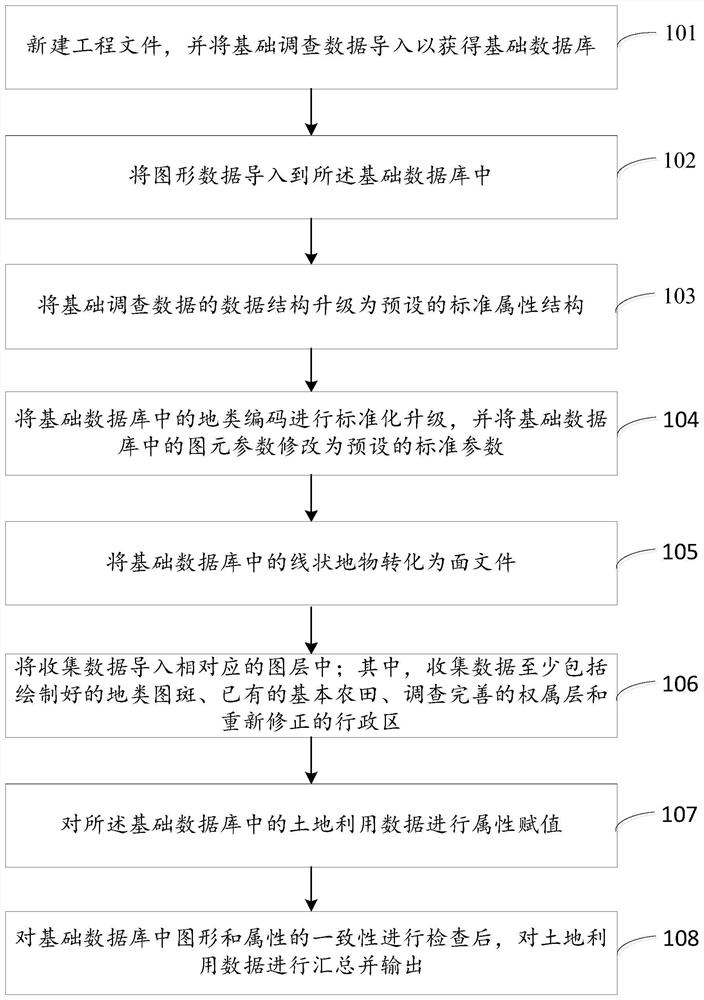
[0006] Embodiments of the present invention provide a method and system for quickly building databases for land surveys, which are used to solve the problems of manually importing data, modifying land type coefficients, modifying cultivated land types, and modifying standard attributes in traditional database building methods for land surveys. , the labor cost is high, and the data error rate is high due to the influence of human factors

Method used


Image

  • Rapid database building method and system for land survey
  • Rapid database building method and system for land survey
  • Rapid database building method and system for land survey

Examples


Embodiment Construction

[0039] In order to make the purpose, technical solutions and advantages of the embodiments of the present invention clearer, the technical solutions in the embodiments of the present invention will be clearly and completely described below in conjunction with the drawings in the embodiments of the present invention. Obviously, the described embodiments It is a part of embodiments of the present invention, but not all embodiments. Based on the embodiments of the present invention, all other embodiments obtained by persons of ordinary skill in the art without creative efforts fall within the protection scope of the present invention.

[0040] The terms "first" and "second" in the embodiments of the present application are used for description purposes only, and cannot be understood as indicating or implying relative importance or implicitly indicating the quantity of indicated technical features. Thus, the features defined as "first" and "second" may explicitly or implicitly inc...


PUM


Abstract

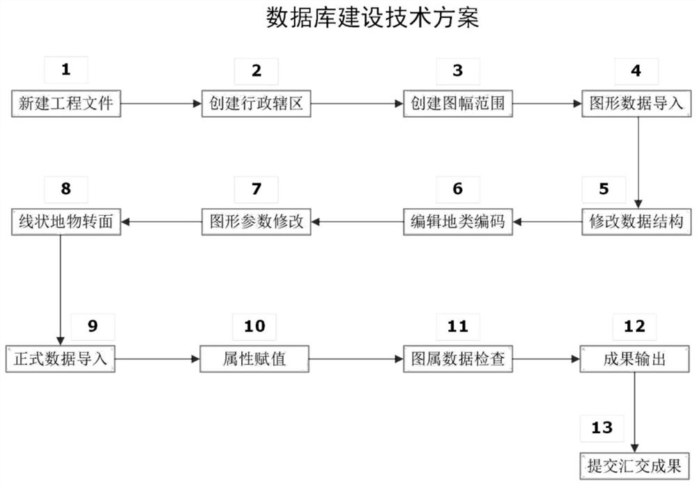
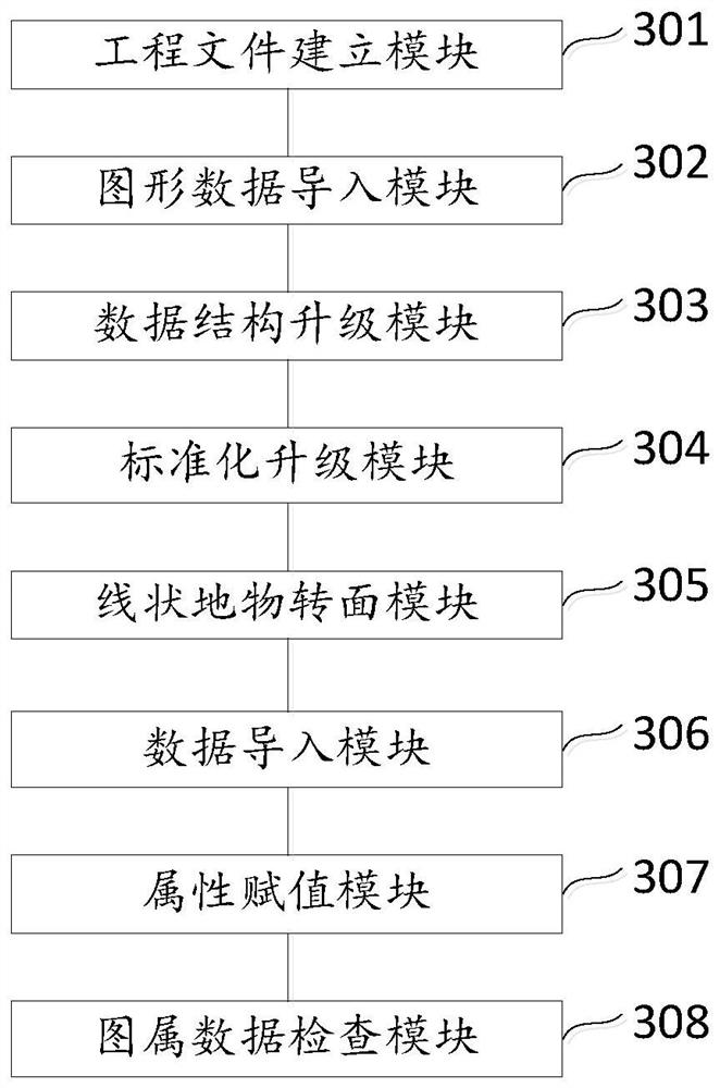
The embodiment of the invention provides a rapid database building method and system for land survey. Secondary dispatch data are imported to obtain a basic database; and basic data and survey resultsof work such as existing land survey, cadastral survey, collective land ownership registration, residential land and collective construction land use right confirmation registration, geographical national condition general survey, rural land contract management right confirmation registration and issuing and the like are fully utilized. A land survey database integrating graphs, images, attributes and documents is formed through processes of data structure upgrading, ground class code assignment, graph parameter modification, ground class coefficient modification, linear ground object surfaceturning and the like, and integrity, accuracy and standardization of data are checked according to national standards to obtain a land survey data result. The data storage process is innovated, the manual participation process is reduced, the labor cost is reduced, and the data quality is improved.

Description

technical field [0001] Embodiments of the present invention relate to the field of geographic information systems, in particular to a method and system for quickly building a database for land survey. Background technique [0002] Land survey is a major national condition and national strength survey, and it is an important means to check the land resources. The purpose of carrying out the third national land survey is to comprehensively investigate the current state of land use in the country, grasp true and accurate basic land data, improve the land survey, monitoring and statistics system, strengthen the socialization service of land resource information, and meet the needs of economic and social development and national land use. Resource management job needs. [0003] The purpose of the third national land survey is to comprehensively refine and improve the basic data of land use on the basis of the results of the second national land survey. , monitoring and statisti...

Claims


Application Information

Patent Timeline
Patent Type & Authority Applications(China)
IPC IPC(8): G06F16/11G06F16/29G06F16/22G06F16/2458G06F16/41
CPCG06F16/11G06F16/29G06F16/2462G06F16/2282G06F16/41
Inventor 郭有世黄春迎李静赵治国梅杰
Owner 武汉欧铭达科技有限公司
Learn More