OBS and sea surface towrope seismic data combined imaging method and processing terminal
A seismic data and imaging method technology, applied in seismic signal processing, seismology, geophysical measurement, etc., can solve the problems of affecting the imaging effect, introducing artifacts into the velocity model, wasting data, etc., to achieve convenient calculation, improve imaging resolution, good effect
- Summary
- Abstract
- Description
- Claims
- Application Information
AI Technical Summary
Problems solved by technology
Method used
Image
Examples
Embodiment Construction
[0042] specific implementation plan
[0043] Below, in conjunction with accompanying drawing and specific embodiment, the present invention is described further:
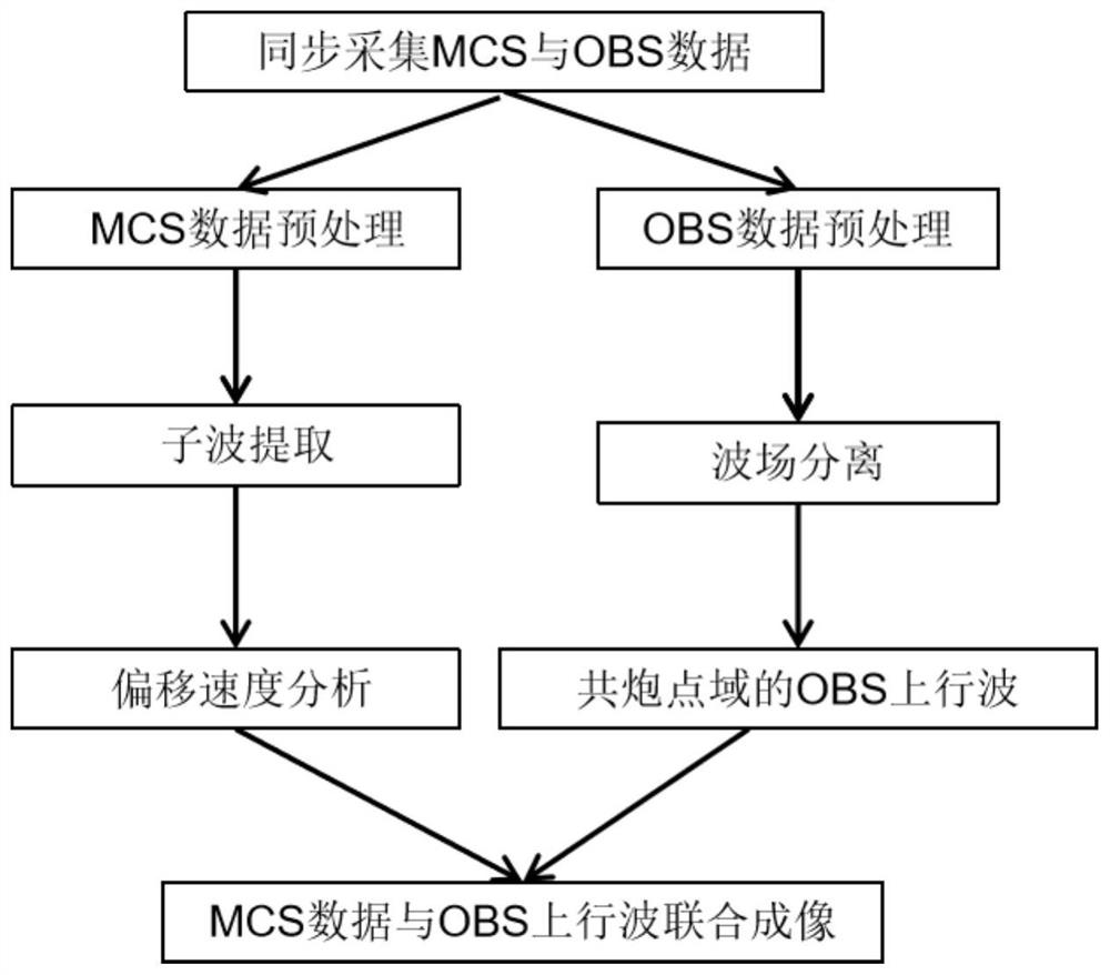
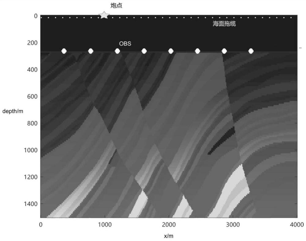
[0044] Such as Figure 1 to Figure 9 As shown, a joint imaging method of OBS and sea surface streamer seismic data includes the following steps:
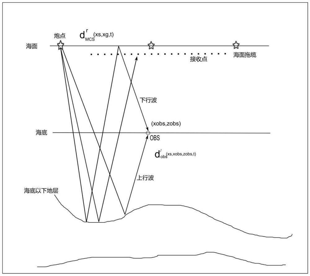
[0045] Step 1: Obtain the original OBS data and MCS data collected at the same time, and record them as d′ obs (x s ,x obs ,z obs ,t) and d′ mcs (x s ,x g ,t),x s Indicates the coordinates of the shot point (i.e. the source), x g Indicates the coordinates of the geophone on the surface streamer, x obs Indicates the horizontal coordinate of the OBS, z obs Indicates the vertical coordinate of the OBS. The OBS data is the reflected wave when the seismic wave excited by the OBS receiving source on the seabed meets the reflecting interface, and the MCS data is the reflected wave when the seismic wave excited by the receiving source located on the sea streamer on the ...
PUM
 Abstract
Description
Claims
Application Information
 - R&D
- Intellectual Property
- Life Sciences
- Materials
- Tech Scout
- Unparalleled Data Quality
- Higher Quality Content
- 60% Fewer Hallucinations
Browse by: Latest US Patents, China's latest patents, Technical Efficacy Thesaurus, Application Domain, Technology Topic, Popular Technical Reports.
© 2025 PatSnap. All rights reserved.Legal|Privacy policy|Modern Slavery Act Transparency Statement|Sitemap|About US| Contact US: help@patsnap.com


