Remote sensing image cloud and shadow restoration method based on gated convolution
A remote sensing image and gating technology, applied in image enhancement, image analysis, image data processing, etc., can solve problems such as insufficient ability, lack of consistency constraints between reconstructed regions and neighborhood textures, and inability to distinguish regional features.
- Summary
- Abstract
- Description
- Claims
- Application Information
AI Technical Summary
Problems solved by technology
Method used
Image
Examples
Embodiment Construction
[0049] The technical solution of the present invention will be further specifically described below through examples and in conjunction with the accompanying drawings.
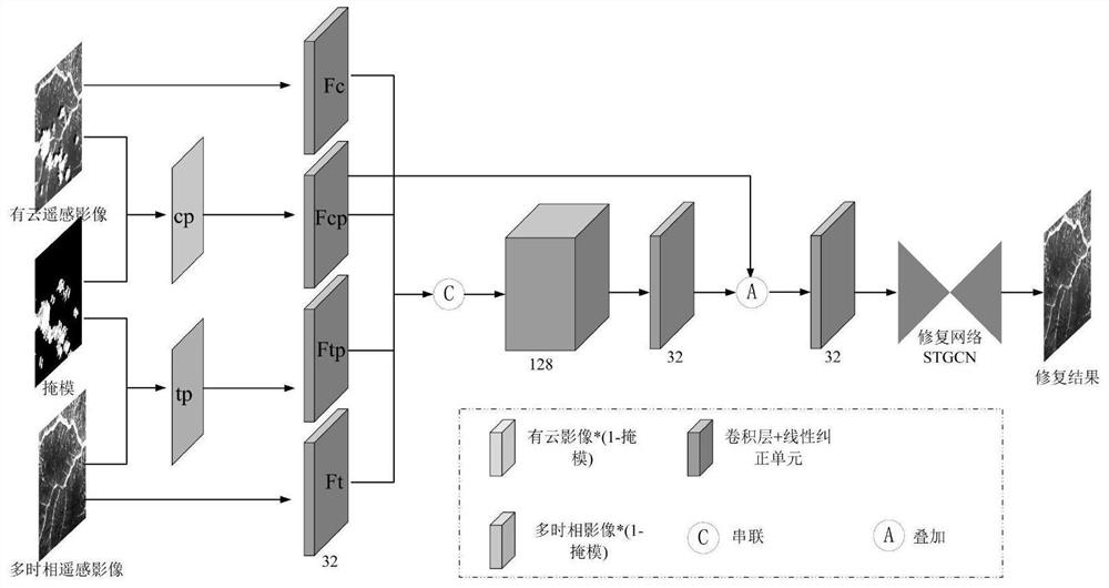
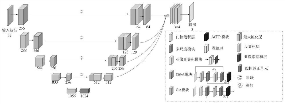
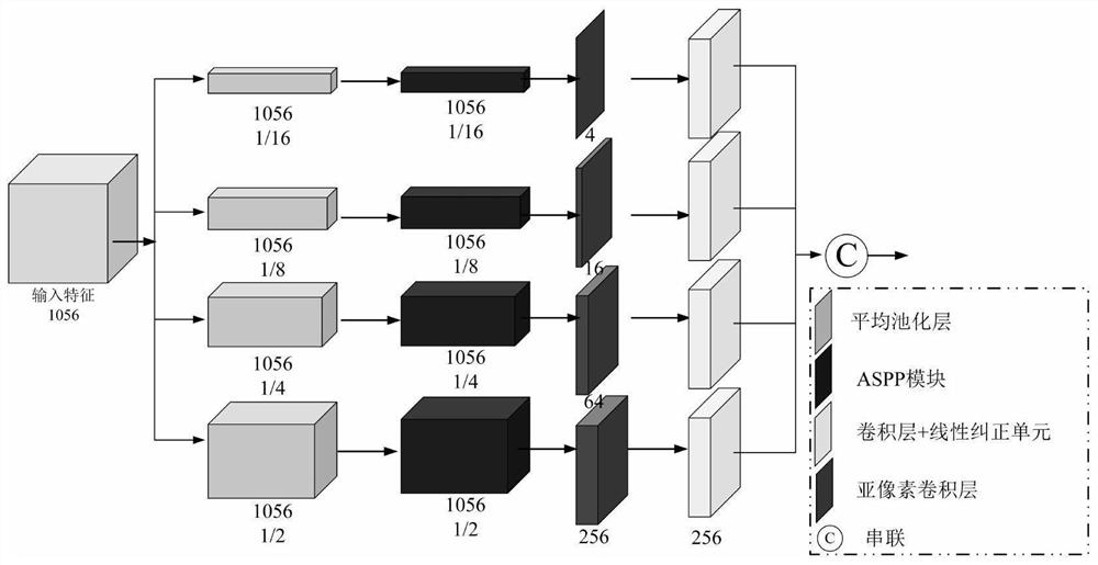
[0050] See attached Figure 1-4 , the present invention provides a cloud restoration method based on gated convolution combined with multi-temporal remote sensing images. Before the main work, it is necessary to preprocess the remote sensing images and complete the data preparation. Use the Image Registration Workflow tool in Envi to register the downloaded Landsat8 remote sensing image with about 5% cloud content and the multi-temporal Landsat8 remote sensing image corresponding to the same row number to eliminate the differences caused by different time, different sensors (imaging equipment), and different shooting Conditions (weather, illuminance, camera position and angle) and other factors caused the deviation between the images. On this basis, according to the geographical coordinate information of the ...
PUM
 Abstract
Description
Claims
Application Information
 - R&D
- Intellectual Property
- Life Sciences
- Materials
- Tech Scout
- Unparalleled Data Quality
- Higher Quality Content
- 60% Fewer Hallucinations
Browse by: Latest US Patents, China's latest patents, Technical Efficacy Thesaurus, Application Domain, Technology Topic, Popular Technical Reports.
© 2025 PatSnap. All rights reserved.Legal|Privacy policy|Modern Slavery Act Transparency Statement|Sitemap|About US| Contact US: help@patsnap.com


