Vector data online calculation method and device
A technology of vector data and calculation method, which is applied in the field of vector data online calculation, and can solve problems such as inability to meet large-scale calculation scenarios
- Summary
- Abstract
- Description
- Claims
- Application Information
AI Technical Summary
Problems solved by technology
Method used
Image
Examples
Embodiment 1
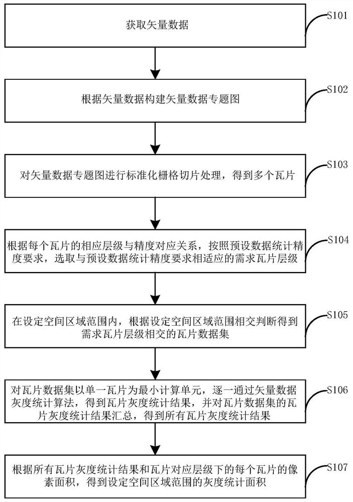
[0055] figure 1 It is a flow chart of the vector data online calculation method provided by Embodiment 1 of the present invention.
[0056] refer to figure 1 , the method includes the following steps:
[0057] Step S101, acquiring vector data;
[0058] Here, the vector data is defined as CGCS2000 latitude and longitude coordinates, that is to say, the latitude and longitude coordinates of the vector data conform to the national geodetic coordinates.
[0059] Step S102, constructing a vector data thematic map according to the vector data;
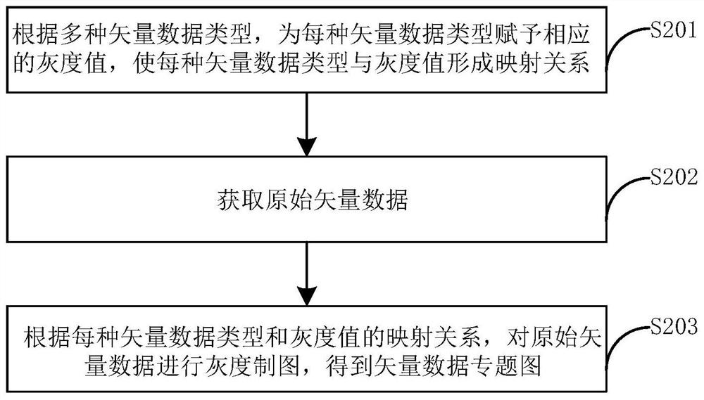
[0060] Specifically, the vector data includes multiple types of vector data, and according to the mapping relationship between each type of vector data and the corresponding gray value, grayscale mapping is performed on the original vector data to obtain a vector data thematic map.
[0061] Step S103, performing standardized grid slicing processing on the vector data thematic map to obtain multiple tiles;
[0062] Specifically, accordin...
Embodiment 2
[0093] Figure 4 It is a schematic diagram of the vector data online computing device provided by Embodiment 2 of the present invention.
[0094] refer to Figure 4 , the device consists of:
[0095] Vector data acquisition unit 1, configured to acquire vector data;
[0096] Construction unit 2, for constructing vector data thematic maps according to vector data;
[0097] The grid slice processing unit 3 is used to perform standardized grid slice processing on the vector data thematic map to obtain multiple tiles;
[0098] The selection unit 4 is used to select the desired tile level that is compatible with the preset data statistical accuracy requirements according to the corresponding relationship between each tile's corresponding level and accuracy, and according to the preset data statistical accuracy requirements;
[0099] A tile data set acquisition unit 5, configured to obtain a tile data set that requires tile-level intersecting within the set spatial area range acco...
PUM
 Abstract
Description
Claims
Application Information
 - R&D
- Intellectual Property
- Life Sciences
- Materials
- Tech Scout
- Unparalleled Data Quality
- Higher Quality Content
- 60% Fewer Hallucinations
Browse by: Latest US Patents, China's latest patents, Technical Efficacy Thesaurus, Application Domain, Technology Topic, Popular Technical Reports.
© 2025 PatSnap. All rights reserved.Legal|Privacy policy|Modern Slavery Act Transparency Statement|Sitemap|About US| Contact US: help@patsnap.com


