Remote sensing image ground object semantic segmentation method

A technology of semantic segmentation and remote sensing images, applied in neural learning methods, biological neural network models, instruments, etc., can solve problems such as insufficient edge recognition, and achieve the effect of improving the learning effect

Inactive Publication Date: 2021-03-30
10TH RES INST OF CETC
View PDF7 Cites 17 Cited by
  • Summary
  • Abstract
  • Description
  • Claims
  • Application Information

AI Technical Summary

Problems solved by technology

[0007] Aiming at high-resolution remote sensing images of complex scenes, the present invention aims to improve the accuracy of ground object segmentation in remote sensing ...

Method used


Image

  • Remote sensing image ground object semantic segmentation method
  • Remote sensing image ground object semantic segmentation method
  • Remote sensing image ground object semantic segmentation method

Examples


Embodiment Construction

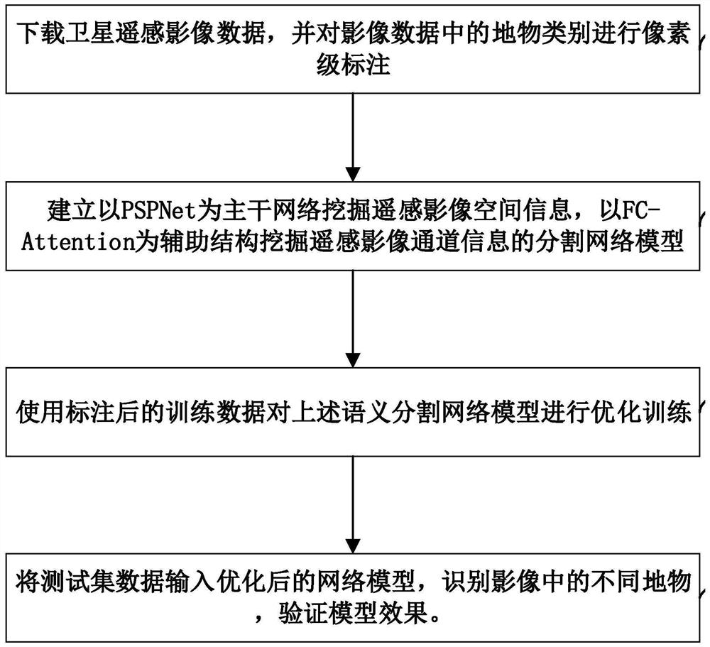
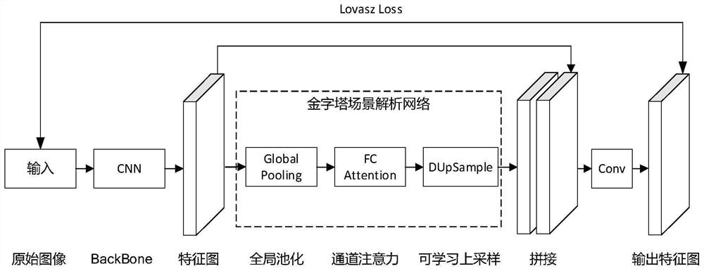
[0020] see figure 1 . According to the present invention, the satellite remote sensing image data is downloaded, the object category in the image data is marked at the pixel level, the multi-channel remote sensing image is directly used as the input of the neural network, and the pyramid scene analysis network PSPNet is used as the backbone network to mine the spatial information of the remote sensing image , and use the channel attention module FC-A as an auxiliary structure to mine the semantic segmentation network model of remote sensing image channel information, and migrate the network model with strong image feature mining capabilities from related fields to the semantic segmentation network model as the backbone network The knowledge structure of BackBone; the pyramid scene analysis module is used to extract spatial features of different spatial scales, and the spatial information of remote sensing images is mined. The channel attention module FC-Attention auxiliary str...


PUM


Abstract

The invention discloses a remote sensing image ground object semantic segmentation method, and aims to improve remote sensing image ground object segmentation accuracy and solve the problem that edgerecognition is not fine enough. According to the technical scheme, the method comprises the steps that a pyramid scene analysis network is constructed, a network model with high image feature mining capacity is migrated to a semantic segmentation network model from the related field, and information contained in a remote sensing image is mined from the channel dimension; spectral information contained in the remote sensing image is mined in combination with a channel attention mechanism, and a data correlation type up-sampling module carries out up-sampling on feature maps of different spatialscales to the size of an original feature map and splices the feature maps with the original feature map; the risks of gradient disappearance and gradient explosion are effectively reduced by adopting a loss function tower, and the prediction effect of the image edge is further improved by adopting an IoU-based loss function; and a network model is trained by using the labeled training data, testset data is inputted into the optimized semantic segmentation network model, and different ground objects in the image are identified.

Description

technical field [0001] The invention belongs to the technical field of semantic segmentation of remote sensing images, in particular to a method for semantic segmentation of ground objects in remote sensing images based on a deep neural network. Background technique [0002] The development of remote sensing technology promotes the explosive growth of remote sensing image data, and presents a trend of higher resolution and wider width. The so-called remote sensing is to perceive the target object from a long distance, that is, to detect the physical properties of the target object from a long distance. "Yao" has the concept of space, and obtains the space information of the target object from near-earth space, outer space and even cosmic space. "Sense" refers to information systems, including information acquisition and transmission, information processing, information analysis and visualization systems, etc. Remote sensing is the technology of detecting and sensing object...

Claims


Application Information

Patent Timeline
IPC IPC(8): G06K9/34G06K9/46G06K9/62G06K9/00G06N3/04G06N3/08
CPCG06N3/08G06V20/13G06V10/267G06V10/454G06N3/045G06F18/253G06F18/214
Inventor 庄旭袁鑫贾莹尹可鑫张乾君
Owner 10TH RES INST OF CETC
Why Eureka
Try Eureka