
Near space atmospheric wind field real-time adaptive visualization method based on Web

A technology of atmospheric wind field and near space, which is used in the processing of 3D images, the generation of 2D images, and the processing of image data.

Pending Publication Date: 2021-04-09
AEROSPACE INFORMATION RES INST CAS
View PDF0 Cites 2 Cited by
  • Summary
  • Abstract
  • Description
  • Claims
  • Application Information

AI Technical Summary

Problems solved by technology

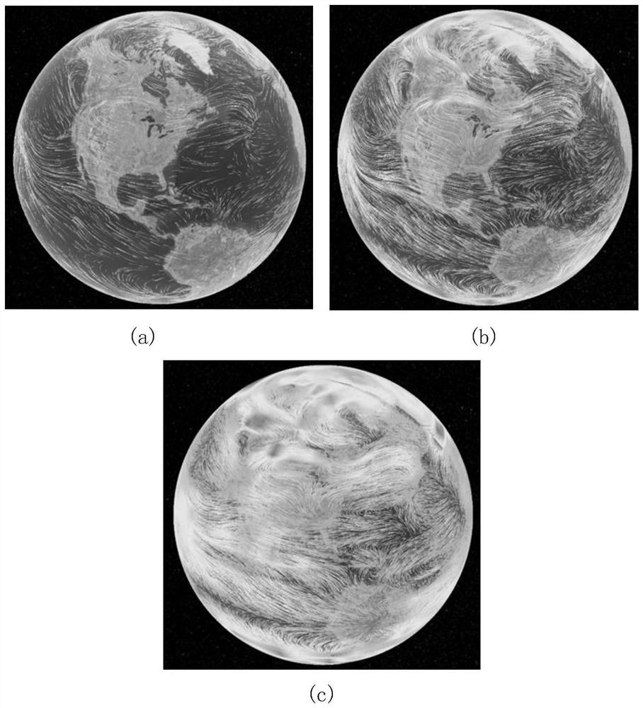
[0006] In order to solve the above-mentioned technical problems, the present invention proposes a Web-based real-time adaptive visualization method for the atmospheric wind field in the near space, which is mainly aimed at how to dynamically express the vector characteristics of the atmospheric wind field in the near space with streamlines of appropriate density on the 3D Web digital earth Problem, the present invention adjusts the number of particles and the distribution area adaptively in real time according to the dynamic change of the viewing area, so that the appropriate particle number and density can be obtained at different viewing heights and different viewing areas, and generates suitable particles based on the method of particle tracking. Density streamlines, and then express the movement characteristics of the atmospheric wind field in the adjacent space, which can not only fully express the overall change trend of the atmospheric wind field, but also describe the local details of the atmospheric wind field in more detail, and achieve different resolutions Realistic and smooth dynamic visualization of lower atmospheric wind field

Method used


Image

  • Near space atmospheric wind field real-time adaptive visualization method based on Web
  • Near space atmospheric wind field real-time adaptive visualization method based on Web
  • Near space atmospheric wind field real-time adaptive visualization method based on Web

Examples


Embodiment 1

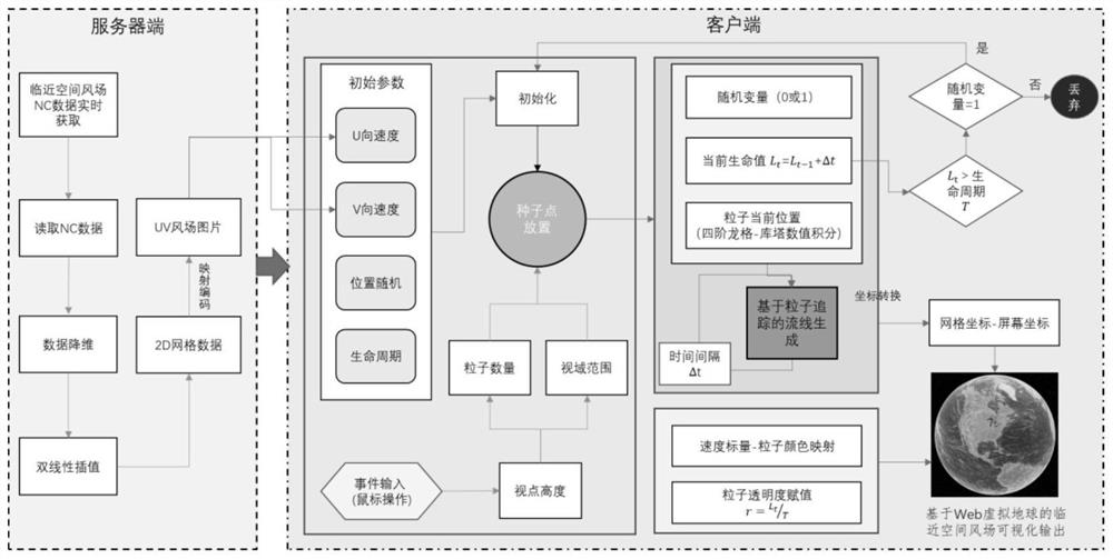
[0049] refer to figure 1 As shown, the present invention provides a web-based real-time self-adaptive visualization method for atmospheric wind field in adjacent space, which specifically includes the following steps:

[0050] S1: Obtain real-time atmospheric wind field data in adjacent space, and preprocess the data;

[0051] First of all, the present invention acquires the vertical layered data of the atmospheric wind field in the adjacent space in real time by regularly scanning the FTP data server. The data is assimilated data of 20-100 km in the global range at 2-hour intervals issued by the National Space Science Center of the Chinese Academy of Sciences in NetCDF format, and the spatial resolution The longitude interval is 2.5°, the latitude interval is 2°, and the altitude interval is 1km.

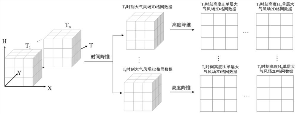
[0052] Then, analyze the NetCDF data, and convert the 4D wind field data into a series of 2D grid data of the atmospheric wind field at different heights and at different times. ...


PUM


Abstract

The invention provides a near space atmospheric wind field real-time adaptive visualization method based on Web. The particle number and the distribution area are adaptively adjusted in real time according to the dynamic change of the vision field range, so that appropriate particle number and density can be obtained at different viewpoint heights and in different vision field ranges; and a streamline with proper density is generated based on a particle tracking method, so that the motion characteristics of the near-space atmospheric wind field of the region are expressed, the overall change trend of the atmospheric wind field can be completely expressed, and the local detail characteristics of the atmospheric wind field can be described more meticulously. And vivid, smooth and dynamic visualization of the atmospheric wind field under different resolutions is realized.

Description

technical field [0001] The invention relates to the technical field of intersecting 3D visualization and atmospheric wind field in adjacent space, and mainly relates to a web-based real-time self-adaptive visualization method for atmospheric wind field in adjacent space. Background technique [0002] The near-space atmosphere, which is about 20-100 km from the ground, is an important part of the Earth's atmosphere. Its complex state changes and dynamic disturbances directly affect human activities such as the safety of near-space vehicles, aerospace activities, and wireless information transmission, and have a significant impact on climate change. has an important influence. The near-space atmospheric wind field is one of the important parameters to characterize the near-space atmospheric environment. It is of great significance to enhance the understanding of the near-space atmospheric environment by visually revealing the temporal and spatial distribution and changing rule...

Claims


Application Information

Patent Timeline
IPC IPC(8): G06T11/00G06T15/00G06T15/20G06T3/40G06K9/62
CPCG06T11/001G06T15/005G06T15/20G06T3/4007G06T2210/56G06F18/213Y02A90/10
Inventor 詹勤范湘涛邰志敏杜小平简洪登
Owner AEROSPACE INFORMATION RES INST CAS
Learn More