Underground rock stratum plane analysis method based on geological disasters
A technology for underground rock formation and plane analysis, applied in geographic information database, image data processing, 3D modeling, etc. And other issues
- Summary
- Abstract
- Description
- Claims
- Application Information
AI Technical Summary
Problems solved by technology
Method used
Image


Examples
Embodiment Construction
[0026] In order to better illustrate the present invention, further description will now be made in conjunction with the embodiments and accompanying drawings.
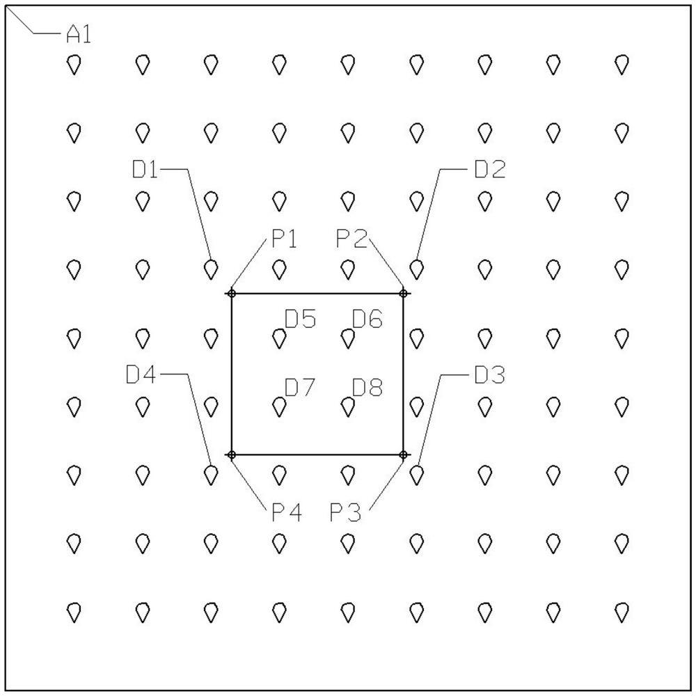
[0027] Such as Figures 1 to 5 As shown, based on the geological disaster underground stratum plane analysis method, the method includes the following steps:
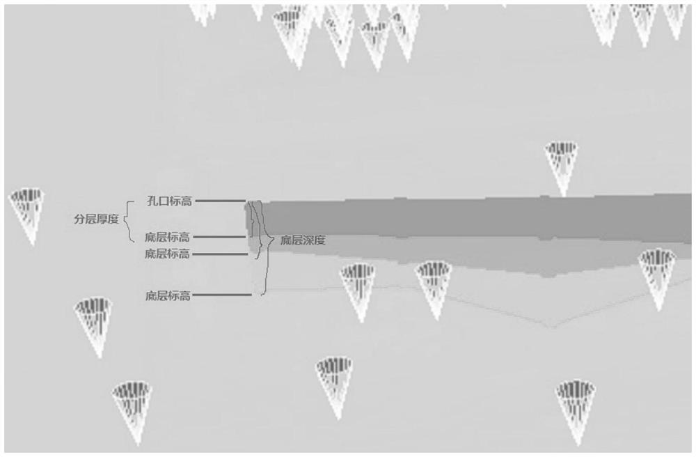
[0028] (1) Use ArcGIS desktop software to make the exploration drilling record point layer into a shapefile point format file supporting (x, y, z) three coordinate axes, (x, y) is used to represent the two-dimensional ground plane The longitude and latitude coordinate position, the z-axis represents the altitude based on the earth reference sea level;
[0029] Table 1: Shapefile format data table
[0030]
[0031]
[0032]
[0033]
[0034] Explanation of the main fields of the exploration drilling record point layer:
[0035] gcmc – exploration project name;
[0036] dirllcode - drill number;
[0037] kkbg - orifice elevation;
[0038] zksd -...
PUM
 Abstract
Description
Claims
Application Information