A large-scale detection method for forest fires based on spatial context features
A technology of spatial context and detection method, applied in the field of remote sensing, can solve the problems of fire point detection and fire extinguishing adverse effects, and achieve the effect of improving forest fire point detection accuracy and spatial sensitivity
- Summary
- Abstract
- Description
- Claims
- Application Information
AI Technical Summary
Problems solved by technology
Method used
Image
Examples
Embodiment Construction
[0064] The present invention will be further described below in conjunction with the accompanying drawings.
[0065] Data acquisition: The remote sensing data used in the present invention is the Japanese Himawari-8 geosynchronous orbit satellite data, the imaging range covers the entire Asia-Pacific region, and the imaging time is 10 minutes per scene. After submitting the account password, the user can obtain data through the following website: ftp: / / ftp.ptree.jaxa.jp / / jma / netcdf.
[0066] Implementation tools:
[0067] The whole test process of the present invention is realized based on PYTHON 3.7, and the process code is original of the present invention.
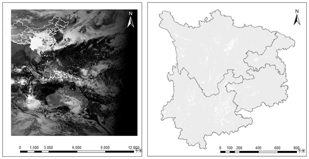
[0068] The image used in the attached drawing is the Himawari-8 image at 13:20 on April 1, 2020 Beijing time, which was intercepted from the research area. The overview of the research area is as follows figure 2 shown.
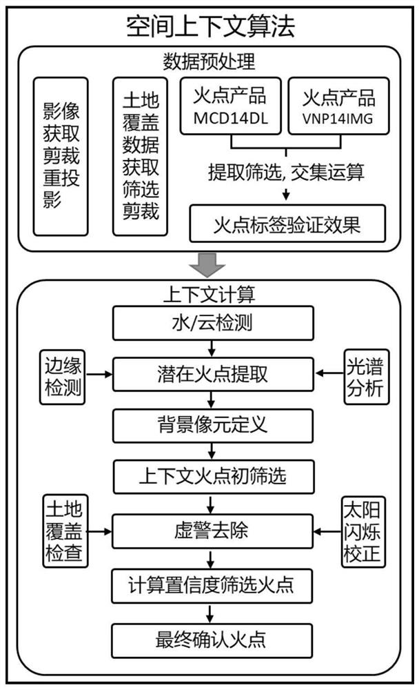
[0069] Implementation process such as figure 1 shown in detail below.
[0070] step 1:
[00...
PUM
 Abstract
Description
Claims
Application Information
 - R&D
- Intellectual Property
- Life Sciences
- Materials
- Tech Scout
- Unparalleled Data Quality
- Higher Quality Content
- 60% Fewer Hallucinations
Browse by: Latest US Patents, China's latest patents, Technical Efficacy Thesaurus, Application Domain, Technology Topic, Popular Technical Reports.
© 2025 PatSnap. All rights reserved.Legal|Privacy policy|Modern Slavery Act Transparency Statement|Sitemap|About US| Contact US: help@patsnap.com


