Large-range detection method for forest fire point based on spatial context features
A technology of spatial context and detection method, applied in the field of remote sensing, can solve the problems of fire point detection and adverse effects of fire extinguishing
- Summary
- Abstract
- Description
- Claims
- Application Information
AI Technical Summary
Problems solved by technology
Method used
Image
Examples
Embodiment Construction
[0064] The present invention will be further described below in conjunction with the accompanying drawings.
[0065] Data acquisition: The remote sensing data used in the present invention is the data of the Japan Himawari-8 geosynchronous orbit satellite, the imaging range covers the entire Asia-Pacific region, and the imaging time is 10 minutes per scene. After submitting the account password, the user can obtain data through the following website: ftp: / / ftp.ptree.jaxa.jp / / jma / netcdf.
[0066] Implementation tools:
[0067] All the test process of the present invention is realized based on PYTHON 3.7, and the flow code is original of the present invention.
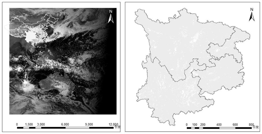
[0068] The image used in the attached figure is the Himawari-8 image at 13:20 on April 1, 2020, Beijing time, which was intercepted to the research area. The overview of the research area is as follows figure 2 shown.
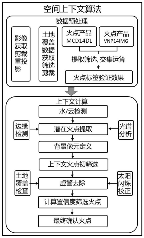
[0069] The implementation process is as follows figure 1 shown in detail below.
[0070] step 1:...
PUM
 Abstract
Description
Claims
Application Information
 - R&D
- Intellectual Property
- Life Sciences
- Materials
- Tech Scout
- Unparalleled Data Quality
- Higher Quality Content
- 60% Fewer Hallucinations
Browse by: Latest US Patents, China's latest patents, Technical Efficacy Thesaurus, Application Domain, Technology Topic, Popular Technical Reports.
© 2025 PatSnap. All rights reserved.Legal|Privacy policy|Modern Slavery Act Transparency Statement|Sitemap|About US| Contact US: help@patsnap.com


