

Omnibearing task management system based on GIS
A task management, all-round technology, applied in the field of all-round task management system, can solve the problem that the management system cannot fully meet the remote, informatization, and panoramic all-round task management system
- Summary
- Abstract
- Description
- Claims
- Application Information
AI Technical Summary
Problems solved by technology
Method used
Image

Examples
Embodiment Construction
[0025] Hereinafter, preferred embodiments of the present invention will be described in detail with reference to the accompanying drawings. It should be understood that the preferred embodiments are only for illustrating the present invention, but not for limiting the protection scope of the present invention.
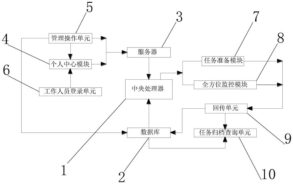
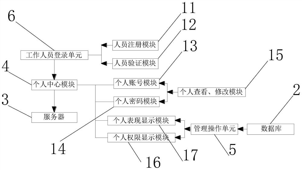
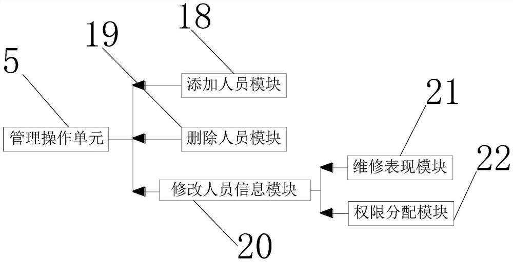
[0026] Such as Figure 1 to Figure 7 As shown, a kind of all-round task management system based on GIS system of the present invention comprises central processing unit 1 and server 3, and server 3 output end is connected with central processing unit 1 receiving end signal, and central processing unit 1 output end is connected with task preparation The signal connection of the receiving end of module 7, the signal connection of the receiving end of the task preparation module 7 and the output end of the task guide import module 23, the signal connection of the receiving end of the task guide import module 23 and the output end of the task guide input module 26, the tas...
PUM
 Abstract
Description
Claims
Application Information