

Layer using method
A layer and class map technology, applied in the field of GIS, can solve the problems of difficult interaction between developers and clients, inconsistent functions and styles, repeated development of map functions, etc., to reduce repeated development, convenient use, and high reuse rate. Effect
- Summary
- Abstract
- Description
- Claims
- Application Information
AI Technical Summary
Problems solved by technology
Method used
Image

Examples
Embodiment Construction
[0058] The present invention will be further described below with reference to the accompanying drawings and specific embodiments, so that those skilled in the art can better understand the present invention and implement it, but the embodiments are not intended to limit the present invention.
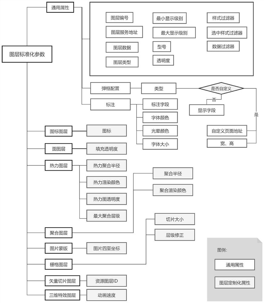
[0059] like figure 1 As shown, in the layer usage method in this embodiment, the loading methods and required parameters of the real-time rendering layer, map service layer, 3D model layer and 3D special effect layer commonly used in daily business standardization( figure 1 The design scheme of standardized parameters is shown in detail), so that specific layers become objects of this general layer class, which can use standard parameters and unified method calls. The layer using method includes the following steps:
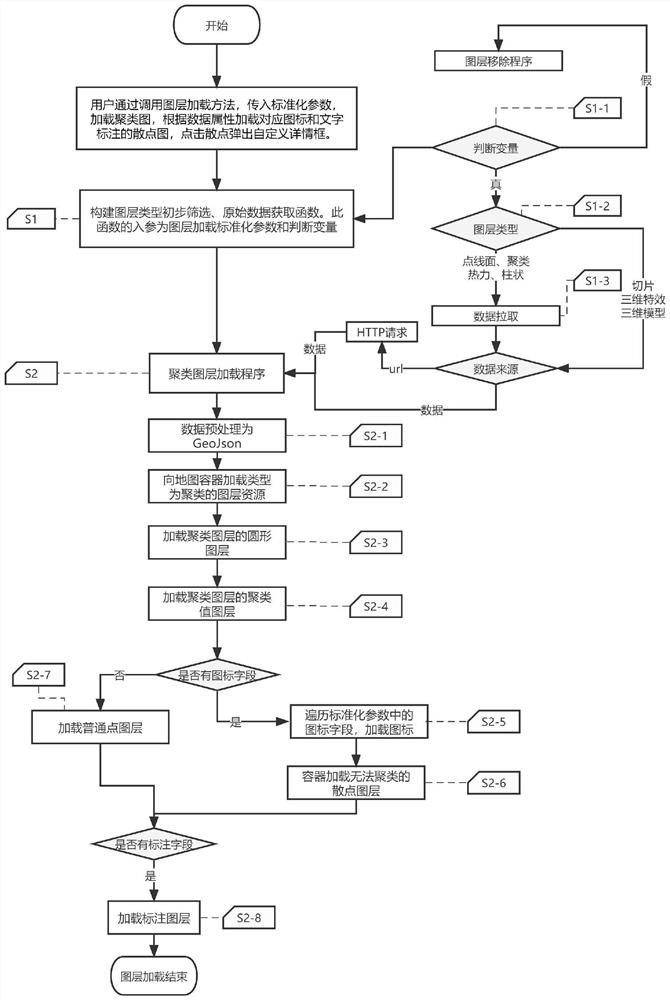
[0060] S11. Call the unified layer loading method (loadLayer), and pass in standardized parameters and judgment variables (boolean values).
[0061] S12. Determine the...
PUM
 Abstract
Description
Claims
Application Information