Sound identifying method for geographic information and its application in navigation system
A speech recognition, geographic information technology, applied in speech recognition, navigation, speech analysis and other directions, can solve the problem of low recognition rate
- Summary
- Abstract
- Description
- Claims
- Application Information
AI Technical Summary
Problems solved by technology
Method used
Image
Examples
Embodiment
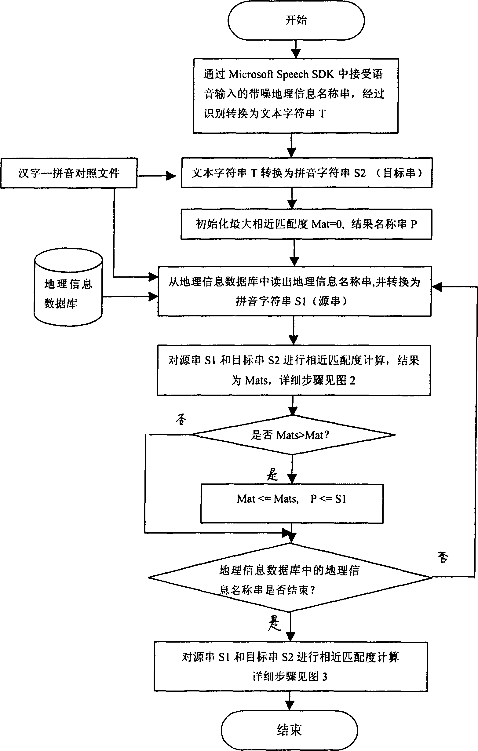
[0039] Taking the traffic navigation system under the support of the electronic map as an example, by collecting the urban electronic map database, including the spatial data and place name information of the urban map (especially including urban traffic), the navigation syntax-keyword rule base is set up, and the voice system of the present invention is used. The recognition method is to convert the keyword string of each syntax into a pinyin string as the source string, and match it with the target string of voice input to obtain a set of similar matching degree values, and take the pinyin character corresponding to the largest value The string is used as a keyword, and based on this, the noisy geographical information name string is intercepted. Take the geographical information name string from the electronic map database and convert it into a pinyin string as the source string, and use the noisy geographical information name string as the target string to calculate the sim...
PUM
 Abstract
Description
Claims
Application Information
 - R&D
- Intellectual Property
- Life Sciences
- Materials
- Tech Scout
- Unparalleled Data Quality
- Higher Quality Content
- 60% Fewer Hallucinations
Browse by: Latest US Patents, China's latest patents, Technical Efficacy Thesaurus, Application Domain, Technology Topic, Popular Technical Reports.
© 2025 PatSnap. All rights reserved.Legal|Privacy policy|Modern Slavery Act Transparency Statement|Sitemap|About US| Contact US: help@patsnap.com


